more stats
1.7 miles
Distance
592 ft
Climb
-293 ft
Descent
00:10:25
Avg time
299 ft
Altitude change
252 ft
Altitude min
570 ft
Altitude max
252 ft
Altitude start
551 ft
Altitude end
3.376%
Grade
-32.005%
Grade max
32.734%
Grade min
4,878 ft
Distance climb
2,799 ft
Distance down
1,154 ft
Distance flat
00:10:25
Avg time

Teleport Details

  • Activities
    • Mountain Bike
    • Winter Fat Bike
    • Trail Running
  • Riding Area
  • Difficulty Rating
  • Local Popularity
    95 in Mountain Biking [+]
    • 100 in Trail Running
  • Global Ranking
    #32261 in Mountain Biking [+]
    • #1182 in Trail Running
  • Hiking SAC Scale
    T1 Hiking
  • Trail Type
    Singletrack
  • Bike Type
    XC, Fat, CX
  • Direction
    Uphill Only
    Popular Direction Shown
  • Physical Rating
    Easy
  • Trail Visibility
    Always easy to follow
  • Family Friendly
    Yes
  • Dogs Allowed
    Yes
  • eBike Allowed
    Yes up to Class 1
  • TTFs on Trail
    Berm
  • Ride in Rain
    Yes
  • Year Opened
    2019
  • Land Owner
    Kentish Council

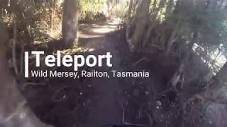
The first trail out of Railton's Goliath Park trail head. An easy beginner friendly climb that finishes at a junction to either take you into the Badgers Range on Sheffield Way or returns on a fun flowing descent returning to the trail head on Green Hornet.

Access Info

Access via the Wild Mersey's Goliath Park Trail Head at Railton

Trail Supporters
Traditionally Indigenous Territory

Recent Activity on Trail

Past Week
  • 2 rides
  • 11 miles average
6 Months
  • 23 rides
  • 15 miles avg distance
All
  • 398 rides
  • Last: Jun 14, 2026
c1c2c3c4
January
February
March
April
May
June
July
August
September
October
November
December
update trails status or condition

Teleport Trail Reports

statusdatedescription
May 16, 2026 @ 8:56am (Australia/Hobart)
May 15, 2026
Green Hornet is being rebuilt, so at this point the top half of Teleport is two-way, while the top of Green Hornet is worked on. Then once that...
Oct 30, 2025 @ 3:29pm (Australia/Hobart)
Oct 29, 2025
Just been completely blown clear so it is in perfect condition
Aug 23, 2025 @ 9:37am
Aug 23, 2025
All clear
Aug 9, 2025 @ 9:22am
Aug 9, 2025
Riding well
Mar 28, 2025 @ 8:51am
Mar 28, 2025
pretty rough at the top
more »
Status:
on May 16, 2026
Ideal
Avg: 4.05 (12 votes)
Your vote: 0

view (3,472)
close
3D
Trail Conditions
  • Unknown
  • Snow Groomed
  • Snow Packed
  • Snow Covered
  • Snow Cover Partial
  • Freeze/thaw Cycle
  • Icy
  • Prevalent Mud
  • Wet
  • Variable
  • Ideal
  • Dry
  • Very Dry
Trail Flow (Ridden Direction)
Trailforks scans users ridelogs to determine the most popular direction each trail is ridden. A good flowing trail network will have most trails flowing in a single direction according to their intension.
The colour categories are based on what percentage of riders are riding a trail in its intended direction.
  • > 96%
  • > 90%
  • > 80%
  • > 70%
  • > 50%
  • < 50%
  • bi-directional trail
  • no data
Trail Last Ridden
Trailforks scans ridelogs to determine the last time a trail was ridden.
  • < 2 days
  • < 1 week
  • < 2 weeks
  • < 1 month
  • < 6 months
  • > 6 months
Trail Ridden Direction
The intended direction a trail should be ridden.
  • Downhill Only
  • Downhill Primary
  • Both Directions
  • Uphill Primary
  • Uphill Only
  • One Direction
Contribute Details
Colors indicate trail is missing specified detail.
  • Description
  • Photos
  • Description & Photos
  • Videos
Trail Popularity ?
Trailforks scans ridelogs to determine which trails are ridden the most in the last 9 months. Trails are compared with nearby trails in the same city region with a possible 25 colour shades. Think of this as a heatmap, more rides = more kinetic energy = warmer colors.
  • most popular
  • popular
  • less popular
  • not popular
ATV/ORV/OHV Filter
Max Vehicle Width
inches
US Cell Coverage
Legend
cell carrier legend

Radar Time
Activity Recordings
Trailforks uses anonymized public activity data. ?
Activity Recordings
Trailforks uses anonymized public activity data. ?
Personal Heatmap
Activity Types
all / none
Options
2
Date range month
Winter Trails
Warning A routing network for winter maps does not exist. Selecting trails using the winter trails layer has been disabled.
Missing Trails
Most Popular
Least Popular
Trails are colored based on popularity. The more popular a trail is, the more red. Less popular trails trend towards green.
Jump Magnitude Heatmap
Heatmap of where riders jump on trails. Zoom in to see individual jumps, click circles to view jump details.
BC Backroad Status

Service Road Atlas is a free to use, community-driven service for viewing and creating reports on the numerous back-country service roads around B.C. and Alberta.

map legend
Slope Aspect
Direction the slope faces
Flat N NE E SE S SW W NW
Trails Deemphasized
Trails are shown in grey.
disable
Only show trails with no bike usage.
Enable
Suggested Layers
Based on selected activity type

    Save the current map location and zoom level as your default home location whenever this page is loaded.

    Save
        Directions to teleport trailhead (-41.342730, 146.413890)

        Photos

        No photos have been added for Teleport yet, add a photo.

        Videos

        2 more »
        Teleport
        14:15 | 377 | Jun 21, 2019 , Railton
        Teleport & Green Hornet
        13:30 | 407 | Jun 16, 2019 , Railton

        Routes with this trail

        3.0 29 miles 2,936 ft 18
        21 miles 2,895 ft 20
        A solid 33km loop through the best trails in the Badgers Range.
        25 miles 2,754 ft 20

        1 Review & Comments


        We hope you've been enjoying Trailforks!

        Create a FREE account to view trail comments and much more.

        • By streddazTF Pro CCMBC & contributors
        • #189614 - 2,169 views

        Frequently Asked Questions About Teleport

        Where is Teleport located?
        Teleport is located in Railton - Wild Mersey Mountain Bike Trails, Railton, Australia. It is part of the Railton - Wild Mersey Mountain Bike Trails trail network. The trailhead is located at coordinates -41.34273, 146.41389.
        How hard is Teleport?
        Teleport is rated as Green difficulty. The physical rating is Easy. The average grade is 3.376%.
        What is the elevation gain for Teleport?
        Teleport has 592 ft of elevation gain. The trail has 293 ft of elevation descent. The elevation ranges from 252 ft to 570 ft.
        Is Teleport a point to point trail?
        Yes, Teleport is a point to point trail. The direction is Uphill Only. The trail type is singletrack.

        Hit the Trail

        Open in App

        Get this trail on your phone instantly.
        open trail in app

        Download Trail

        Save to wishlist, Garmin & download.
        save the trail

        Find Related Routes

        Find routes and users activities that include this trail.
        find routes for this trail

        You must enter a description before submitting.