more stats
325 ft
Distance
00:01:44
Avg time
756 ft
Altitude min
756 ft
Altitude max
756 ft
Altitude start
755 ft
Altitude end
00:01:44
Avg time

The Horn Details

  • Activities
    • Mountain Bike
    • Winter Fat Bike
    • Hike
    • Trail Running
  • Riding Area
    Bison Butte Recreational Trails
    Winnipeg, Manitoba
  • Difficulty Rating
  • Local Popularity
    75 in Mountain Biking [+]
    • 55 in Trail Running
    • 5 in Hiking
  • Global Ranking
    #71420 in Mountain Biking [+]
    • #102608 in Trail Running
    • #306994 in Hiking
  • Trail Type
    Singletrack
  • Bike Type
    AM, XC, Fat
  • Direction
    Downhill Only
    Popular Direction Shown
  • Dogs Allowed
    Yes
  • TTFs on Trail
    Berm, Drop

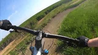
Steep downhill drops. Two lines adjacent to each other. West line has a mandatory drop, East line has drop that can be rolled. Both lines have a rock garden entry.

Disclaimer

Helmets mandatory. Riders assume all risks.

Local Trail Association

Recent Activity on Trail

Past Week
  • 1 rides
  • 15 miles average
6 Months
  • 11 rides
  • 13 miles avg distance
All
  • 230 rides
  • Last: Jun 16, 2026
c1c2c3c4
January
February
March
April
May
June
July
August
September
October
November
December
Status:
on May 20, 2025
Ideal
Avg: 3.99 (4 votes)
Your vote: 0

view (1,821)
close
3D
Trail Conditions
  • Unknown
  • Snow Groomed
  • Snow Packed
  • Snow Covered
  • Snow Cover Partial
  • Freeze/thaw Cycle
  • Icy
  • Prevalent Mud
  • Wet
  • Variable
  • Ideal
  • Dry
  • Very Dry
Trail Flow (Ridden Direction)
Trailforks scans users ridelogs to determine the most popular direction each trail is ridden. A good flowing trail network will have most trails flowing in a single direction according to their intension.
The colour categories are based on what percentage of riders are riding a trail in its intended direction.
  • > 96%
  • > 90%
  • > 80%
  • > 70%
  • > 50%
  • < 50%
  • bi-directional trail
  • no data
Trail Last Ridden
Trailforks scans ridelogs to determine the last time a trail was ridden.
  • < 2 days
  • < 1 week
  • < 2 weeks
  • < 1 month
  • < 6 months
  • > 6 months
Trail Ridden Direction
The intended direction a trail should be ridden.
  • Downhill Only
  • Downhill Primary
  • Both Directions
  • Uphill Primary
  • Uphill Only
  • One Direction
Contribute Details
Colors indicate trail is missing specified detail.
  • Description
  • Photos
  • Description & Photos
  • Videos
Trail Popularity ?
Trailforks scans ridelogs to determine which trails are ridden the most in the last 9 months. Trails are compared with nearby trails in the same city region with a possible 25 colour shades. Think of this as a heatmap, more rides = more kinetic energy = warmer colors.
  • most popular
  • popular
  • less popular
  • not popular
ATV/ORV/OHV Filter
Max Vehicle Width
inches
US Cell Coverage
Legend
cell carrier legend

Radar Time
Activity Recordings
Trailforks uses anonymized public activity data. ?
Activity Recordings
Trailforks uses anonymized public activity data. ?
Personal Heatmap
Activity Types
all / none
Options
2
Date range month
Winter Trails
Warning A routing network for winter maps does not exist. Selecting trails using the winter trails layer has been disabled.
Missing Trails
Most Popular
Least Popular
Trails are colored based on popularity. The more popular a trail is, the more red. Less popular trails trend towards green.
Jump Magnitude Heatmap
Heatmap of where riders jump on trails. Zoom in to see individual jumps, click circles to view jump details.
BC Backroad Status

Service Road Atlas is a free to use, community-driven service for viewing and creating reports on the numerous back-country service roads around B.C. and Alberta.

map legend
Slope Aspect
Direction the slope faces
Flat N NE E SE S SW W NW
Trails Deemphasized
Trails are shown in grey.
disable
Only show trails with no bike usage.
Enable
Suggested Layers
Based on selected activity type

    Save the current map location and zoom level as your default home location whenever this page is loaded.

    Save
        Directions to the-horn trailhead (49.833850, -97.218020)

        Photos

        6 more »
        337 |
        Aug 6, 2020 @ 9:18am
        Aug 6, 2020
        326 |
        Aug 6, 2020 @ 9:18am
        Aug 6, 2020
        311 |
        Aug 6, 2020 @ 9:18am
        Aug 6, 2020
        315 |
        Aug 6, 2020 @ 9:18am
        Aug 6, 2020

        Videos

        2 more »
        Quick ride at Bison Butte, Winnipeg Manitoba |...
        2:59 | 60 | Sep 10, 2024 , Winnipeg
        Canada Summer Games 2017 XC
        0:25 | 714 | Apr 28, 2018 , Winnipeg

        Reviews / Comments

        No reviews yet, be the first to write a review or ask a question.
        Use trail reports to comment on trail conditions.


        We hope you've been enjoying Trailforks!

        Create a FREE account to view trail comments and much more.

        • By crislabossiereTF Pro SWTA MTB MB & contributors
        • #126145 - 2,159 views

        Frequently Asked Questions About The Horn

        Where is The Horn located?
        The Horn is located in Bison Butte Recreational Trails, Winnipeg, Manitoba, Canada. It is part of the Bison Butte Recreational Trails trail network. The trailhead is located at coordinates 49.83385, -97.21802.
        How hard is The Horn?
        The Horn is rated as Black Diamond difficulty.
        Is The Horn a point to point trail?
        Yes, The Horn is a point to point trail. The direction is Downhill Only. The trail type is singletrack.
        How long is The Horn?
        The Horn is 325 ft long. The trail type is singletrack.

        Hit the Trail

        Open in App

        Get this trail on your phone instantly.
        open trail in app

        Download Trail

        Save to wishlist, Garmin & download.
        save the trail

        Find Related Routes

        Find routes and users activities that include this trail.
        find routes for this trail

        You must enter a description before submitting.