more stats
2,690 ft
Distance
4 ft
Climb
-213 ft
Descent
00:04:42
Avg time
-209 ft
Altitude change
2,004 ft
Altitude min
2,217 ft
Altitude max
2,217 ft
Altitude start
2,008 ft
Altitude end
-7.8%
Grade
-28%
Grade max
6.7%
Grade min
75 ft
Distance climb
2,497 ft
Distance down
121 ft
Distance flat
00:04:42
Avg time

Three Amigos Details

  • Activities
    • Mountain Bike
  • Riding Area
  • Difficulty Rating
  • Local Popularity
    40 in Mountain Biking
  • Global Ranking
    #83571 in Mountain Biking
  • Trail Type
    Singletrack
  • Bike Type
    AM, XC
  • Direction
    Downhill Only
    Popular Direction Shown
  • Climb Difficulty
    Green
  • Physical Rating
    Extreme
  • eBike Allowed
  • TTFs on Trail
    Berm, Drop, Jump, Rock Face, Rock Garden
  • Year Opened
    2018
  • Land Owner
    CMTEDD - National Arboretum Canberra/Stromlo Forest Park

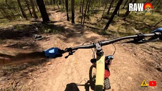
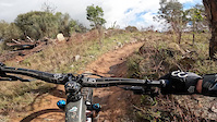
A volunteer hand-built raw & natural trail snaking its way down to [L=https://www.trailforks.com/trails/spin-doctor/]Spin Doctor[/L]. A physical trail that requires the rider to be very active on the bike to make it flow through its raw rough nature.

Trail Supporters

Bike Park

Local Trail Association
Traditionally Indigenous Territory

Recent Activity on Trail

Past Week
  • 0 rides
  •  
6 Months
  • 30 rides
  • 11 miles avg distance
All
  • 309 rides
  • Last: Jun 21, 2026
c1c2c3c4
January
February
March
April
May
June
July
August
September
October
November
December
update trails status or condition

Three Amigos Trail Reports

statusdatedescription
May 26, 2026 @ 6:41am (Australia/Sydney)
May 25, 2026
Getting a bit wide with some sneaky lines to miss the 2nd Amigo, and then after the 3rd amigo gets narrow. Good narrow, but not far off the start...
Oct 21, 2025 @ 11:20am (Australia/Sydney)
Oct 20, 2025
Oct 10, 2024 @ 10:29am
Oct 10, 2024
Lots a rock!
Sep 23, 2023 @ 3:52pm
Sep 23, 2023
perfection
Sep 16, 2023 @ 5:13pm
Sep 16, 2023
more »
Status:
on May 26, 2026
Wet
Avg: 3.99 (4 votes)
Your vote: 0

view (4,014)
close
3D
Trail Conditions
  • Unknown
  • Snow Groomed
  • Snow Packed
  • Snow Covered
  • Snow Cover Partial
  • Freeze/thaw Cycle
  • Icy
  • Prevalent Mud
  • Wet
  • Variable
  • Ideal
  • Dry
  • Very Dry
Trail Flow (Ridden Direction)
Trailforks scans users ridelogs to determine the most popular direction each trail is ridden. A good flowing trail network will have most trails flowing in a single direction according to their intension.
The colour categories are based on what percentage of riders are riding a trail in its intended direction.
  • > 96%
  • > 90%
  • > 80%
  • > 70%
  • > 50%
  • < 50%
  • bi-directional trail
  • no data
Trail Last Ridden
Trailforks scans ridelogs to determine the last time a trail was ridden.
  • < 2 days
  • < 1 week
  • < 2 weeks
  • < 1 month
  • < 6 months
  • > 6 months
Trail Ridden Direction
The intended direction a trail should be ridden.
  • Downhill Only
  • Downhill Primary
  • Both Directions
  • Uphill Primary
  • Uphill Only
  • One Direction
Contribute Details
Colors indicate trail is missing specified detail.
  • Description
  • Photos
  • Description & Photos
  • Videos
Trail Popularity ?
Trailforks scans ridelogs to determine which trails are ridden the most in the last 9 months. Trails are compared with nearby trails in the same city region with a possible 25 colour shades. Think of this as a heatmap, more rides = more kinetic energy = warmer colors.
  • most popular
  • popular
  • less popular
  • not popular
ATV/ORV/OHV Filter
Max Vehicle Width
inches
US Cell Coverage
Legend
cell carrier legend

Radar Time
Activity Recordings
Trailforks uses anonymized public activity data. ?
Activity Recordings
Trailforks uses anonymized public activity data. ?
Personal Heatmap
Activity Types
all / none
Options
2
Date range month
Winter Trails
Warning A routing network for winter maps does not exist. Selecting trails using the winter trails layer has been disabled.
Missing Trails
Most Popular
Least Popular
Trails are colored based on popularity. The more popular a trail is, the more red. Less popular trails trend towards green.
Jump Magnitude Heatmap
Heatmap of where riders jump on trails. Zoom in to see individual jumps, click circles to view jump details.
BC Backroad Status

Service Road Atlas is a free to use, community-driven service for viewing and creating reports on the numerous back-country service roads around B.C. and Alberta.

map legend
Slope Aspect
Direction the slope faces
Flat N NE E SE S SW W NW
Trails Deemphasized
Trails are shown in grey.
disable
Only show trails with no bike usage.
Enable
Suggested Layers
Based on selected activity type

    Save the current map location and zoom level as your default home location whenever this page is loaded.

    Save
        Directions to three-amigos-150577 trailhead (-35.307190, 149.008480)

        Photos

        2 more »
        186 |
        Jun 7, 2020 @ 2:38am
        Jun 7, 2020
        259 |
        Jun 7, 2020 @ 2:38am
        Jun 7, 2020

        Videos

        3 more »
        Raw Three Amigos
        2:59 | 281 | Mar 28, 2024 , Canberra
        Rollerslickamigo
        8:52 | 272 | Jul 7, 2022 , Canberra
        Stromlo Bike Park - Three Amigos Black trail
        3:13 | 463 | Nov 26, 2020 , Canberra

        Routes with this trail

        17 miles 2,501 ft 33
        Shimano 30 Course length 27km. Climbing 800m per lap. Approximately 75% of the trails in Stromlo used or...
        41 miles 7,928 ft 115 Loop
        Planning for a Stromlo big loop
        40 miles 6,253 ft 118
        Full set of Stromlo trails, missing only a B line and short links.

        Reviews / Comments

        No reviews yet, be the first to write a review or ask a question.
        Use trail reports to comment on trail conditions.


        We hope you've been enjoying Trailforks!

        Create a FREE account to view trail comments and much more.

        • By ZippyBlingTF Pro & contributors
        • #150577 - 4,471 views

        Frequently Asked Questions About Three Amigos

        Where is Three Amigos located?
        Three Amigos is located in Stromlo Forest Park, Canberra, Australia. It is part of the Stromlo Forest Park trail network. The trailhead is located at coordinates -35.30719, 149.00848.
        How hard is Three Amigos?
        Three Amigos is rated as Black Diamond difficulty. The physical rating is Extreme. The average grade is 7.8%. The climb difficulty is rated Green.
        What is the elevation gain for Three Amigos?
        Three Amigos has 4 ft of elevation gain. The trail has 213 ft of elevation descent. The elevation ranges from 2,004 ft to 2,217 ft.
        Is Three Amigos a point to point trail?
        Yes, Three Amigos is a point to point trail. The direction is Downhill Only. The trail type is singletrack.

        Hit the Trail

        Open in App

        Get this trail on your phone instantly.
        open trail in app

        Download Trail

        Save to wishlist, Garmin & download.
        save the trail

        Find Related Routes

        Find routes and users activities that include this trail.
        find routes for this trail

        You must enter a description before submitting.