more stats
1,739 ft
Distance
13 ft
Climb
-59 ft
Descent
00:05:50
Avg time
-48 ft
Altitude change
1,558 ft
Altitude min
1,619 ft
Altitude max
1,606 ft
Altitude start
1,558 ft
Altitude end
-2.8%
Grade
-13.5%
Grade max
3.5%
Grade min
456 ft
Distance climb
1,102 ft
Distance down
184 ft
Distance flat
00:05:50
Avg time

Three Bridges Trail Details

  • Activities
    • Mountain Bike
    • E-Bike
    • Hike
    • Trail Running
  • Riding Area
    Galbraith Gap (Rothrock State Forest)
    State College, Pennsylvania
  • Difficulty Rating
  • Local Popularity
    95 in Mountain Biking [+]
    • 90 in E-Biking
    • 100 in Trail Running
    • 100 in Hiking
  • Global Ranking
    #45836 in Mountain Biking [+]
    • #14912 in Trail Running
    • #15553 in Hiking
  • Trail Type
    Singletrack
  • Bike Type
    DH, AM, XC
  • Direction
    Both Directions
  • Climb Difficulty
    Blue
  • Physical Rating
    Moderate
  • Season
    All Year
  • Dogs Allowed
    Yes
  • eBike Allowed
  • TTFs on Trail
    Bridge
  • Year Opened
    2014
  • Land Owner

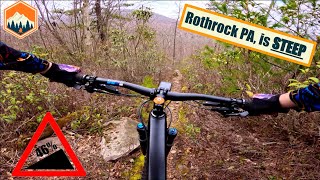
Connector trail from Laurel Run Rd to Lornberger. Has wicked rock garden that presents a great challenge to all and also 3 separate bridges to be crossed

Access Info

From Lornberger Trail or off Laurel Run Rd at the intersection of Laurel Run Rd & Old Laurel Trail

Local Trail Association
Traditionally Indigenous Territory

Recent Activity on Trail

Past Week
  • 1 rides
  • 7 miles average
6 Months
  • 16 rides
  • 14 miles avg distance
All
  • 373 rides
  • Last: Jun 16, 2026
c1c2c3c4
January
February
March
April
May
June
July
August
September
October
November
December
Status:
on May 5, 2026
Ideal
Avg: 4.16 (6 votes)
Your vote: 0

view (2,545)
close
3D
Trail Conditions
  • Unknown
  • Snow Groomed
  • Snow Packed
  • Snow Covered
  • Snow Cover Partial
  • Freeze/thaw Cycle
  • Icy
  • Prevalent Mud
  • Wet
  • Variable
  • Ideal
  • Dry
  • Very Dry
Trail Flow (Ridden Direction)
Trailforks scans users ridelogs to determine the most popular direction each trail is ridden. A good flowing trail network will have most trails flowing in a single direction according to their intension.
The colour categories are based on what percentage of riders are riding a trail in its intended direction.
  • > 96%
  • > 90%
  • > 80%
  • > 70%
  • > 50%
  • < 50%
  • bi-directional trail
  • no data
Trail Last Ridden
Trailforks scans ridelogs to determine the last time a trail was ridden.
  • < 2 days
  • < 1 week
  • < 2 weeks
  • < 1 month
  • < 6 months
  • > 6 months
Trail Ridden Direction
The intended direction a trail should be ridden.
  • Downhill Only
  • Downhill Primary
  • Both Directions
  • Uphill Primary
  • Uphill Only
  • One Direction
Contribute Details
Colors indicate trail is missing specified detail.
  • Description
  • Photos
  • Description & Photos
  • Videos
Trail Popularity ?
Trailforks scans ridelogs to determine which trails are ridden the most in the last 9 months. Trails are compared with nearby trails in the same city region with a possible 25 colour shades. Think of this as a heatmap, more rides = more kinetic energy = warmer colors.
  • most popular
  • popular
  • less popular
  • not popular
ATV/ORV/OHV Filter
Max Vehicle Width
inches
US Cell Coverage
Legend
cell carrier legend

Radar Time
Activity Recordings
Trailforks uses anonymized public activity data. ?
Activity Recordings
Trailforks uses anonymized public activity data. ?
Personal Heatmap
Activity Types
all / none
Options
2
Date range month
Winter Trails
Warning A routing network for winter maps does not exist. Selecting trails using the winter trails layer has been disabled.
Missing Trails
Most Popular
Least Popular
Trails are colored based on popularity. The more popular a trail is, the more red. Less popular trails trend towards green.
Jump Magnitude Heatmap
Heatmap of where riders jump on trails. Zoom in to see individual jumps, click circles to view jump details.
BC Backroad Status

Service Road Atlas is a free to use, community-driven service for viewing and creating reports on the numerous back-country service roads around B.C. and Alberta.

map legend
Slope Aspect
Direction the slope faces
Flat N NE E SE S SW W NW
Trails Deemphasized
Trails are shown in grey.
disable
Only show trails with no bike usage.
Enable
Suggested Layers
Based on selected activity type

    Save the current map location and zoom level as your default home location whenever this page is loaded.

    Save
        Directions to three-bridges-trail trailhead (40.759470, -77.753490)

        Photos

        14 more »
        55 |
        Jun 16, 2023 @ 3:47pm
        Jun 16, 2023
        61 |
        Jun 16, 2023 @ 3:46pm
        Jun 16, 2023
        50 |
        Jun 16, 2023 @ 3:44pm
        Jun 16, 2023
        47 |
        Jun 16, 2023 @ 3:44pm
        Jun 16, 2023

        Videos

        2 more »
        This place gets SKETCHY!  Rothrock state...
        12:57 | 40 | Jul 8, 2025 , State College
        Wilderness 101
        4:31 | 372 | Apr 8, 2014 , State College

        Routes with this trail

        3.7 35 miles 4,277 ft 25 Loop
        Overview The 36-mile Rothrock TrailMix course provides a combination of some of the best trails within...
        5.0 32 miles 3,886 ft 18
        This is a close relative to the Rothrock TrailMix NMBA Epic, but with two changes: one, it starts in a...
        4.5 13 miles 1,922 ft 13 Loop
        This is a technical loop the climbs Greenshoot, crosses Bald Knob before dropping Maguire and then...

        Trail Products

        1 Review & Comments


        We hope you've been enjoying Trailforks!

        Create a FREE account to view trail comments and much more.

        • By SaclydesdaleTF Pro NMBA & contributors
        • #21396 - 2,992 views

        Frequently Asked Questions About Three Bridges Trail

        Where is Three Bridges Trail located?
        Three Bridges Trail is located in Galbraith Gap (Rothrock State Forest), State College, Pennsylvania, United States. It is part of the Galbraith Gap (Rothrock State Forest) trail network. The trailhead is located at coordinates 40.75947, -77.75349.
        How hard is Three Bridges Trail?
        Three Bridges Trail is rated as Black Diamond difficulty. The physical rating is Moderate. The average grade is 2.8%. The climb difficulty is rated Blue.
        What is the elevation gain for Three Bridges Trail?
        Three Bridges Trail has 13 ft of elevation gain. The trail has 59 ft of elevation descent. The elevation ranges from 1,558 ft to 1,619 ft.
        Is Three Bridges Trail a point to point trail?
        Three Bridges Trail is not a point to point trail. The direction is Both Directions. The trail type is singletrack.

        Hit the Trail

        Open in App

        Get this trail on your phone instantly.
        open trail in app

        Download Trail

        Save to wishlist, Garmin & download.
        save the trail

        Find Related Routes

        Find routes and users activities that include this trail.
        find routes for this trail

        You must enter a description before submitting.