more stats
1.4 miles
Distance
39 ft
Climb
-425 ft
Descent
00:10:51
Avg time
-386 ft
Altitude change
93 ft
Altitude min
506 ft
Altitude max
479 ft
Altitude start
92 ft
Altitude end
-5.1%
Grade
-19.2%
Grade max
10.6%
Grade min
1,017 ft
Distance climb
1 mile
Distance down
400 ft
Distance flat
00:10:51
Avg time

Three Hills Details

  • Activities
    • Mountain Bike
    • E-Bike
  • Riding Area
  • Ref Number
    #5
  • Difficulty Rating
  • Voted Difficulty
    Black Diamond (4 votes)
  • Local Popularity
    95 in Mountain Biking [+]
    • 90 in E-Biking
  • Global Ranking
    #9246 in Mountain Biking [+]
    • #2528 in E-Biking
  • Trail Type
    Singletrack
  • Bike Type
    AM, XC
  • Direction
    Both Directions
    Popular Direction Shown
  • Climb Difficulty
    Blue
  • Physical Rating
    Moderate
  • Trail Visibility
    Always easy to follow
  • eBike Allowed
    Yes up to Class 1
  • TTFs on Trail
    Drop, Jump
  • Land Owner
  • OSM Way

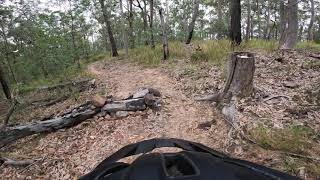
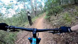
This track has been here for a long time. It's had some changes over that time such as course alterations and jumps added. It has some very rough sections that typify parts of Nerang National Park. The lower part near Casurina has a jump section with a couple of doubles that catch a lot of riders unaware. Take care on the trail, but it is a lot of fun when all jumps are made.
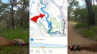
*NTCA has realigned the exit to avoid conflict with uphill riders on Casurina. Trail now merges with Comm Games loop. *

Local Trail Association
Traditionally Indigenous Territory

Recent Activity on Trail

Past Week
  • 2 rides
  • 4 miles average
6 Months
  • 72 rides
  • 10 miles avg distance
All
  • 1,694 rides
  • Last: Jun 19, 2026
c1c2c3c4
January
February
March
April
May
June
July
August
September
October
November
December
update trails status or condition

Three Hills Trail Reports

statusdatedescription
Mar 28, 2026 @ 10:43am (Australia/Brisbane)
Mar 27, 2026
Running amazing, not to dry, not to dusty, and the final jumps and berms at the bottom have been fixed and are running better than ever.
Mar 17, 2026 @ 12:28pm (Australia/Brisbane)
Mar 16, 2026
The bottom section berms just got redone, as well as the 2 drops at the very end, with the rut that formed there now gone
Oct 1, 2025 @ 7:04am (Australia/Brisbane)
Sep 30, 2025
nice and dry
Aug 10, 2025 @ 4:16pm
Aug 10, 2025
Perfect time to go
Jun 1, 2024 @ 9:25pm
Jun 1, 2024
For those that haven't done it for a while, watch the changed drops.
more »
Status:
on Mar 28, 2026
Ideal
Avg: 3.61 (20 votes)
Your vote: 0

view (9,547)
close
3D
Trail Conditions
  • Unknown
  • Snow Groomed
  • Snow Packed
  • Snow Covered
  • Snow Cover Partial
  • Freeze/thaw Cycle
  • Icy
  • Prevalent Mud
  • Wet
  • Variable
  • Ideal
  • Dry
  • Very Dry
Trail Flow (Ridden Direction)
Trailforks scans users ridelogs to determine the most popular direction each trail is ridden. A good flowing trail network will have most trails flowing in a single direction according to their intension.
The colour categories are based on what percentage of riders are riding a trail in its intended direction.
  • > 96%
  • > 90%
  • > 80%
  • > 70%
  • > 50%
  • < 50%
  • bi-directional trail
  • no data
Trail Last Ridden
Trailforks scans ridelogs to determine the last time a trail was ridden.
  • < 2 days
  • < 1 week
  • < 2 weeks
  • < 1 month
  • < 6 months
  • > 6 months
Trail Ridden Direction
The intended direction a trail should be ridden.
  • Downhill Only
  • Downhill Primary
  • Both Directions
  • Uphill Primary
  • Uphill Only
  • One Direction
Contribute Details
Colors indicate trail is missing specified detail.
  • Description
  • Photos
  • Description & Photos
  • Videos
Trail Popularity ?
Trailforks scans ridelogs to determine which trails are ridden the most in the last 9 months. Trails are compared with nearby trails in the same city region with a possible 25 colour shades. Think of this as a heatmap, more rides = more kinetic energy = warmer colors.
  • most popular
  • popular
  • less popular
  • not popular
ATV/ORV/OHV Filter
Max Vehicle Width
inches
US Cell Coverage
Legend
cell carrier legend

Radar Time
Activity Recordings
Trailforks uses anonymized public activity data. ?
Activity Recordings
Trailforks uses anonymized public activity data. ?
Personal Heatmap
Activity Types
all / none
Options
2
Date range month
Winter Trails
Warning A routing network for winter maps does not exist. Selecting trails using the winter trails layer has been disabled.
Missing Trails
Most Popular
Least Popular
Trails are colored based on popularity. The more popular a trail is, the more red. Less popular trails trend towards green.
Jump Magnitude Heatmap
Heatmap of where riders jump on trails. Zoom in to see individual jumps, click circles to view jump details.
BC Backroad Status

Service Road Atlas is a free to use, community-driven service for viewing and creating reports on the numerous back-country service roads around B.C. and Alberta.

map legend
Slope Aspect
Direction the slope faces
Flat N NE E SE S SW W NW
Trails Deemphasized
Trails are shown in grey.
disable
Only show trails with no bike usage.
Enable
Suggested Layers
Based on selected activity type

    Save the current map location and zoom level as your default home location whenever this page is loaded.

    Save
        Directions to three-hills trailhead (-27.973110, 153.327250)

        Photos

        50 more »
        187 |
        Aug 11, 2022 @ 6:44pm
        Aug 11, 2022
        117 |
        Jul 15, 2021 @ 12:19am
        Jul 15, 2021
        92 |
        Jun 19, 2020 @ 3:45pm
        Jun 19, 2020
        135 |
        Aug 31, 2019 @ 4:23am
        Aug 31, 2019

        Videos

        4 more »
        Three Hills to Trailhead - Nerang MTB Park
        8:52 | 424 | Oct 30, 2022 , Gold Coast
        Three Hills (Downhill) - Nerang National Park...
        8:11 | 2511 | Jul 27, 2020 , Gold Coast
        Three hills trail, top to bottom, Nerang state...
        8:30 | 958 | Jun 20, 2020 , Gold Coast
        Three Hills @ Nerang MTB Park - Trail Detail Vid
        7:18 | 127 | Apr 29, 2022 , Gold Coast

        Routes with this trail

        2.0 9 miles 1,229 ft 10
        Suggested loop while closed
        1.0 10 miles 1,302 ft 26 Loop
        Good loop for beginners looking to ride some blue trails as well. A few narrow climbing trails that can be...
        6 miles 795 ft 4
        2020 Fox Superflow course

        Trail Events

        7 Reviews & Comments


        We hope you've been enjoying Trailforks!

        Create a FREE account to view trail comments and much more.

        • By aaroncobTF Pro & contributors
        • #49597 - 5,478 views

        Frequently Asked Questions About Three Hills

        Where is Three Hills located?
        Three Hills is located in Nerang National Park, Gold Coast, Australia. It is part of the Nerang National Park trail network. The trailhead is located at coordinates -27.97311, 153.32725.
        How hard is Three Hills?
        Three Hills is rated as Blue difficulty. The physical rating is Moderate. The average grade is 5.1%. The climb difficulty is rated Blue.
        What is the elevation gain for Three Hills?
        Three Hills has 39 ft of elevation gain. The trail has 425 ft of elevation descent. The elevation ranges from 93 ft to 506 ft.
        Is Three Hills a point to point trail?
        Three Hills is not a point to point trail. The direction is Both Directions. The trail type is singletrack.

        Hit the Trail

        Open in App

        Get this trail on your phone instantly.
        open trail in app

        Download Trail

        Save to wishlist, Garmin & download.
        save the trail

        Find Related Routes

        Find routes and users activities that include this trail.
        find routes for this trail

        You must enter a description before submitting.