more stats
1.1 miles
Distance
-1,064 ft
Descent
00:08:15
Avg time
-1,064 ft
Altitude change
3,760 ft
Altitude min
4,824 ft
Altitude max
4,824 ft
Altitude start
3,760 ft
Altitude end
-18.1%
Grade
-65.2%
Grade max
1 mile
Distance down
135 ft
Distance flat
00:08:15
Avg time

Three Kings Details

  • Activities
    • Mountain Bike
    • E-Bike
    • Hike
    • Trail Running
  • Riding Area
    Morrissey Ridge
    Fernie, British Columbia
  • Difficulty Rating
  • Local Popularity
    60 in Mountain Biking [+]
    • 55 in E-Biking
    • 5 in Trail Running
    • 5 in Hiking
  • Global Ranking
    #75547 in Mountain Biking [+]
    • #84707 in E-Biking
    • #287680 in Trail Running
    • #274689 in Hiking
  • Trail Type
    Singletrack
  • Bike Type
    DH, AM
  • Dogs Allowed
    Yes
  • eBike Allowed
    Yes up to Class 1
  • TTFs on Trail
    Bridge, Drop, Jump, Skinny, Wallride

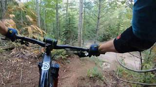
A trail of two halves - ride it form the gravel pit at the top of the Shuttle Road and the first half is very steep, but stunt free, regularly crossing the shuttle road. About half way down it changes into something much more mellow: lots of log rides and wooden stunts, all of which should be looked at before being attempted. Note the steep ride around on the map if you're getting tired of having your privates rubbing on your back tire.

Access Info

Ride of drive up the shuttle road. Start is on the left as you look up at the mountain, where 48 Hours also starts. They split shortly after the start. If you want to miss the steep rocky stuff at the top, then start on 48 Hours until you get to the "Kootenay Anal" section. Turn left here and loop out to the left. As it turns back right towards 48 Hours again, there is a left that will take you down to join the mellower sections of Three Kings.

Local Trail Association
Traditionally Indigenous Territory

Recent Activity on Trail

Past Week
  • 1 rides
  • 6 miles average
6 Months
  • 6 rides
  • 13 miles avg distance
All
  • 102 rides
  • Last: Jun 20, 2026
c1c2c3c4
January
February
March
April
May
June
July
August
September
October
November
December
update trails status or condition

Three Kings Trail Reports

statusdatedescription
May 3, 2026 @ 5:47pm (America/Edmonton)
May 3, 2026
Trail is rideable - could use a rake to remove some of the loose rocks. A fee if the bridges had missing or broken boards. Some erosion from last...
Oct 25, 2025 @ 9:30am (America/Edmonton)
Oct 25, 2025
Morrissey shuttle trails and roads are open again
Sep 4, 2025 @ 10:19am
Sep 4, 2025
Morrissey Shuttle trails and roads are closed until further notice due to logging operations. This includes all trails accessed via Matheson...
Jul 23, 2025 @ 5:42am
Jul 23, 2025
48 hours and Three Kings and One More Steeps and Green Matador have been brushcut in the past week.
May 8, 2025 @ 7:39pm
May 8, 2025
more »
Status:
on May 3, 2026
Variable
Avg: 4.52 (19 votes)
Your vote: 0

view (986)
close
3D
Trail Conditions
  • Unknown
  • Snow Groomed
  • Snow Packed
  • Snow Covered
  • Snow Cover Partial
  • Freeze/thaw Cycle
  • Icy
  • Prevalent Mud
  • Wet
  • Variable
  • Ideal
  • Dry
  • Very Dry
Trail Flow (Ridden Direction)
Trailforks scans users ridelogs to determine the most popular direction each trail is ridden. A good flowing trail network will have most trails flowing in a single direction according to their intension.
The colour categories are based on what percentage of riders are riding a trail in its intended direction.
  • > 96%
  • > 90%
  • > 80%
  • > 70%
  • > 50%
  • < 50%
  • bi-directional trail
  • no data
Trail Last Ridden
Trailforks scans ridelogs to determine the last time a trail was ridden.
  • < 2 days
  • < 1 week
  • < 2 weeks
  • < 1 month
  • < 6 months
  • > 6 months
Trail Ridden Direction
The intended direction a trail should be ridden.
  • Downhill Only
  • Downhill Primary
  • Both Directions
  • Uphill Primary
  • Uphill Only
  • One Direction
Contribute Details
Colors indicate trail is missing specified detail.
  • Description
  • Photos
  • Description & Photos
  • Videos
Trail Popularity ?
Trailforks scans ridelogs to determine which trails are ridden the most in the last 9 months. Trails are compared with nearby trails in the same city region with a possible 25 colour shades. Think of this as a heatmap, more rides = more kinetic energy = warmer colors.
  • most popular
  • popular
  • less popular
  • not popular
ATV/ORV/OHV Filter
Max Vehicle Width
inches
US Cell Coverage
Legend
cell carrier legend

Radar Time
Activity Recordings
Trailforks uses anonymized public activity data. ?
Activity Recordings
Trailforks uses anonymized public activity data. ?
Personal Heatmap
Activity Types
all / none
Options
2
Date range month
Winter Trails
Warning A routing network for winter maps does not exist. Selecting trails using the winter trails layer has been disabled.
Missing Trails
Most Popular
Least Popular
Trails are colored based on popularity. The more popular a trail is, the more red. Less popular trails trend towards green.
Jump Magnitude Heatmap
Heatmap of where riders jump on trails. Zoom in to see individual jumps, click circles to view jump details.
BC Backroad Status

Service Road Atlas is a free to use, community-driven service for viewing and creating reports on the numerous back-country service roads around B.C. and Alberta.

map legend
Slope Aspect
Direction the slope faces
Flat N NE E SE S SW W NW
Trails Deemphasized
Trails are shown in grey.
disable
Only show trails with no bike usage.
Enable
Suggested Layers
Based on selected activity type

    Save the current map location and zoom level as your default home location whenever this page is loaded.

    Save
        Directions to three-kings trailhead (49.455330, -115.018070)

        Photos

        60 more »
        1,530 |
        Oct 5, 2005 @ 4:55pm
        Oct 5, 2005
        642 |
        Sep 3, 2008 @ 8:01pm
        Sep 3, 2008
        139 |
        Sep 5, 2021 @ 10:06am
        Sep 5, 2021
        478 |
        Jul 11, 2021 @ 9:01pm
        Jul 11, 2021

        Videos

        8 more »
        youtuber I Couldn't Decide... and It Cost Me...
        8:27 | 853 | Sep 3, 2020 , Fernie
        youtuber Mountain Biking: 3 Kings, Fernie, BC.
        5:57 | 791 | Jan 27, 2020 , Fernie
        Three Kings - Fernie, BC - August 2019 (HD POV)
        6:45 | 553 | Aug 29, 2019 , Fernie
        Three Kings Trail, July 2012
        901 | Aug 1, 2012 , Fernie

        5 Reviews & Comments


        We hope you've been enjoying Trailforks!

        Create a FREE account to view trail comments and much more.

        • By canadakaTF Pro Trailforks & contributors
        • #1960 - 8,358 views

        Frequently Asked Questions About Three Kings

        Where is Three Kings located?
        Three Kings is located in Morrissey Ridge, Fernie, British Columbia, Canada. It is part of the Morrissey Ridge trail network. The trailhead is located at coordinates 49.45533, -115.01807.
        How hard is Three Kings?
        Three Kings is rated as Black Diamond difficulty. The average grade is 18.1%.
        What is the elevation gain for Three Kings?
        The trail has 1,064 ft of elevation descent. The elevation ranges from 3,760 ft to 4,824 ft.
        How long is Three Kings?
        Three Kings is 1.1 miles long. The trail type is singletrack.

        Hit the Trail

        Open in App

        Get this trail on your phone instantly.
        open trail in app

        Download Trail

        Save to wishlist, Garmin & download.
        save the trail

        Find Related Routes

        Find routes and users activities that include this trail.
        find routes for this trail

        You must enter a description before submitting.