more stats
3,120 ft
Distance
-308 ft
Descent
00:03:47
Avg time
-308 ft
Altitude change
1,119 ft
Altitude min
1,427 ft
Altitude max
1,427 ft
Altitude start
1,119 ft
Altitude end
-9.9%
Grade
-21%
Grade max
-2.2%
Grade min
3,015 ft
Distance down
105 ft
Distance flat
00:03:47
Avg time

TNT Details

  • Activities
    • Mountain Bike
  • Riding Area
    Sandy Ridge
    Sandy, Oregon
  • Difficulty Rating
  • Voted Difficulty
    Black Diamond (5 votes)
  • Local Popularity
    85 in Mountain Biking
  • Global Ranking
    #51825 in Mountain Biking
  • Trail Type
    Singletrack
  • Bike Type
    DH, AM, DJ
  • Physical Rating
    Moderate
  • Trail Visibility
    Always easy to follow
  • Dogs Allowed
    Yes
  • eBike Allowed
  • TTFs on Trail
    Berm, Drop, Jump, Gap Jump
  • Ride in Rain
    Yes
  • Land Owner
    BLM

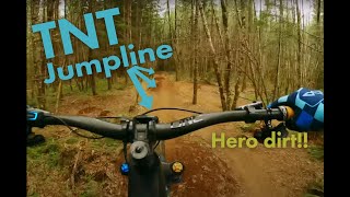
Sandy Ridge's Freeride trail. Almost all jumps are gaps, a few step-downs too. Eventually connects to Little Monkey and then to Lower Hide and Seek

Trail Supporters
  • BLM
    BLM
    Land Manager
Local Trail Association
Traditionally Indigenous Territory

Recent Activity on Trail

Past Week
  • 8 rides
  • 13 miles average
6 Months
  • 118 rides
  • 13 miles avg distance
All
  • 1,149 rides
  • Last: Jun 21, 2026
c1c2c3c4
January
February
March
April
May
June
July
August
September
October
November
December
Status:
on Apr 19, 2026
Ideal
Avg: 4.26 (21 votes)
Your vote: 0

view (5,958)
close
3D
Trail Conditions
  • Unknown
  • Snow Groomed
  • Snow Packed
  • Snow Covered
  • Snow Cover Partial
  • Freeze/thaw Cycle
  • Icy
  • Prevalent Mud
  • Wet
  • Variable
  • Ideal
  • Dry
  • Very Dry
Trail Flow (Ridden Direction)
Trailforks scans users ridelogs to determine the most popular direction each trail is ridden. A good flowing trail network will have most trails flowing in a single direction according to their intension.
The colour categories are based on what percentage of riders are riding a trail in its intended direction.
  • > 96%
  • > 90%
  • > 80%
  • > 70%
  • > 50%
  • < 50%
  • bi-directional trail
  • no data
Trail Last Ridden
Trailforks scans ridelogs to determine the last time a trail was ridden.
  • < 2 days
  • < 1 week
  • < 2 weeks
  • < 1 month
  • < 6 months
  • > 6 months
Trail Ridden Direction
The intended direction a trail should be ridden.
  • Downhill Only
  • Downhill Primary
  • Both Directions
  • Uphill Primary
  • Uphill Only
  • One Direction
Contribute Details
Colors indicate trail is missing specified detail.
  • Description
  • Photos
  • Description & Photos
  • Videos
Trail Popularity ?
Trailforks scans ridelogs to determine which trails are ridden the most in the last 9 months. Trails are compared with nearby trails in the same city region with a possible 25 colour shades. Think of this as a heatmap, more rides = more kinetic energy = warmer colors.
  • most popular
  • popular
  • less popular
  • not popular
ATV/ORV/OHV Filter
Max Vehicle Width
inches
US Cell Coverage
Legend
cell carrier legend

Radar Time
Activity Recordings
Trailforks uses anonymized public activity data. ?
Activity Recordings
Trailforks uses anonymized public activity data. ?
Personal Heatmap
Activity Types
all / none
Options
2
Date range month
Winter Trails
Warning A routing network for winter maps does not exist. Selecting trails using the winter trails layer has been disabled.
Missing Trails
Most Popular
Least Popular
Trails are colored based on popularity. The more popular a trail is, the more red. Less popular trails trend towards green.
Jump Magnitude Heatmap
Heatmap of where riders jump on trails. Zoom in to see individual jumps, click circles to view jump details.
BC Backroad Status

Service Road Atlas is a free to use, community-driven service for viewing and creating reports on the numerous back-country service roads around B.C. and Alberta.

map legend
Slope Aspect
Direction the slope faces
Flat N NE E SE S SW W NW
Trails Deemphasized
Trails are shown in grey.
disable
Only show trails with no bike usage.
Enable
Suggested Layers
Based on selected activity type

    Save the current map location and zoom level as your default home location whenever this page is loaded.

    Save
        Directions to tnt-49901 trailhead (45.384440, -122.018610)

        Photos

        44 more »
        778 |
        Aug 13, 2017 @ 10:55pm
        Aug 13, 2017
        1,063 |
        Dec 10, 2012 @ 10:52pm
        Dec 10, 2012
        13 |
        Apr 29, 2026 @ 8:34am
        Apr 29, 2026
        62 |
        Jan 26, 2025 @ 2:46pm
        Jan 26, 2025

        Videos

        17 more »
        Hero Dirt! TNT  is the Perfect Jumpline
        2:04 | 411 | May 4, 2023 , Sandy
        TNT | Sandy Ridge MTB | 4K
        0:16 | 212 | Nov 19, 2022 , Sandy
        TNT Full Run
        15:48 | 267 | Sep 8, 2022 , Sandy
        Mouth Breathing (Even On the Descents) Mtb...
        6:35 | 194 | Feb 24, 2022 , Sandy

        Routes with this trail

        2.5 14 miles 2,941 ft 30 Loop
        Two laps at Sandy Ridge hitting most of the favorite trails.

        4 Reviews & Comments


        We hope you've been enjoying Trailforks!

        Create a FREE account to view trail comments and much more.

        • By chriscliffordTF Pro & contributors
        • #49901 - 7,018 views

        Frequently Asked Questions About TNT

        Where is TNT located?
        TNT is located in Sandy Ridge, Sandy, Oregon, United States. It is part of the Sandy Ridge trail network. The trailhead is located at coordinates 45.38444, -122.01861.
        How hard is TNT?
        TNT is rated as Double Black Diamond difficulty. The physical rating is Moderate. The average grade is 9.9%.
        What is the elevation gain for TNT?
        The trail has 308 ft of elevation descent. The elevation ranges from 1,119 ft to 1,427 ft.
        How long is TNT?
        TNT is 3,120 ft long. The trail type is singletrack.

        Hit the Trail

        Open in App

        Get this trail on your phone instantly.
        open trail in app

        Download Trail

        Save to wishlist, Garmin & download.
        save the trail

        Find Related Routes

        Find routes and users activities that include this trail.
        find routes for this trail

        You must enter a description before submitting.