more stats
2,874 ft
Distance
9 ft
Climb
-246 ft
Descent
00:03:03
Avg time
-238 ft
Altitude change
686 ft
Altitude min
930 ft
Altitude max
924 ft
Altitude start
686 ft
Altitude end
-8.3%
Grade
-23.7%
Grade max
7.1%
Grade min
213 ft
Distance climb
2,103 ft
Distance down
558 ft
Distance flat
00:03:03
Avg time

Torpedo Run Details

  • Activities
    • Mountain Bike
    • E-Bike
  • Riding Area
    Hartland Mountain Bike Park
    Victoria, British Columbia
  • Difficulty Rating
  • Voted Difficulty
    Blue (7 votes)
  • Local Popularity
    100 in Mountain Biking [+]
    • 100 in E-Biking
  • Global Ranking
    #863 in Mountain Biking [+]
    • #1868 in E-Biking
  • Trail Type
    Doubletrack
  • Bike Type
    AM
  • Direction
    Downhill Only
    Popular Direction Shown
  • Physical Rating
    Moderate
  • Trail Visibility
    Always easy to follow
  • Dogs Allowed
    Yes
  • eBike Allowed
  • TTFs on Trail
    Berm, Drop, Jump, Wallride
  • Ride in Rain
    Yes
  • Year Opened
    2011
  • Land Owner

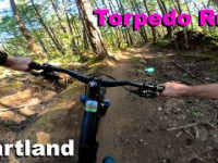
Torpedo Run is Hartland's original flow trail, and remains the only trail to have been mostly machine built. A double-track blue flow trail, it has good sight lines, lots of speed and options for all levels of riders. It has undergone a rebuild by the SIMBS trail crew to improve flow and overall speed. Be sure to check out the world's only (that we know of) Wood Armoured Berm (W.A.B.)!

Access Info

The best route takes Middle-earth up to Pay It Forward and gets you right to Torpedo. From the north end of the park, you can take Old Payoff to Pay It Forward, or for a grunt, you can hike up the Push Up access off Middle-earth.

Trail Supporters
  • Chris Oman/ Craig Gillett/ SIMBS/ CRD
    since 2011
    Builder
  • Erik Beiderwieden
    since 2023
    Builder
Local Trail Association

Recent Activity on Trail

Past Week
  • 56 rides
  • 13.0 km average
6 Months
  • 1,090 rides
  • 11.6 km avg distance
All
  • 6,616 rides
  • Last: Jun 21, 2026
c1c2c3c4
January
February
March
April
May
June
July
August
September
October
November
December
Status:
on Jun 14, 2026
Dry
Avg: 4.42 (67 votes)
Your vote: 0

view (25,361)
close
3D
Trail Conditions
  • Unknown
  • Snow Groomed
  • Snow Packed
  • Snow Covered
  • Snow Cover Partial
  • Freeze/thaw Cycle
  • Icy
  • Prevalent Mud
  • Wet
  • Variable
  • Ideal
  • Dry
  • Very Dry
Trail Flow (Ridden Direction)
Trailforks scans users ridelogs to determine the most popular direction each trail is ridden. A good flowing trail network will have most trails flowing in a single direction according to their intension.
The colour categories are based on what percentage of riders are riding a trail in its intended direction.
  • > 96%
  • > 90%
  • > 80%
  • > 70%
  • > 50%
  • < 50%
  • bi-directional trail
  • no data
Trail Last Ridden
Trailforks scans ridelogs to determine the last time a trail was ridden.
  • < 2 days
  • < 1 week
  • < 2 weeks
  • < 1 month
  • < 6 months
  • > 6 months
Trail Ridden Direction
The intended direction a trail should be ridden.
  • Downhill Only
  • Downhill Primary
  • Both Directions
  • Uphill Primary
  • Uphill Only
  • One Direction
Contribute Details
Colors indicate trail is missing specified detail.
  • Description
  • Photos
  • Description & Photos
  • Videos
Trail Popularity ?
Trailforks scans ridelogs to determine which trails are ridden the most in the last 9 months. Trails are compared with nearby trails in the same city region with a possible 25 colour shades. Think of this as a heatmap, more rides = more kinetic energy = warmer colors.
  • most popular
  • popular
  • less popular
  • not popular
ATV/ORV/OHV Filter
Max Vehicle Width
inches
US Cell Coverage
Legend
cell carrier legend

Radar Time
Activity Recordings
Trailforks uses anonymized public activity data. ?
Activity Recordings
Trailforks uses anonymized public activity data. ?
Personal Heatmap
Activity Types
all / none
Options
2
Date range month
Winter Trails
Warning A routing network for winter maps does not exist. Selecting trails using the winter trails layer has been disabled.
Missing Trails
Most Popular
Least Popular
Trails are colored based on popularity. The more popular a trail is, the more red. Less popular trails trend towards green.
Jump Magnitude Heatmap
Heatmap of where riders jump on trails. Zoom in to see individual jumps, click circles to view jump details.
BC Backroad Status

Service Road Atlas is a free to use, community-driven service for viewing and creating reports on the numerous back-country service roads around B.C. and Alberta.

map legend
Slope Aspect
Direction the slope faces
Flat N NE E SE S SW W NW
Trails Deemphasized
Trails are shown in grey.
disable
Only show trails with no bike usage.
Enable
Suggested Layers
Based on selected activity type

    Save the current map location and zoom level as your default home location whenever this page is loaded.

    Save
        Directions to torpedo-run trailhead (48.533300, -123.470300)

        Photos

        126 more »
        3 |
        Jun 18, 2026 @ 3:44pm
        Jun 18, 2026
        6 |
        Jun 18, 2026 @ 3:44pm
        Jun 18, 2026
        0 |
        Jun 18, 2026 @ 3:44pm
        Jun 18, 2026
        1 |
        Jun 18, 2026 @ 3:44pm
        Jun 18, 2026

        Videos

        66 more »
        youtuber MTB Riding Hartland Trails, Victoria on...
        11:28 | 130 | Sep 20, 2025 , Victoria
        Torpedo Run - Hartland 2026
        27 | May 21, 2026 , Victoria
        youtuber I need to ride these Victoria trails more often...
        8:24 | 75 | Nov 20, 2025 , Victoria
        MB6 Light on Torpedo Run
        2:09 | 62 | Jul 21, 2025 , Victoria

        Routes with this trail

        5.0 6 miles 1,087 ft 13
        This loop suggestion is part of our Community Routes—a group of routes created by the community, for the...
        4.8 5 miles 981 ft 26 Loop
        Pretty fantastic route around Hartland. Easily sub Snakes for Torpedo and/or for Sofa if you want to up...
        5 miles 952 ft 11
        Join us for a women's and non-binary community enduro race at Hartland Bike Park! Low barrier, high vibes,...

        9 Reviews & Comments


        We hope you've been enjoying Trailforks!

        Create a FREE account to view trail comments and much more.

        • By KZ-Powned & contributors
        • #1153 - 12,516 views

        Frequently Asked Questions About Torpedo Run

        Where is Torpedo Run located?
        Torpedo Run is located in Hartland Mountain Bike Park, Victoria, British Columbia, Canada. It is part of the Hartland Mountain Bike Park trail network. The trailhead is located at coordinates 48.5333, -123.4703.
        How hard is Torpedo Run?
        Torpedo Run is rated as Blue difficulty. The physical rating is Moderate. The average grade is 8.3%.
        What is the elevation gain for Torpedo Run?
        Torpedo Run has 9 ft of elevation gain. The trail has 246 ft of elevation descent. The elevation ranges from 686 ft to 930 ft.
        Is Torpedo Run a point to point trail?
        Yes, Torpedo Run is a point to point trail. The direction is Downhill Only. The trail type is doubletrack.

        Hit the Trail

        Open in App

        Get this trail on your phone instantly.
        open trail in app

        Download Trail

        Save to wishlist, Garmin & download.
        save the trail

        Find Related Routes

        Find routes and users activities that include this trail.
        find routes for this trail

        You must enter a description before submitting.