more stats
2,877 ft
Distance
120 ft
Climb
-29 ft
Descent
00:05:52
Avg time
92 ft
Altitude change
899 ft
Altitude min
993 ft
Altitude max
899 ft
Altitude start
991 ft
Altitude end
3.2%
Grade
-19.3%
Grade max
11.8%
Grade min
2,064 ft
Distance climb
394 ft
Distance down
390 ft
Distance flat
00:05:52
Avg time

Tracks from Hell Details

  • Activities
    • Mountain Bike
    • E-Bike
    • Hike
    • Trail Running
  • Riding Area
    Alice Lake & Highlands
    Squamish, British Columbia
  • Difficulty Rating
  • Voted Difficulty
    Blue (3 votes)
  • Local Popularity
    100 in Mountain Biking [+]
    • 100 in E-Biking
    • 100 in Trail Running
    • 90 in Hiking
  • Global Ranking
    #156 in Mountain Biking [+]
    • #1828 in E-Biking
    • #241 in Trail Running
    • #1522 in Hiking
  • Hiking SAC Scale
    T1 Hiking
  • Trail Type
    Singletrack
  • Bike Type
    AM, XC
  • Direction
    Both Directions
    Popular Direction Shown
  • Climb Difficulty
    Blue
  • Physical Rating
    Moderate
  • Trail Visibility
    Always easy to follow
  • Dogs Allowed
    Yes
  • eBike Allowed
    Yes up to Class 1
  • TTFs on Trail
    Bridge, Skinny
  • Ride in Rain
    Yes

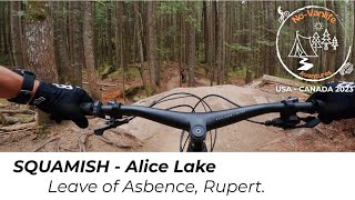
This is an old logging road that connects the mashiter to Edith lake.
It can be ridden in both directions and has a long skinny/boardwalk.

The name references the wood that is built into the road, that feels like railway tiles when biking over them.

Local Trail Association
Traditionally Indigenous Territory

Recent Activity on Trail

Past Week
  • 64 rides
  • 11 miles average
6 Months
  • 955 rides
  • 12 miles avg distance
All
  • 11,059 rides
  • Last: Jun 17, 2026
c1c2c3c4
January
February
March
April
May
June
July
August
September
October
November
December
update trails status or condition

Tracks from Hell Trail Reports

statusdatedescription
Jun 17, 2026 @ 9:52pm (America/Vancouver)
14 hours
Tree down
Jun 17, 2026 @ 2:21pm (America/Vancouver)
21 hours
pic of the tree for perspective. Bigger than a handsaw.
Jun 16, 2026 @ 5:00pm (America/Vancouver)
2 days
As of 5pm June 16, tree down across trail a few metres from the north side of skinny/boardwalk section. Trunk is ~1.5ft in diameter.
Jun 13, 2026 @ 8:23am (America/Vancouver)
Jun 13, 2026
Jun 11, 2026 @ 5:48pm (America/Vancouver)
Jun 11, 2026
more »
Status:
on Jun 17, 2026
Avg: 3.78 (81 votes)
Your vote: 0

view (83,289)
close
3D
Trail Conditions
  • Unknown
  • Snow Groomed
  • Snow Packed
  • Snow Covered
  • Snow Cover Partial
  • Freeze/thaw Cycle
  • Icy
  • Prevalent Mud
  • Wet
  • Variable
  • Ideal
  • Dry
  • Very Dry
Trail Flow (Ridden Direction)
Trailforks scans users ridelogs to determine the most popular direction each trail is ridden. A good flowing trail network will have most trails flowing in a single direction according to their intension.
The colour categories are based on what percentage of riders are riding a trail in its intended direction.
  • > 96%
  • > 90%
  • > 80%
  • > 70%
  • > 50%
  • < 50%
  • bi-directional trail
  • no data
Trail Last Ridden
Trailforks scans ridelogs to determine the last time a trail was ridden.
  • < 2 days
  • < 1 week
  • < 2 weeks
  • < 1 month
  • < 6 months
  • > 6 months
Trail Ridden Direction
The intended direction a trail should be ridden.
  • Downhill Only
  • Downhill Primary
  • Both Directions
  • Uphill Primary
  • Uphill Only
  • One Direction
Contribute Details
Colors indicate trail is missing specified detail.
  • Description
  • Photos
  • Description & Photos
  • Videos
Trail Popularity ?
Trailforks scans ridelogs to determine which trails are ridden the most in the last 9 months. Trails are compared with nearby trails in the same city region with a possible 25 colour shades. Think of this as a heatmap, more rides = more kinetic energy = warmer colors.
  • most popular
  • popular
  • less popular
  • not popular
ATV/ORV/OHV Filter
Max Vehicle Width
inches
US Cell Coverage
Legend
cell carrier legend

Radar Time
Activity Recordings
Trailforks uses anonymized public activity data. ?
Activity Recordings
Trailforks uses anonymized public activity data. ?
Personal Heatmap
Activity Types
all / none
Options
2
Date range month
Winter Trails
Warning A routing network for winter maps does not exist. Selecting trails using the winter trails layer has been disabled.
Missing Trails
Most Popular
Least Popular
Trails are colored based on popularity. The more popular a trail is, the more red. Less popular trails trend towards green.
Jump Magnitude Heatmap
Heatmap of where riders jump on trails. Zoom in to see individual jumps, click circles to view jump details.
BC Backroad Status

Service Road Atlas is a free to use, community-driven service for viewing and creating reports on the numerous back-country service roads around B.C. and Alberta.

map legend
Slope Aspect
Direction the slope faces
Flat N NE E SE S SW W NW
Trails Deemphasized
Trails are shown in grey.
disable
Only show trails with no bike usage.
Enable
Suggested Layers
Based on selected activity type

    Save the current map location and zoom level as your default home location whenever this page is loaded.

    Save
        Directions to tracks-from-hell-3436 trailhead (49.769910, -123.102600)

        Photos

        40 more »
        1,039 |
        Apr 16, 2017 @ 9:38pm
        Apr 16, 2017
        1,073 |
        Sep 7, 2016 @ 11:10pm
        Sep 7, 2016
        66 |
        Aug 13, 2025 @ 10:07am
        Aug 13, 2025
        78 |
        Aug 13, 2025 @ 10:07am
        Aug 13, 2025

        Videos

        3 more »
        Bike Balance Trail: Tracks from Hell
        3:44 | 308 | Jul 10, 2024 , Squamish
        MTB - Squamish (BC) : Alice Lake - Leave of...
        11:41 | 466 | Jul 5, 2023 , Squamish
        This Trail Is A Dangerous Balance Act With...
        2:16 | 605 | Jul 30, 2022 , Squamish

        Routes with this trail

        5.0 5 miles 755 ft 8 Loop
        Check out or recommended route for the Alice Lakes & Highlands zone!
        5 miles 756 ft 7
        3.0 11 miles 2,094 ft 37 Loop
        The toughest trails in Squamish, compiled. Try not to crash.

        7 Reviews & Comments


        We hope you've been enjoying Trailforks!

        Create a FREE account to view trail comments and much more.

        • By davereidTF Pro & contributors
        • #3436 - 20,742 views

        Frequently Asked Questions About Tracks from Hell

        Where is Tracks from Hell located?
        Tracks from Hell is located in Alice Lake & Highlands, Squamish, British Columbia, Canada. It is part of the Alice Lake & Highlands trail network. The trailhead is located at coordinates 49.76991, -123.1026.
        How hard is Tracks from Hell?
        Tracks from Hell is rated as Blue difficulty. The physical rating is Moderate. The average grade is 3.2%. The climb difficulty is rated Blue.
        What is the elevation gain for Tracks from Hell?
        Tracks from Hell has 120 ft of elevation gain. The trail has 29 ft of elevation descent. The elevation ranges from 899 ft to 993 ft.
        Is Tracks from Hell a point to point trail?
        Tracks from Hell is not a point to point trail. The direction is Both Directions. The trail type is singletrack.

        Hit the Trail

        Open in App

        Get this trail on your phone instantly.
        open trail in app

        Download Trail

        Save to wishlist, Garmin & download.
        save the trail

        Find Related Routes

        Find routes and users activities that include this trail.
        find routes for this trail

        You must enter a description before submitting.