more stats
2.9 miles
Distance
66 ft
Climb
-1,351 ft
Descent
00:21:42
Avg time
-1,285 ft
Altitude change
3,237 ft
Altitude min
4,523 ft
Altitude max
4,523 ft
Altitude start
3,238 ft
Altitude end
-8.3%
Grade
-54.6%
Grade max
20.2%
Grade min
1,857 ft
Distance climb
2 miles
Distance down
1,102 ft
Distance flat
00:21:42
Avg time

Lower 290 Details

  • Activities
    • Mountain Bike
    • E-Bike
  • Riding Area
    Mount Spokane
    Spokane, Washington
  • AKA
    The Goods
  • Difficulty Rating
  • Local Popularity
    85 in Mountain Biking [+]
    • 80 in E-Biking
  • Global Ranking
    #31753 in Mountain Biking [+]
    • #5066 in E-Biking
  • Trail Type
    Singletrack
  • Bike Type
    DH, AM, XC, CX
  • Direction
    Downhill Only
    Popular Direction Shown
  • Climb Difficulty
    Black Diamond
  • Physical Rating
    Moderate
  • Trail Visibility
    Always easy to follow
  • eBike Allowed
    Yes up to Class 1
  • TTFs on Trail
    Berm, Bridge, Drop, Jump, Gap Jump, Ladder Bridge, Rock Garden
  • Year Opened
    2015
  • Land Owner
    Mt. Spokane state park

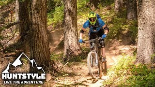
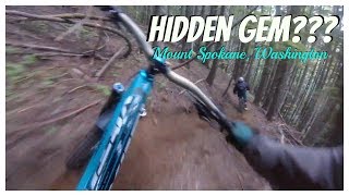
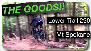
Beginning at the snowmobile parking lot and ending at the first parking lot inside the park, 290 (aka "The Goods") will challenge every rider. This downhill specific trail has a lot of fun stuff, rock gardens, jumps, tight trees, bridges, bonus lines and lots of corners to rip and beautiful ROOTS

Access Info

from the snowmobile parking lot, head down the trail 70ft below the bathroom. Go down the road 340 feet and it is on the right.

Traditionally Indigenous Territory

Recent Activity on Trail

Past Week
  • 5 rides
  • 13 miles average
6 Months
  • 45 rides
  • 11 miles avg distance
All
  • 476 rides
  • Last: Jun 15, 2026
c1c2c3c4
January
February
March
April
May
June
July
August
September
October
November
December
Status:
on May 9, 2026
Ideal
Avg: 4.43 (19 votes)
Your vote: 0

view (2,858)
close
3D
Trail Conditions
  • Unknown
  • Snow Groomed
  • Snow Packed
  • Snow Covered
  • Snow Cover Partial
  • Freeze/thaw Cycle
  • Icy
  • Prevalent Mud
  • Wet
  • Variable
  • Ideal
  • Dry
  • Very Dry
Trail Flow (Ridden Direction)
Trailforks scans users ridelogs to determine the most popular direction each trail is ridden. A good flowing trail network will have most trails flowing in a single direction according to their intension.
The colour categories are based on what percentage of riders are riding a trail in its intended direction.
  • > 96%
  • > 90%
  • > 80%
  • > 70%
  • > 50%
  • < 50%
  • bi-directional trail
  • no data
Trail Last Ridden
Trailforks scans ridelogs to determine the last time a trail was ridden.
  • < 2 days
  • < 1 week
  • < 2 weeks
  • < 1 month
  • < 6 months
  • > 6 months
Trail Ridden Direction
The intended direction a trail should be ridden.
  • Downhill Only
  • Downhill Primary
  • Both Directions
  • Uphill Primary
  • Uphill Only
  • One Direction
Contribute Details
Colors indicate trail is missing specified detail.
  • Description
  • Photos
  • Description & Photos
  • Videos
Trail Popularity ?
Trailforks scans ridelogs to determine which trails are ridden the most in the last 9 months. Trails are compared with nearby trails in the same city region with a possible 25 colour shades. Think of this as a heatmap, more rides = more kinetic energy = warmer colors.
  • most popular
  • popular
  • less popular
  • not popular
ATV/ORV/OHV Filter
Max Vehicle Width
inches
US Cell Coverage
Legend
cell carrier legend

Radar Time
Activity Recordings
Trailforks uses anonymized public activity data. ?
Activity Recordings
Trailforks uses anonymized public activity data. ?
Personal Heatmap
Activity Types
all / none
Options
2
Date range month
Winter Trails
Warning A routing network for winter maps does not exist. Selecting trails using the winter trails layer has been disabled.
Missing Trails
Most Popular
Least Popular
Trails are colored based on popularity. The more popular a trail is, the more red. Less popular trails trend towards green.
Jump Magnitude Heatmap
Heatmap of where riders jump on trails. Zoom in to see individual jumps, click circles to view jump details.
BC Backroad Status

Service Road Atlas is a free to use, community-driven service for viewing and creating reports on the numerous back-country service roads around B.C. and Alberta.

map legend
Slope Aspect
Direction the slope faces
Flat N NE E SE S SW W NW
Trails Deemphasized
Trails are shown in grey.
disable
Only show trails with no bike usage.
Enable
Suggested Layers
Based on selected activity type

    Save the current map location and zoom level as your default home location whenever this page is loaded.

    Save
        Directions to lower-290 trailhead (47.903560, -117.102590)

        Photos

        74 more »
        6 |
        Jun 13, 2026 @ 8:20pm
        Jun 13, 2026
        5 |
        Jun 13, 2026 @ 8:20pm
        Jun 13, 2026
        23 |
        Jul 26, 2025 @ 4:27pm
        Jul 26, 2025
        30 |
        Jul 26, 2025 @ 4:27pm
        Jul 26, 2025

        Videos

        8 more »
        youtuber Mountain Biking Trail 290 'The Goods' at Mount...
        6:24 | 1447 | Aug 16, 2018 , Spokane
        youtuber 'The Goods' - Trail 290 @ Mount Spokane,...
        7:57 | 1273 | Jun 13, 2017 , Spokane
        Rooty & ROWDY | Lower 290 'THE...
        15:03 | 277 | Jul 22, 2022 , Spokane
        The Goods 290 Part 2: Mt. Spokane
        9:38 | 382 | Jul 18, 2019 , Spokane

        Routes with this trail

        5.0 19 miles 4,244 ft 11 Loop
        This route uses as little road as possible to ride 290 and 140. Go up 120, down 290, then up 110 (hitting...
        12 miles 2,792 ft 7
        The full loop for Trail 290 minimizing the road.
        5.0 3 miles 58 ft 2 Race
        The People's Enduro Mt Spokane Stages 4 & 5 velonw.com All courses are subject to change at the promoters...

        12 Reviews & Comments


        We hope you've been enjoying Trailforks!

        Create a FREE account to view trail comments and much more.

        • By TimRidesBikesTF Pro & contributors
        • #66205 - 7,447 views

        Frequently Asked Questions About Lower 290

        Where is Lower 290 located?
        Lower 290 is located in Mount Spokane, Spokane, Washington, United States. It is part of the Mount Spokane trail network. The trailhead is located at coordinates 47.90356, -117.10259.
        How hard is Lower 290?
        Lower 290 is rated as Black Diamond difficulty. The physical rating is Moderate. The average grade is 8.3%. The climb difficulty is rated Black Diamond.
        What is the elevation gain for Lower 290?
        Lower 290 has 66 ft of elevation gain. The trail has 1,351 ft of elevation descent. The elevation ranges from 3,237 ft to 4,523 ft.
        Is Lower 290 a point to point trail?
        Yes, Lower 290 is a point to point trail. The direction is Downhill Only. The trail type is singletrack.

        Hit the Trail

        Open in App

        Get this trail on your phone instantly.
        open trail in app

        Download Trail

        Save to wishlist, Garmin & download.
        save the trail

        Find Related Routes

        Find routes and users activities that include this trail.
        find routes for this trail

        You must enter a description before submitting.