more stats
1.1 miles
Distance
48 ft
Climb
-186 ft
Descent
00:17:34
Avg time
-139 ft
Altitude change
1,834 ft
Altitude min
1,974 ft
Altitude max
1,974 ft
Altitude start
1,834 ft
Altitude end
-2.5%
Grade
-26.4%
Grade max
24.4%
Grade min
623 ft
Distance climb
2,490 ft
Distance down
2,388 ft
Distance flat
00:17:34
Avg time

Trash Details

  • Activities
    • Mountain Bike
    • Hike
    • Trail Running
  • Riding Area
    Cheakamus
    Whistler, British Columbia
  • Difficulty Rating
  • Local Popularity
    40 in Mountain Biking [+]
    • 85 in Trail Running
    • 75 in Hiking
  • Global Ranking
    #109784 in Mountain Biking [+]
    • #20272 in Trail Running
    • #63345 in Hiking
  • Trail Type
    Singletrack
  • Bike Type
    AM, XC
  • Direction
    Both Directions
  • Climb Difficulty
    Black Diamond
  • Physical Rating
    Moderate
  • Trail Visibility
    Always easy to follow
  • Dogs Allowed
    Yes
  • eBike Allowed

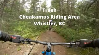
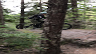
Trash is great single-track trail that winds through the forest on the east side of Cheakamus river. The trail winds it way south, paralleling the Cheakamus river and offers a couple of nice viewpoints. Although rated 'blue' it has some challenging sections and could easily be upgraded to 'black'

Access Info

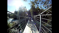
Make your way south of the Village to Function Junction and turn left (south) off the highway onto Chekamus Lake Road. If you need parking, there are ample spots available along this road. The start can be a little difficult to find so we have included a photo of the trailhead - it starts just past a 30km/h sign but before you enter the Cheakamus Crossing neighbourhood. The trail can be ridden in both directions (i.e. out and back) or, if you've had enough after one lap, follow the new Sea to Sky trail back towards Cheakamus Crossing.

Local Trail Association

Recent Activity on Trail

Past Week
  • 0 rides
  •  
6 Months
  • 7 rides
  • 7 miles avg distance
All
  • 279 rides
  • Last: Jun 16, 2026
c1c2c3c4
January
February
March
April
May
June
July
August
September
October
November
December
update trails status or condition

Trash Trail Reports

statusdatedescription
Apr 22, 2026 @ 5:32pm (America/Vancouver)
Apr 22, 2026
One tree down. Easy to get around or under.
Mar 29, 2026 @ 5:03pm (America/Vancouver)
Mar 29, 2026
Cleared and cut two trees on the small trail connector down to the bridge.
Mar 8, 2026 @ 3:41pm (America/Vancouver)
Mar 8, 2026
Cleared trees and branches from bridge to cut off to S2S EXCEPT large tree near bridge which needs chainsaw
Mar 8, 2026 @ 3:20pm (America/Vancouver)
Mar 8, 2026
Large tree needs clearing with chainsaw. Silky Big Boy I've got won't do....
Sep 2, 2025 @ 1:42pm
Sep 2, 2025
more »
Status:
on Apr 22, 2026
Ideal
Avg: 3.47 (13 votes)
Your vote: 0

view (1,147)
close
3D
Trail Conditions
  • Unknown
  • Snow Groomed
  • Snow Packed
  • Snow Covered
  • Snow Cover Partial
  • Freeze/thaw Cycle
  • Icy
  • Prevalent Mud
  • Wet
  • Variable
  • Ideal
  • Dry
  • Very Dry
Trail Flow (Ridden Direction)
Trailforks scans users ridelogs to determine the most popular direction each trail is ridden. A good flowing trail network will have most trails flowing in a single direction according to their intension.
The colour categories are based on what percentage of riders are riding a trail in its intended direction.
  • > 96%
  • > 90%
  • > 80%
  • > 70%
  • > 50%
  • < 50%
  • bi-directional trail
  • no data
Trail Last Ridden
Trailforks scans ridelogs to determine the last time a trail was ridden.
  • < 2 days
  • < 1 week
  • < 2 weeks
  • < 1 month
  • < 6 months
  • > 6 months
Trail Ridden Direction
The intended direction a trail should be ridden.
  • Downhill Only
  • Downhill Primary
  • Both Directions
  • Uphill Primary
  • Uphill Only
  • One Direction
Contribute Details
Colors indicate trail is missing specified detail.
  • Description
  • Photos
  • Description & Photos
  • Videos
Trail Popularity ?
Trailforks scans ridelogs to determine which trails are ridden the most in the last 9 months. Trails are compared with nearby trails in the same city region with a possible 25 colour shades. Think of this as a heatmap, more rides = more kinetic energy = warmer colors.
  • most popular
  • popular
  • less popular
  • not popular
ATV/ORV/OHV Filter
Max Vehicle Width
inches
US Cell Coverage
Legend
cell carrier legend

Radar Time
Activity Recordings
Trailforks uses anonymized public activity data. ?
Activity Recordings
Trailforks uses anonymized public activity data. ?
Personal Heatmap
Activity Types
all / none
Options
2
Date range month
Winter Trails
Warning A routing network for winter maps does not exist. Selecting trails using the winter trails layer has been disabled.
Missing Trails
Most Popular
Least Popular
Trails are colored based on popularity. The more popular a trail is, the more red. Less popular trails trend towards green.
Jump Magnitude Heatmap
Heatmap of where riders jump on trails. Zoom in to see individual jumps, click circles to view jump details.
BC Backroad Status

Service Road Atlas is a free to use, community-driven service for viewing and creating reports on the numerous back-country service roads around B.C. and Alberta.

map legend
Slope Aspect
Direction the slope faces
Flat N NE E SE S SW W NW
Trails Deemphasized
Trails are shown in grey.
disable
Only show trails with no bike usage.
Enable
Suggested Layers
Based on selected activity type

    Save the current map location and zoom level as your default home location whenever this page is loaded.

    Save
        Directions to trash trailhead (50.081110, -123.038790)

        Photos

        39 more »
        85 |
        Jun 29, 2024 @ 11:42pm
        Jun 29, 2024
        93 |
        Jul 8, 2023 @ 6:10pm
        Jul 8, 2023
        121 |
        Jul 6, 2021 @ 12:16pm
        Jul 6, 2021
        134 |
        Feb 21, 2021 @ 7:11am
        Feb 21, 2021

        Videos

        4 more »
        Trash in Whistler, BC
        14:12 | 202 | Nov 3, 2023 , Whistler
        Mel OTB
        0:07 | | Jul 24, 2023 , Whistler
        Mel OTB
        0:07 | | Jul 24, 2023 , Whistler
        Whistler - Part 2
        7:35 | 437 | Sep 10, 2015 , Whistler

        Trail Lists

        Routes with this trail

        30 miles 4,490 ft 25
        proposed running race course for Tenderfoot Boogie 2024
        6 miles 901 ft 7
        Whistler Relive Your Rides Cheakumus Quickie For other ride suggestions for this and other areas. As well...
        25 miles 5,110 ft 22
        2020 Cheakamus trail supporter challenge.

        Trail Products

        9 Reviews & Comments


        We hope you've been enjoying Trailforks!

        Create a FREE account to view trail comments and much more.

        • By canadakaTF Pro Trailforks & contributors
        • #4820 - 10,575 views

        Frequently Asked Questions About Trash

        Where is Trash located?
        Trash is located in Cheakamus, Whistler, British Columbia, Canada. It is part of the Cheakamus trail network. The trailhead is located at coordinates 50.08111, -123.03879.
        How hard is Trash?
        Trash is rated as Black Diamond difficulty. The physical rating is Moderate. The average grade is 2.5%. The climb difficulty is rated Black Diamond.
        What is the elevation gain for Trash?
        Trash has 48 ft of elevation gain. The trail has 186 ft of elevation descent. The elevation ranges from 1,834 ft to 1,974 ft.
        Is Trash a point to point trail?
        Trash is not a point to point trail. The direction is Both Directions. The trail type is singletrack.

        Hit the Trail

        Open in App

        Get this trail on your phone instantly.
        open trail in app

        Download Trail

        Save to wishlist, Garmin & download.
        save the trail

        Find Related Routes

        Find routes and users activities that include this trail.
        find routes for this trail

        You must enter a description before submitting.