more stats
2,448 ft
Distance
23 ft
Climb
-223 ft
Descent
00:05:15
Avg time
-200 ft
Altitude change
680 ft
Altitude min
883 ft
Altitude max
880 ft
Altitude start
679 ft
Altitude end
-8.2%
Grade
-30.2%
Grade max
23.8%
Grade min
417 ft
Distance climb
1,578 ft
Distance down
453 ft
Distance flat
00:05:15
Avg time

Trillium Details

  • Activities
    • Mountain Bike
    • E-Bike
    • Hike
    • Trail Running
  • Riding Area
    Hartland Mountain Bike Park
    Victoria, British Columbia
  • Difficulty Rating
  • Voted Difficulty
    Blue (1 vote)
  • Local Popularity
    90 in Mountain Biking [+]
    • 95 in E-Biking
    • 75 in Trail Running
    • 60 in Hiking
  • Global Ranking
    #24055 in Mountain Biking [+]
    • #6318 in E-Biking
    • #60688 in Trail Running
    • #81323 in Hiking
  • Hiking SAC Scale
    T1 Hiking
  • Trail Type
    Singletrack
  • Bike Type
    AM, XC
  • Direction
    Both Directions
  • Climb Difficulty
    Blue
  • Physical Rating
    Moderate
  • Trail Visibility
    Always easy to follow
  • Dogs Allowed
    Yes
  • eBike Allowed
  • TTFs on Trail
    Berm, Jump, Log Ride, Rock Garden
  • Ride in Rain
    Yes
  • Year Opened
    2012
  • Land Owner
    Capital Regional District

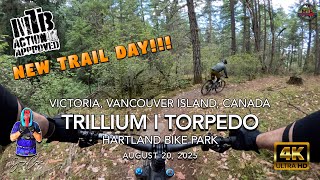
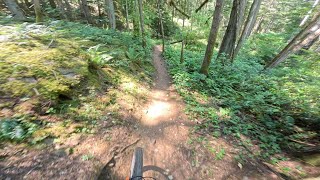
A fun swoopy downhill to get you to the bottom of Sidewinder, or a good climb to get you up to Old Payoff or Who's Your Daddy. Completed in March 2012, this is a good example of sustainable and fun trail design. Trillium offers a great singletrack alternative to the regional trail (road).

Access Info

The top of Trillium is at the intersection of Old Payoff and the regional trail. The bottom is at the regional trail near Mindbender and Sidewinder.

Trail Supporters
  • Craig Gillett/ Chad Lazaruk/ SIMBS
    Builder
  • SIMBS
    Maintainer
Local Trail Association

Recent Activity on Trail

Past Week
  • 8 rides
  • 11 miles average
6 Months
  • 304 rides
  • 9 miles avg distance
All
  • 3,261 rides
  • Last: Jun 19, 2026
c1c2c3c4
January
February
March
April
May
June
July
August
September
October
November
December
Status:
on Mar 16, 2026
Variable
Avg: 4.23 (37 votes)
Your vote: 0

view (15,875)
close
3D
Trail Conditions
  • Unknown
  • Snow Groomed
  • Snow Packed
  • Snow Covered
  • Snow Cover Partial
  • Freeze/thaw Cycle
  • Icy
  • Prevalent Mud
  • Wet
  • Variable
  • Ideal
  • Dry
  • Very Dry
Trail Flow (Ridden Direction)
Trailforks scans users ridelogs to determine the most popular direction each trail is ridden. A good flowing trail network will have most trails flowing in a single direction according to their intension.
The colour categories are based on what percentage of riders are riding a trail in its intended direction.
  • > 96%
  • > 90%
  • > 80%
  • > 70%
  • > 50%
  • < 50%
  • bi-directional trail
  • no data
Trail Last Ridden
Trailforks scans ridelogs to determine the last time a trail was ridden.
  • < 2 days
  • < 1 week
  • < 2 weeks
  • < 1 month
  • < 6 months
  • > 6 months
Trail Ridden Direction
The intended direction a trail should be ridden.
  • Downhill Only
  • Downhill Primary
  • Both Directions
  • Uphill Primary
  • Uphill Only
  • One Direction
Contribute Details
Colors indicate trail is missing specified detail.
  • Description
  • Photos
  • Description & Photos
  • Videos
Trail Popularity ?
Trailforks scans ridelogs to determine which trails are ridden the most in the last 9 months. Trails are compared with nearby trails in the same city region with a possible 25 colour shades. Think of this as a heatmap, more rides = more kinetic energy = warmer colors.
  • most popular
  • popular
  • less popular
  • not popular
ATV/ORV/OHV Filter
Max Vehicle Width
inches
US Cell Coverage
Legend
cell carrier legend

Radar Time
Activity Recordings
Trailforks uses anonymized public activity data. ?
Activity Recordings
Trailforks uses anonymized public activity data. ?
Personal Heatmap
Activity Types
all / none
Options
2
Date range month
Winter Trails
Warning A routing network for winter maps does not exist. Selecting trails using the winter trails layer has been disabled.
Missing Trails
Most Popular
Least Popular
Trails are colored based on popularity. The more popular a trail is, the more red. Less popular trails trend towards green.
Jump Magnitude Heatmap
Heatmap of where riders jump on trails. Zoom in to see individual jumps, click circles to view jump details.
BC Backroad Status

Service Road Atlas is a free to use, community-driven service for viewing and creating reports on the numerous back-country service roads around B.C. and Alberta.

map legend
Slope Aspect
Direction the slope faces
Flat N NE E SE S SW W NW
Trails Deemphasized
Trails are shown in grey.
disable
Only show trails with no bike usage.
Enable
Suggested Layers
Based on selected activity type

    Save the current map location and zoom level as your default home location whenever this page is loaded.

    Save
        Directions to trillium trailhead (48.538300, -123.473270)

        Photos

        15 more »
        32 |
        Jan 13, 2026 @ 11:40am
        Jan 13, 2026
        154 |
        Sep 10, 2020 @ 1:58pm
        Sep 10, 2020
        389 |
        Mar 5, 2016 @ 4:07pm
        Mar 5, 2016
        44 |
        Dec 22, 2025 @ 11:31am
        Dec 22, 2025

        Videos

        46 more »
        youtuber MTB Riding Hartland Trails, Victoria on...
        7:38 | 80 | Sep 30, 2025 , Victoria
        Trillium on to Seven - Hartland 2026
        14 | May 21, 2026 , Victoria
        youtuber MTB Riding Hartland Trails, Victoria on...
        10:39 | 55 | Sep 23, 2025 , Victoria
        Trillium to Seven - July 1st, 2024
        6:35 | 139 | Jul 18, 2024 , Victoria

        Routes with this trail

        3.7 8 miles 1,160 ft 22
        So much fun. Tech singletrack bookmarked by steep fire road climbs
        4.0 10 miles 1,892 ft 28
        A technical XC trail (by Hartland standards) or "aggressive Trail/ all mountain" by magazine standards -...
        3.0 16 miles 2,306 ft 33
        Shorter track but deceivingly difficult terrain.

        1 Review & Comments


        We hope you've been enjoying Trailforks!

        Create a FREE account to view trail comments and much more.

        • By KZ-Powned & contributors
        • #1135 - 7,116 views

        Frequently Asked Questions About Trillium

        Where is Trillium located?
        Trillium is located in Hartland Mountain Bike Park, Victoria, British Columbia, Canada. It is part of the Hartland Mountain Bike Park trail network. The trailhead is located at coordinates 48.5383, -123.47327.
        How hard is Trillium?
        Trillium is rated as Blue difficulty. The physical rating is Moderate. The average grade is 8.2%. The climb difficulty is rated Blue.
        What is the elevation gain for Trillium?
        Trillium has 23 ft of elevation gain. The trail has 223 ft of elevation descent. The elevation ranges from 680 ft to 883 ft.
        Is Trillium a point to point trail?
        Trillium is not a point to point trail. The direction is Both Directions. The trail type is singletrack.

        Hit the Trail

        Open in App

        Get this trail on your phone instantly.
        open trail in app

        Download Trail

        Save to wishlist, Garmin & download.
        save the trail

        Find Related Routes

        Find routes and users activities that include this trail.
        find routes for this trail

        You must enter a description before submitting.