more stats
1.4 miles
Distance
172 ft
Climb
-582 ft
Descent
00:18:15
Avg time
-410 ft
Altitude change
478 ft
Altitude min
948 ft
Altitude max
901 ft
Altitude start
492 ft
Altitude end
-5.4%
Grade
-40.6%
Grade max
19.7%
Grade min
2,287 ft
Distance climb
4,839 ft
Distance down
459 ft
Distance flat
00:18:15
Avg time

Triple T Details

  • Activities
    • Mountain Bike
    • Hike
    • Trail Running
  • Riding Area
    Buntzen Lake Recreation Area
    Anmore, British Columbia
  • AKA
    Triple T with new line
  • Difficulty Rating
  • Voted Difficulty
    Black Diamond (3 votes)
  • Local Popularity
    60 in Mountain Biking [+]
    • 55 in Trail Running
    • 20 in Hiking
  • Global Ranking
    #116136 in Mountain Biking [+]
    • #106461 in Trail Running
    • #121592 in Hiking
  • Trail Type
    Singletrack
  • Bike Type
    AM, XC
  • Direction
    One Direction
    Popular Direction Shown
  • Climb Difficulty
    Blue
  • Physical Rating
    Moderate
  • Dogs Allowed
    Yes
  • Ride in Rain
    Yes
  • Year Opened
    2006
  • Land Owner
    BC Hydro

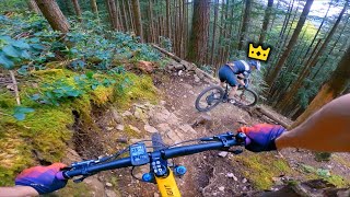
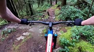
Ted's Triple T (Torture Trail) not fairly named but a fun older school cross country ride

Access Info

Buntzen Lake west service road turn left up to saddle ridge trail. go straight past the diez vistas trail down the rocky fire road descent approximately 500 meters, triple t starts on the right off fire road

This trail is unsanctioned.

Recent Activity on Trail

Past Week
  • 0 rides
  •  
6 Months
  • 4 rides
  • 18 miles avg distance
All
  • 35 rides
  • Last: Jun 1, 2026
c1c2c3c4
January
February
March
April
May
June
July
August
September
October
November
December
update trails status or condition

Triple T Trail Reports

statusdatedescription
Nov 16, 2025 @ 5:02pm (America/Vancouver)
Nov 16, 2025
reporter Two trees cleared.
Nov 15, 2025 @ 3:28pm (America/Vancouver)
Nov 15, 2025
Anything that could be handled with a handsaw is now cleared. The two big ones right near the start at the top remain. Those have been there for a...
Nov 14, 2025 @ 7:24pm (America/Vancouver)
Nov 14, 2025
reporter Four trees down. One at the crux descent (handsaw), one about two thirds of the way down the trail (handsaw), and two within the first 200m of the...
Jan 12, 2025 @ 4:05pm
Jan 12, 2025
reporter All the trees cleared.
Jan 6, 2025 @ 11:57am
Jan 6, 2025
Lots of trees down. I stopped counting after 10. They are between 4 and 24" diameter. You won't have a continuous run.
more »
Status:
on Nov 16, 2025
Avg: 3.89 (4 votes)
Your vote: 0

view (299)
close
3D
Trail Conditions
  • Unknown
  • Snow Groomed
  • Snow Packed
  • Snow Covered
  • Snow Cover Partial
  • Freeze/thaw Cycle
  • Icy
  • Prevalent Mud
  • Wet
  • Variable
  • Ideal
  • Dry
  • Very Dry
Trail Flow (Ridden Direction)
Trailforks scans users ridelogs to determine the most popular direction each trail is ridden. A good flowing trail network will have most trails flowing in a single direction according to their intension.
The colour categories are based on what percentage of riders are riding a trail in its intended direction.
  • > 96%
  • > 90%
  • > 80%
  • > 70%
  • > 50%
  • < 50%
  • bi-directional trail
  • no data
Trail Last Ridden
Trailforks scans ridelogs to determine the last time a trail was ridden.
  • < 2 days
  • < 1 week
  • < 2 weeks
  • < 1 month
  • < 6 months
  • > 6 months
Trail Ridden Direction
The intended direction a trail should be ridden.
  • Downhill Only
  • Downhill Primary
  • Both Directions
  • Uphill Primary
  • Uphill Only
  • One Direction
Contribute Details
Colors indicate trail is missing specified detail.
  • Description
  • Photos
  • Description & Photos
  • Videos
Trail Popularity ?
Trailforks scans ridelogs to determine which trails are ridden the most in the last 9 months. Trails are compared with nearby trails in the same city region with a possible 25 colour shades. Think of this as a heatmap, more rides = more kinetic energy = warmer colors.
  • most popular
  • popular
  • less popular
  • not popular
ATV/ORV/OHV Filter
Max Vehicle Width
inches
US Cell Coverage
Legend
cell carrier legend

Radar Time
Activity Recordings
Trailforks uses anonymized public activity data. ?
Activity Recordings
Trailforks uses anonymized public activity data. ?
Personal Heatmap
Activity Types
all / none
Options
2
Date range month
Winter Trails
Warning A routing network for winter maps does not exist. Selecting trails using the winter trails layer has been disabled.
Missing Trails
Most Popular
Least Popular
Trails are colored based on popularity. The more popular a trail is, the more red. Less popular trails trend towards green.
Jump Magnitude Heatmap
Heatmap of where riders jump on trails. Zoom in to see individual jumps, click circles to view jump details.
BC Backroad Status

Service Road Atlas is a free to use, community-driven service for viewing and creating reports on the numerous back-country service roads around B.C. and Alberta.

map legend
Slope Aspect
Direction the slope faces
Flat N NE E SE S SW W NW
Trails Deemphasized
Trails are shown in grey.
disable
Only show trails with no bike usage.
Enable
Suggested Layers
Based on selected activity type

    Save the current map location and zoom level as your default home location whenever this page is loaded.

    Save
        Directions to triple-t trailhead (49.331160, -122.875250)

        Photos

        15 more »
        509 |
        Oct 1, 2016 @ 11:36pm
        Oct 1, 2016
        600 |
        Oct 1, 2016 @ 11:36pm
        Oct 1, 2016
        56 |
        Nov 16, 2025 @ 5:02pm
        Nov 16, 2025
        34 |
        Nov 1, 2024 @ 10:50am
        Nov 1, 2024

        Videos

        2 more »
        youtuber Following a Pro Racer Down His Own Trail
        17:02 | 860 | May 23, 2021 , Anmore
        Riding Some of the GNARLIEST Trails I've...
        0:45 | 534 | Feb 25, 2021 , Anmore

        Reviews / Comments

        No reviews yet, be the first to write a review or ask a question.
        Use trail reports to comment on trail conditions.


        We hope you've been enjoying Trailforks!

        Create a FREE account to view trail comments and much more.

        • #52987 - 5,074 views

        Frequently Asked Questions About Triple T

        Where is Triple T located?
        Triple T is located in Buntzen Lake Recreation Area, Anmore, British Columbia, Canada. It is part of the Buntzen Lake Recreation Area trail network. The trailhead is located at coordinates 49.33116, -122.87525.
        How hard is Triple T?
        Triple T is rated as Black Diamond difficulty. The physical rating is Moderate. The average grade is 5.4%. The climb difficulty is rated Blue.
        What is the elevation gain for Triple T?
        Triple T has 172 ft of elevation gain. The trail has 582 ft of elevation descent. The elevation ranges from 478 ft to 948 ft.
        Is Triple T a point to point trail?
        Yes, Triple T is a point to point trail. The direction is One Direction. The trail type is singletrack.

        Hit the Trail

        Open in App

        Get this trail on your phone instantly.
        open trail in app

        Download Trail

        Save to wishlist, Garmin & download.
        save the trail

        Find Related Routes

        Find routes and users activities that include this trail.
        find routes for this trail

        You must enter a description before submitting.