more stats
1.5 miles
Distance
2 ft
Climb
-1,325 ft
Descent
00:16:09
Avg time
-1,323 ft
Altitude change
626 ft
Altitude min
1,949 ft
Altitude max
1,949 ft
Altitude start
627 ft
Altitude end
-17.2%
Grade
-80.1%
Grade max
1.4%
Grade min
161 ft
Distance climb
1 mile
Distance down
00:16:09
Avg time

Trivio Trail Details

  • Activities
    • Mountain Bike
    • Hike
    • Trail Running
  • Riding Area
  • Difficulty Rating
  • Voted Difficulty
    Blue (1 vote)
  • Local Popularity
    100 in Mountain Biking [+]
    • 5 in Trail Running
    • 5 in Hiking
  • Global Ranking
    #40242 in Mountain Biking [+]
    • #131164 in Trail Running
    • #124296 in Hiking
  • Trail Type
    Singletrack
  • Bike Type
    DH, AM
  • Direction
    Downhill Primary
    Popular Direction Shown
  • Climb Difficulty
    Blue
  • Physical Rating
    Moderate
  • Trail Visibility
    Sometimes hard to follow
  • Dogs Allowed
    Yes
  • eBike Allowed
    Yes up to Class 1
  • Land Owner
    Italia

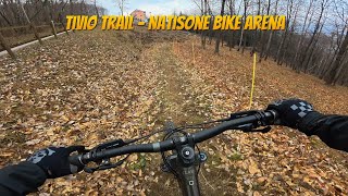
Percorso molto conosciuto che dalla località Trivio porta fino a valle. Percorso interamente nel bosco con alcuni tratti di mulattiera ciottolata. Troviamo da subito una parte veloce e guidabile ma con qualche piccolo rilancio seguita da due muri un po' più tecnici dove far valere le proprie capacità (sono comunque presenti delle linee alternative consigliate in caso di fango). Si prosegue con una parte più flow con alcune varianti costruite sfruttando un canalone. A questo punto incontriamo due tratti ciottolati con alcuni saltini: tratto molto divertente e veloce da affrontare con attenzione in caso di percorso bagnato. La parte finale è in falsopiano e bisogna guidare puliti per non perdere velocità.

Well-known trail leading from the locality Trivio down to the valley. Trail entirely in the woods with some sections of cobblestone mule track.
We immediately find a fast and drivable part but with some small relaunches followed by two walls a bit more technical where to make the most of one's skills (there are however alternative lines recommended in case of mud).
This is followed by a more flowy part with some variants built by taking advantage of a gully. At this point we encounter two cobbled sections with some small jumps: a very fun and fast section to be tackled with care in case of a wet trail.
The final part is false-slope and you have to ride smoothly, in order not to lose speed.

Recent Activity on Trail

Past Week
  • 2 rides
  • 9 miles average
6 Months
  • 18 rides
  • 15 miles avg distance
All
  • 122 rides
  • Last: Jun 24, 2026
c1c2c3c4
January
February
March
April
May
June
July
August
September
October
November
December
update trails status or condition

Trivio Trail Trail Reports

statusdatedescription
Mar 3, 2026 @ 3:22pm (Europe/Rome)
Mar 3, 2026
Nov 30, 2025 @ 8:02am (Europe/Rome)
Nov 29, 2025
covered with leaves, but less than other trails. some water damage, but completely rideable
Aug 4, 2025 @ 1:17am
Aug 4, 2025
May 2, 2025 @ 6:07am
May 2, 2025
Sep 25, 2024 @ 7:58am
Sep 25, 2024
Quite slick in places, lots of branches and leaves on the trail
more »
Status:
on Mar 3, 2026
Wet
Avg: 4.17 (6 votes)
Your vote: 0

view (526)
close
3D
Trail Conditions
  • Unknown
  • Snow Groomed
  • Snow Packed
  • Snow Covered
  • Snow Cover Partial
  • Freeze/thaw Cycle
  • Icy
  • Prevalent Mud
  • Wet
  • Variable
  • Ideal
  • Dry
  • Very Dry
Trail Flow (Ridden Direction)
Trailforks scans users ridelogs to determine the most popular direction each trail is ridden. A good flowing trail network will have most trails flowing in a single direction according to their intension.
The colour categories are based on what percentage of riders are riding a trail in its intended direction.
  • > 96%
  • > 90%
  • > 80%
  • > 70%
  • > 50%
  • < 50%
  • bi-directional trail
  • no data
Trail Last Ridden
Trailforks scans ridelogs to determine the last time a trail was ridden.
  • < 2 days
  • < 1 week
  • < 2 weeks
  • < 1 month
  • < 6 months
  • > 6 months
Trail Ridden Direction
The intended direction a trail should be ridden.
  • Downhill Only
  • Downhill Primary
  • Both Directions
  • Uphill Primary
  • Uphill Only
  • One Direction
Contribute Details
Colors indicate trail is missing specified detail.
  • Description
  • Photos
  • Description & Photos
  • Videos
Trail Popularity ?
Trailforks scans ridelogs to determine which trails are ridden the most in the last 9 months. Trails are compared with nearby trails in the same city region with a possible 25 colour shades. Think of this as a heatmap, more rides = more kinetic energy = warmer colors.
  • most popular
  • popular
  • less popular
  • not popular
ATV/ORV/OHV Filter
Max Vehicle Width
inches
US Cell Coverage
Legend
cell carrier legend

Radar Time
Activity Recordings
Trailforks uses anonymized public activity data. ?
Activity Recordings
Trailforks uses anonymized public activity data. ?
Personal Heatmap
Activity Types
all / none
Options
2
Date range month
Winter Trails
Warning A routing network for winter maps does not exist. Selecting trails using the winter trails layer has been disabled.
Missing Trails
Most Popular
Least Popular
Trails are colored based on popularity. The more popular a trail is, the more red. Less popular trails trend towards green.
Jump Magnitude Heatmap
Heatmap of where riders jump on trails. Zoom in to see individual jumps, click circles to view jump details.
BC Backroad Status

Service Road Atlas is a free to use, community-driven service for viewing and creating reports on the numerous back-country service roads around B.C. and Alberta.

map legend
Slope Aspect
Direction the slope faces
Flat N NE E SE S SW W NW
Trails Deemphasized
Trails are shown in grey.
disable
Only show trails with no bike usage.
Enable
Suggested Layers
Based on selected activity type

    Save the current map location and zoom level as your default home location whenever this page is loaded.

    Save
        Directions to trivio-trail trailhead (46.100970, 13.535370)

        Photos

        4 more »
        155 |
        Apr 8, 2022 @ 12:37pm
        Apr 8, 2022
        162 |
        Apr 8, 2022 @ 12:37pm
        Apr 8, 2022
        78 |
        Jun 2, 2023 @ 1:16am
        Jun 2, 2023
        106 |
        Aug 10, 2022 @ 12:48pm
        Aug 10, 2022

        Videos

        2 more »
        Trivio Trail - Natisone Bike Arena
        8:05 | 139 | Mar 13, 2025 , San Leonardo
        Caccia ai leprotti Trivio 4gen2019
        7:49 | 924 | Jan 30, 2020 , San Leonardo

        Routes with this trail

        9 miles 1,881 ft 1
        Percorso XC(E-bike) che partendo da S.Leonardo ci porta al santuario di Castelmonte utilizzando la...

        4 Reviews & Comments


        We hope you've been enjoying Trailforks!

        Create a FREE account to view trail comments and much more.

        • By maxmisdarisTF Pro MGNR & contributors
        • #118606 - 3,009 views

        Frequently Asked Questions About Trivio Trail

        Where is Trivio Trail located?
        Trivio Trail is located in Natisone Bike Arena (S.Leonardo), San Leonardo, Italy. It is part of the Natisone Bike Arena (S.Leonardo) trail network. The trailhead is located at coordinates 46.10097, 13.53537.
        How hard is Trivio Trail?
        Trivio Trail is rated as Red difficulty. The physical rating is Moderate. The average grade is 17.2%. The climb difficulty is rated Blue.
        What is the elevation gain for Trivio Trail?
        Trivio Trail has 2 ft of elevation gain. The trail has 1,325 ft of elevation descent. The elevation ranges from 626 ft to 1,949 ft.
        Is Trivio Trail a point to point trail?
        Trivio Trail is not a point to point trail. The direction is Downhill Primary. The trail type is singletrack.

        Hit the Trail

        Open in App

        Get this trail on your phone instantly.
        open trail in app

        Download Trail

        Save to wishlist, Garmin & download.
        save the trail

        Find Related Routes

        Find routes and users activities that include this trail.
        find routes for this trail

        You must enter a description before submitting.