more stats
1,335 ft
Distance
12 ft
Climb
-136 ft
Descent
00:01:33
Avg time
-124 ft
Altitude change
1,644 ft
Altitude min
1,781 ft
Altitude max
1,778 ft
Altitude start
1,654 ft
Altitude end
-9.3%
Grade
-26.3%
Grade max
3.8%
Grade min
367 ft
Distance climb
899 ft
Distance down
69 ft
Distance flat
00:01:33
Avg time

Tsweet Tsue Details

  • Activities
    • Mountain Bike
    • E-Bike
    • Hike
    • Trail Running
  • Riding Area
    Three Blind Mice
    Penticton, British Columbia
  • AKA
    Sweet Sue
  • Difficulty Rating
  • Voted Difficulty
    Black Diamond (1 vote)
  • Local Popularity
    100 in Mountain Biking [+]
    • 100 in E-Biking
    • 90 in Trail Running
    • 95 in Hiking
  • Global Ranking
    #18135 in Mountain Biking [+]
    • #3332 in E-Biking
    • #48926 in Trail Running
    • #22493 in Hiking
  • Trail Type
    Singletrack
  • Bike Type
    AM, XC
  • Physical Rating
    Easy
  • Season
    March-December
  • Dogs Allowed
    Yes
  • eBike Allowed
    Yes up to Class 1

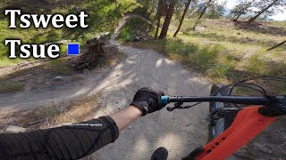
Ahhh, Tsweet Tsue (aka Sweet Sue). Always a favourite way of ending the ride, up and down the gully.
In the summer months, the trail is very sandy.
Ends right at the Pearly Gates.

Access Info

If you've come from the Compression Redemption jump, keep on the straight and narrow and follow the path. It will turn into 2-track immediately. Follow until the berm/hip jump. Arrived.
If you've dropped into the 2-track via a trail higher up, same thing. Keep on the 2-track and you can't* miss it.

Local Trail Association

Recent Activity on Trail

Past Week
  • 17 rides
  • 9 miles average
6 Months
  • 169 rides
  • 12 miles avg distance
All
  • 2,786 rides
  • Last: Jun 20, 2026
c1c2c3c4
January
February
March
April
May
June
July
August
September
October
November
December
Status:
on Apr 19, 2026
Very Dry
Avg: 4.13 (42 votes)
Your vote: 0

view (14,865)
close
3D
Trail Conditions
  • Unknown
  • Snow Groomed
  • Snow Packed
  • Snow Covered
  • Snow Cover Partial
  • Freeze/thaw Cycle
  • Icy
  • Prevalent Mud
  • Wet
  • Variable
  • Ideal
  • Dry
  • Very Dry
Trail Flow (Ridden Direction)
Trailforks scans users ridelogs to determine the most popular direction each trail is ridden. A good flowing trail network will have most trails flowing in a single direction according to their intension.
The colour categories are based on what percentage of riders are riding a trail in its intended direction.
  • > 96%
  • > 90%
  • > 80%
  • > 70%
  • > 50%
  • < 50%
  • bi-directional trail
  • no data
Trail Last Ridden
Trailforks scans ridelogs to determine the last time a trail was ridden.
  • < 2 days
  • < 1 week
  • < 2 weeks
  • < 1 month
  • < 6 months
  • > 6 months
Trail Ridden Direction
The intended direction a trail should be ridden.
  • Downhill Only
  • Downhill Primary
  • Both Directions
  • Uphill Primary
  • Uphill Only
  • One Direction
Contribute Details
Colors indicate trail is missing specified detail.
  • Description
  • Photos
  • Description & Photos
  • Videos
Trail Popularity ?
Trailforks scans ridelogs to determine which trails are ridden the most in the last 9 months. Trails are compared with nearby trails in the same city region with a possible 25 colour shades. Think of this as a heatmap, more rides = more kinetic energy = warmer colors.
  • most popular
  • popular
  • less popular
  • not popular
ATV/ORV/OHV Filter
Max Vehicle Width
inches
US Cell Coverage
Legend
cell carrier legend

Radar Time
Activity Recordings
Trailforks uses anonymized public activity data. ?
Activity Recordings
Trailforks uses anonymized public activity data. ?
Personal Heatmap
Activity Types
all / none
Options
2
Date range month
Winter Trails
Warning A routing network for winter maps does not exist. Selecting trails using the winter trails layer has been disabled.
Missing Trails
Most Popular
Least Popular
Trails are colored based on popularity. The more popular a trail is, the more red. Less popular trails trend towards green.
Jump Magnitude Heatmap
Heatmap of where riders jump on trails. Zoom in to see individual jumps, click circles to view jump details.
BC Backroad Status

Service Road Atlas is a free to use, community-driven service for viewing and creating reports on the numerous back-country service roads around B.C. and Alberta.

map legend
Slope Aspect
Direction the slope faces
Flat N NE E SE S SW W NW
Trails Deemphasized
Trails are shown in grey.
disable
Only show trails with no bike usage.
Enable
Suggested Layers
Based on selected activity type

    Save the current map location and zoom level as your default home location whenever this page is loaded.

    Save
        Directions to tsweet-tsue trailhead (49.541500, -119.556790)

        Photos

        35 more »
        1,077 |
        Jun 9, 2015 @ 2:24pm
        Jun 9, 2015
        828 |
        Jun 9, 2015 @ 2:34pm
        Jun 9, 2015
        135 |
        Jun 22, 2021 @ 8:36am
        Jun 22, 2021
        237 |
        Jul 11, 2018 @ 8:43pm
        Jul 11, 2018

        Videos

        9 more »
        youtuber Is my Tsweet Tsue KOM Real? How Legit is...
        3:23 | 841 | May 13, 2019 , Penticton
        Tsweet Tsue - Three Blind Mice
        0:06 | 144 | Oct 5, 2024 , Penticton
        Flow Coaster & Tsweet Tsue - 2022
        3:59 | 485 | May 28, 2022 , Penticton
        Wine Country 1
        34:13 | 344 | Jul 29, 2020 , Penticton

        Routes with this trail

        Lookout Loop Featured
        3.7 8 miles 1,154 ft 13 Loop
        A good intro to the Three Blind Mice trails. Easy up and back. Just follow the round blue signs that say...
        4.0 14 miles 2,247 ft 11
        Swagman's Backyard Ride Guide is back - this time, in two parts for the largest of the Penticton Trail...
        4.0 5 miles 202 ft 11 Shuttled
        So, you find yourself at the top of 3 Blind Mice, you may ask yourself the following questions. What's the...

        Trail Products

        2 Reviews & Comments


        We hope you've been enjoying Trailforks!

        Create a FREE account to view trail comments and much more.

        • By 1partatatimeTF Pro PACA & contributors
        • #18892 - 11,036 views

        Frequently Asked Questions About Tsweet Tsue

        Where is Tsweet Tsue located?
        Tsweet Tsue is located in Three Blind Mice, Penticton, British Columbia, Canada. It is part of the Three Blind Mice trail network. The trailhead is located at coordinates 49.5415, -119.55679.
        How hard is Tsweet Tsue?
        Tsweet Tsue is rated as Black Diamond difficulty. The physical rating is Easy. The average grade is 9.3%.
        What is the elevation gain for Tsweet Tsue?
        Tsweet Tsue has 4 m of elevation gain. The trail has 42 m of elevation descent. The elevation ranges from 501 m to 543 m.
        How long is Tsweet Tsue?
        Tsweet Tsue is 407.0 m long. The trail type is singletrack.

        Hit the Trail

        Open in App

        Get this trail on your phone instantly.
        open trail in app

        Download Trail

        Save to wishlist, Garmin & download.
        save the trail

        Find Related Routes

        Find routes and users activities that include this trail.
        find routes for this trail

        You must enter a description before submitting.