more stats
3,018 ft
Distance
-49 ft
Descent
00:06:36
Avg time
-51 ft
Altitude change
259 ft
Altitude min
309 ft
Altitude max
309 ft
Altitude start
259 ft
Altitude end
-1.7%
Grade
-5.2%
Grade max
2,441 ft
Distance down
472 ft
Distance flat
00:06:36
Avg time

Tunnel 1 Details

  • Activities
    • Mountain Bike
    • E-Bike
    • Winter Fat Bike
    • Hike
    • Trail Running
  • Riding Area
    Los Peñasquitos Canyon
    San Diego, California
  • Difficulty Rating
  • Voted Difficulty
    Blue (2 votes)
  • Local Popularity
    95 in Mountain Biking [+]
    • 90 in E-Biking
    • 95 in Trail Running
    • 80 in Hiking
  • Global Ranking
    #39151 in Mountain Biking [+]
    • #16039 in E-Biking
    • #3041 in Trail Running
    • #37464 in Hiking
  • Trail Type
    Singletrack
  • Bike Type
    AM, XC, Fat
  • Direction
    Both Directions
  • Climb Difficulty
    Green
  • Physical Rating
    Moderate
  • Trail Visibility
    Always easy to follow
  • Family Friendly
    Yes
  • Dogs Allowed
    Yes
  • eBike Allowed
    Yes up to Class 1
  • Land Owner
    City of San Diego

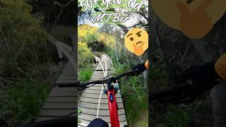
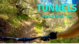
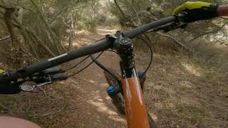
Fun singletrack almost completely encased in trees

ADAPTIVE MTB INFO
Rating: aMTB3 - Major Obstacles Exist - Support Rider Needed

Adaptive Riders, avoiding altogether recommended. Too much work to get through this. East Deer Canyon to West Deer Canyon is better

Disclaimer

Mostly Impassable for Adaptive MTB

Local Trail Association
Traditionally Indigenous Territory

Recent Activity on Trail

Past Week
  • 7 rides
  • 14 miles average
6 Months
  • 171 rides
  • 14 miles avg distance
All
  • 1,519 rides
  • Last: Jun 23, 2026
c1c2c3c4
January
February
March
April
May
June
July
August
September
October
November
December
update trails status or condition

Tunnel 1 Trail Reports

statusdatedescription
Apr 8, 2026 @ 7:53am (America/Los_Angeles)
Apr 8, 2026
Running great today!
Dec 7, 2025 @ 9:03am (America/Tijuana)
Dec 7, 2025
Jul 17, 2025 @ 5:38pm
Jul 17, 2025
Tall grass is overgrown and covering the trail in areas but still very rideable
Jun 21, 2025 @ 6:27am
Jun 21, 2025
Apr 5, 2025 @ 6:04pm
Apr 5, 2025
Trail is dynamite- ride it
more »
Status:
on Apr 8, 2026
Ideal
Avg: 4.11 (12 votes)
Your vote: 0

view (8,818)
close
3D
Trail Conditions
  • Unknown
  • Snow Groomed
  • Snow Packed
  • Snow Covered
  • Snow Cover Partial
  • Freeze/thaw Cycle
  • Icy
  • Prevalent Mud
  • Wet
  • Variable
  • Ideal
  • Dry
  • Very Dry
Trail Flow (Ridden Direction)
Trailforks scans users ridelogs to determine the most popular direction each trail is ridden. A good flowing trail network will have most trails flowing in a single direction according to their intension.
The colour categories are based on what percentage of riders are riding a trail in its intended direction.
  • > 96%
  • > 90%
  • > 80%
  • > 70%
  • > 50%
  • < 50%
  • bi-directional trail
  • no data
Trail Last Ridden
Trailforks scans ridelogs to determine the last time a trail was ridden.
  • < 2 days
  • < 1 week
  • < 2 weeks
  • < 1 month
  • < 6 months
  • > 6 months
Trail Ridden Direction
The intended direction a trail should be ridden.
  • Downhill Only
  • Downhill Primary
  • Both Directions
  • Uphill Primary
  • Uphill Only
  • One Direction
Contribute Details
Colors indicate trail is missing specified detail.
  • Description
  • Photos
  • Description & Photos
  • Videos
Trail Popularity ?
Trailforks scans ridelogs to determine which trails are ridden the most in the last 9 months. Trails are compared with nearby trails in the same city region with a possible 25 colour shades. Think of this as a heatmap, more rides = more kinetic energy = warmer colors.
  • most popular
  • popular
  • less popular
  • not popular
ATV/ORV/OHV Filter
Max Vehicle Width
inches
US Cell Coverage
Legend
cell carrier legend

Radar Time
Activity Recordings
Trailforks uses anonymized public activity data. ?
Activity Recordings
Trailforks uses anonymized public activity data. ?
Personal Heatmap
Activity Types
all / none
Options
2
Date range month
Winter Trails
Warning A routing network for winter maps does not exist. Selecting trails using the winter trails layer has been disabled.
Missing Trails
Most Popular
Least Popular
Trails are colored based on popularity. The more popular a trail is, the more red. Less popular trails trend towards green.
Jump Magnitude Heatmap
Heatmap of where riders jump on trails. Zoom in to see individual jumps, click circles to view jump details.
BC Backroad Status

Service Road Atlas is a free to use, community-driven service for viewing and creating reports on the numerous back-country service roads around B.C. and Alberta.

map legend
Slope Aspect
Direction the slope faces
Flat N NE E SE S SW W NW
Trails Deemphasized
Trails are shown in grey.
disable
Only show trails with no bike usage.
Enable
Suggested Layers
Based on selected activity type

    Save the current map location and zoom level as your default home location whenever this page is loaded.

    Save
        Directions to tunnel-1 trailhead (32.955240, -117.153890)

        Photos

        20 more »
        62 |
        Apr 7, 2025 @ 11:15am
        Apr 7, 2025
        49 |
        Apr 7, 2025 @ 11:15am
        Apr 7, 2025
        89 |
        Jun 10, 2023 @ 11:33am
        Jun 10, 2023
        73 |
        Jun 10, 2023 @ 11:33am
        Jun 10, 2023

        Videos

        4 more »
        MTB at 52 years old. No, I’m 30 again on my EMTB
        0:26 | 95 | May 17, 2024 , San Diego
        Tunnel 1 - Rancho Peñasquitos Canyon (PQ) -...
        4:22 | 296 | Sep 10, 2023 , San Diego
        Tunnels | San Diego, CA
        7:38 | 227 | Nov 17, 2021 , San Diego
        Tunnel 1 - Los Peñasquitos Canyon Preserve,...
        8:28 | 614 | Nov 23, 2020 , San Diego

        Routes with this trail

        4.3 22 miles 1,799 ft 21
        Those bells that you hear are not those of in the East End of London, where the Cockney accent is heard....
        3.5 23 miles 1,957 ft 61 Loop
        This route through Los Penasquitos Canyon and Del Mar Mesa hits some of the most popular trails in the...
        4.0 15 miles 1,079 ft 11
        LP Canyon Preserve Del Mar Mesa

        6 Reviews & Comments


        We hope you've been enjoying Trailforks!

        Create a FREE account to view trail comments and much more.

        • By The-dirt-farmerTF Pro & contributors
        • #48296 - 6,093 views

        Frequently Asked Questions About Tunnel 1

        Where is Tunnel 1 located?
        Tunnel 1 is located in Los Peñasquitos Canyon, San Diego, California, United States. It is part of the Los Peñasquitos Canyon trail network. The trailhead is located at coordinates 32.95524, -117.15389.
        How hard is Tunnel 1?
        Tunnel 1 is rated as Blue difficulty. The physical rating is Moderate. The average grade is 1.7%. The climb difficulty is rated Green.
        What is the elevation gain for Tunnel 1?
        The trail has 49 ft of elevation descent. The elevation ranges from 259 ft to 309 ft.
        Is Tunnel 1 a point to point trail?
        Tunnel 1 is not a point to point trail. The direction is Both Directions. The trail type is singletrack.

        Hit the Trail

        Open in App

        Get this trail on your phone instantly.
        open trail in app

        Download Trail

        Save to wishlist, Garmin & download.
        save the trail

        Find Related Routes

        Find routes and users activities that include this trail.
        find routes for this trail

        You must enter a description before submitting.