more stats
3,655 ft
Distance
11 ft
Climb
-259 ft
Descent
00:02:27
Avg time
-248 ft
Altitude change
114 ft
Altitude min
362 ft
Altitude max
362 ft
Altitude start
115 ft
Altitude end
-6.8%
Grade
-36.8%
Grade max
7.8%
Grade min
554 ft
Distance climb
2,589 ft
Distance down
394 ft
Distance flat
00:02:27
Avg time

Twitching Whisker Details

  • Activities
    • Mountain Bike
    • E-Bike
  • Riding Area
    Narooma Trails
    Narooma
  • Difficulty Rating
  • Local Popularity
    80 in Mountain Biking [+]
    • 80 in E-Biking
  • Global Ranking
    #10207 in Mountain Biking [+]
    • #32917 in E-Biking
  • Trail Type
    Singletrack
  • Direction
    Downhill Only
    Popular Direction Shown
  • eBike Allowed
    Yes up to Class 1

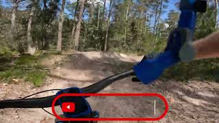
Flow – open and fast with large radius berms and rollers. Combines with Multipass to provide a connection from the upper Northern Zone to the wider trail network.

This trail is accessible by vehicle shuttle from the Northern Zone Drop off point.

Local Trail Association
Traditionally Indigenous Territory

Recent Activity on Trail

Past Week
  • 2 rides
  • 10 miles average
6 Months
  • 63 rides
  • 13 miles avg distance
All
  • 320 rides
  • Last: Jun 6, 2026
c1c2c3c4
January
February
March
April
May
June
July
August
September
October
November
December
Status:
on Apr 20, 2026
Very Dry
Avg: 3.99 (3 votes)
Your vote: 0

view (2,391)
close
3D
Trail Conditions
  • Unknown
  • Snow Groomed
  • Snow Packed
  • Snow Covered
  • Snow Cover Partial
  • Freeze/thaw Cycle
  • Icy
  • Prevalent Mud
  • Wet
  • Variable
  • Ideal
  • Dry
  • Very Dry
Trail Flow (Ridden Direction)
Trailforks scans users ridelogs to determine the most popular direction each trail is ridden. A good flowing trail network will have most trails flowing in a single direction according to their intension.
The colour categories are based on what percentage of riders are riding a trail in its intended direction.
  • > 96%
  • > 90%
  • > 80%
  • > 70%
  • > 50%
  • < 50%
  • bi-directional trail
  • no data
Trail Last Ridden
Trailforks scans ridelogs to determine the last time a trail was ridden.
  • < 2 days
  • < 1 week
  • < 2 weeks
  • < 1 month
  • < 6 months
  • > 6 months
Trail Ridden Direction
The intended direction a trail should be ridden.
  • Downhill Only
  • Downhill Primary
  • Both Directions
  • Uphill Primary
  • Uphill Only
  • One Direction
Contribute Details
Colors indicate trail is missing specified detail.
  • Description
  • Photos
  • Description & Photos
  • Videos
Trail Popularity ?
Trailforks scans ridelogs to determine which trails are ridden the most in the last 9 months. Trails are compared with nearby trails in the same city region with a possible 25 colour shades. Think of this as a heatmap, more rides = more kinetic energy = warmer colors.
  • most popular
  • popular
  • less popular
  • not popular
ATV/ORV/OHV Filter
Max Vehicle Width
inches
US Cell Coverage
Legend
cell carrier legend

Radar Time
Activity Recordings
Trailforks uses anonymized public activity data. ?
Activity Recordings
Trailforks uses anonymized public activity data. ?
Personal Heatmap
Activity Types
all / none
Options
2
Date range month
Winter Trails
Warning A routing network for winter maps does not exist. Selecting trails using the winter trails layer has been disabled.
Missing Trails
Most Popular
Least Popular
Trails are colored based on popularity. The more popular a trail is, the more red. Less popular trails trend towards green.
Jump Magnitude Heatmap
Heatmap of where riders jump on trails. Zoom in to see individual jumps, click circles to view jump details.
BC Backroad Status

Service Road Atlas is a free to use, community-driven service for viewing and creating reports on the numerous back-country service roads around B.C. and Alberta.

map legend
Slope Aspect
Direction the slope faces
Flat N NE E SE S SW W NW
Trails Deemphasized
Trails are shown in grey.
disable
Only show trails with no bike usage.
Enable
Suggested Layers
Based on selected activity type

    Save the current map location and zoom level as your default home location whenever this page is loaded.

    Save
        Directions to twitching-whisker trailhead (-36.158770, 150.079460)

        Photos

        1 more »
        75 |
        Mar 3, 2024 @ 3:18pm
        Mar 3, 2024

        Videos

        2 more »
        Narooma Mountain Bike Park - Twitching Whisker
        4:06 | 111 | Aug 4, 2024 , Narooma
        Twitching Whisker - Narooma Mountain Bike Park
        2:39 | 240 | Mar 1, 2024 , Narooma

        Routes with this trail

        5.0 10 miles 1,277 ft 10 Loop
        Uses the easier Green and Blue trails to visit the Trail Map Board for each zone of the park, allowing...

        Reviews / Comments

        No reviews yet, be the first to write a review or ask a question.
        Use trail reports to comment on trail conditions.


        We hope you've been enjoying Trailforks!

        Create a FREE account to view trail comments and much more.

        • By mtbnarooma NMBC & contributors
        • #591151 - 358 views

        Frequently Asked Questions About Twitching Whisker

        Where is Twitching Whisker located?
        Twitching Whisker is located in Narooma Trails, Narooma, Australia. It is part of the Narooma Trails trail network. The trailhead is located at coordinates -36.15877, 150.07946.
        How hard is Twitching Whisker?
        Twitching Whisker is rated as Blue difficulty. The average grade is 6.8%.
        What is the elevation gain for Twitching Whisker?
        Twitching Whisker has 3 m of elevation gain. The trail has 79 m of elevation descent. The elevation ranges from 35 m to 110 m.
        Is Twitching Whisker a point to point trail?
        Yes, Twitching Whisker is a point to point trail. The direction is Downhill Only. The trail type is singletrack.

        Hit the Trail

        Open in App

        Get this trail on your phone instantly.
        open trail in app

        Download Trail

        Save to wishlist, Garmin & download.
        save the trail

        Find Related Routes

        Find routes and users activities that include this trail.
        find routes for this trail

        You must enter a description before submitting.