more stats
7.5 miles
Distance
-2,955 ft
Descent
01:11:10
Avg time
-2,957 ft
Altitude change
8,029 ft
Altitude min
10,986 ft
Altitude max
10,986 ft
Altitude start
8,028 ft
Altitude end
-7.5%
Grade
-37.3%
Grade max
-0.4%
Grade min
7 miles
Distance down
131 ft
Distance flat
01:11:10
Avg time

Two Elk Details

  • Activities
    • Mountain Bike
    • Horse
    • Hike
    • Trail Running
  • Riding Area
    Vail Pass
    Vail, Colorado
  • Difficulty Rating
  • Voted Difficulty
    Black Diamond (2 votes)
  • Local Popularity
    65 in Mountain Biking [+]
    • 5 in Trail Running
    • 5 in Hiking
    • 5 in Horseback
  • Global Ranking
    #49527 in Mountain Biking [+]
    • #127207 in Trail Running
    • #120419 in Hiking
    • #895 in Horseback
  • Trail Type
    Singletrack
  • Direction
    Downhill Primary
    Popular Direction Shown
  • Climb Difficulty
    Black Diamond
  • Physical Rating
    Hard
  • Dogs Allowed
    Yes
  • eBike Allowed
  • Land Owner

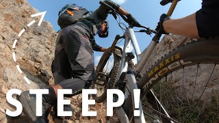
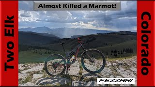
Typically referred to separately as Two Elk and Two Elk East, with the division at Two Elk Pass sign and the Bowman's Shortcut intersection. Two Elk via Bowman's is one of the areas best longer rides, shuttled by many via Shrine Pass Rd our of Red Cliff. Other good options to ride are up Mill Creek Rd from Vail, or ride the Vail Gondola for a boost, and acess via Grand Traverse Trail and mountain roads up past Chair 21 and the Poma. Ride goes through Vail's Back Bowls, and becomes moderately technical with rock gardens and hidden pedal strikers on Two Elk Creek past Chair 5. Drops you at the gun range in Minturn.

Disclaimer

This trail is subject to a USFS seasonal wildlife closure from 5/6 - 6/30 to protect deer and elk during calving season

Trail Supporters
Local Trail Association
Traditionally Indigenous Territory

Recent Activity on Trail

Past Week
  • 0 rides
  •  
6 Months
  • 0 rides
  •  
All
  • 49 rides
  • Last: Oct 19, 2025
c1c2c3c4
January
February
March
April
May
June
July
August
September
October
November
December
update trails status or condition

Two Elk Trail Reports

statusdatedescription
May 15, 2026 @ 1:00am (America/Denver)
May 15, 2026
reporter
May 6, 2026 @ 1:00am (America/Denver)
May 6, 2026
reporter
Aug 16, 2025 @ 9:53am
Aug 16, 2025
About 3 hours total including Bowmans
Jul 3, 2025 @ 4:16pm
Jul 3, 2025
reporter
May 27, 2025 @ 7:49am
May 27, 2025
reporter Seasonal wildlife closure from May 6 through June 30
more »
Status:
on May 15, 2026
Dry
Avg: 3.88 (13 votes)
Your vote: 0

view (313)
close
3D
Trail Conditions
  • Unknown
  • Snow Groomed
  • Snow Packed
  • Snow Covered
  • Snow Cover Partial
  • Freeze/thaw Cycle
  • Icy
  • Prevalent Mud
  • Wet
  • Variable
  • Ideal
  • Dry
  • Very Dry
Trail Flow (Ridden Direction)
Trailforks scans users ridelogs to determine the most popular direction each trail is ridden. A good flowing trail network will have most trails flowing in a single direction according to their intension.
The colour categories are based on what percentage of riders are riding a trail in its intended direction.
  • > 96%
  • > 90%
  • > 80%
  • > 70%
  • > 50%
  • < 50%
  • bi-directional trail
  • no data
Trail Last Ridden
Trailforks scans ridelogs to determine the last time a trail was ridden.
  • < 2 days
  • < 1 week
  • < 2 weeks
  • < 1 month
  • < 6 months
  • > 6 months
Trail Ridden Direction
The intended direction a trail should be ridden.
  • Downhill Only
  • Downhill Primary
  • Both Directions
  • Uphill Primary
  • Uphill Only
  • One Direction
Contribute Details
Colors indicate trail is missing specified detail.
  • Description
  • Photos
  • Description & Photos
  • Videos
Trail Popularity ?
Trailforks scans ridelogs to determine which trails are ridden the most in the last 9 months. Trails are compared with nearby trails in the same city region with a possible 25 colour shades. Think of this as a heatmap, more rides = more kinetic energy = warmer colors.
  • most popular
  • popular
  • less popular
  • not popular
ATV/ORV/OHV Filter
Max Vehicle Width
inches
US Cell Coverage
Legend
cell carrier legend

Radar Time
Activity Recordings
Trailforks uses anonymized public activity data. ?
Activity Recordings
Trailforks uses anonymized public activity data. ?
Personal Heatmap
Activity Types
all / none
Options
2
Date range month
Winter Trails
Warning A routing network for winter maps does not exist. Selecting trails using the winter trails layer has been disabled.
Missing Trails
Most Popular
Least Popular
Trails are colored based on popularity. The more popular a trail is, the more red. Less popular trails trend towards green.
Jump Magnitude Heatmap
Heatmap of where riders jump on trails. Zoom in to see individual jumps, click circles to view jump details.
BC Backroad Status

Service Road Atlas is a free to use, community-driven service for viewing and creating reports on the numerous back-country service roads around B.C. and Alberta.

map legend
Slope Aspect
Direction the slope faces
Flat N NE E SE S SW W NW
Trails Deemphasized
Trails are shown in grey.
disable
Only show trails with no bike usage.
Enable
Suggested Layers
Based on selected activity type

    Save the current map location and zoom level as your default home location whenever this page is loaded.

    Save
        Directions to two-elk trailhead (39.591320, -106.293080)

        Photos

        56 more »
        234 |
        Sep 26, 2025 @ 4:59pm
        Sep 26, 2025
        72 |
        Sep 26, 2025 @ 10:15am
        Sep 26, 2025
        117 |
        Sep 4, 2023 @ 9:05pm
        Sep 4, 2023
        100 |
        Sep 4, 2023 @ 9:05pm
        Sep 4, 2023

        Videos

        5 more »
        youtuber The ultimate Colorado MTB road trip kickoff |...
        14:17 | 642 | Dec 22, 2020 , Vail
        youtuber Two Elk (West) - Finally Riding in Colorado...
        27:59 | 210 | Aug 25, 2023 , Vail
        Bowmans- two elk- grand traverse
        5:01 | 173 | Aug 5, 2023 , Vail
        Mountain Biking Vail's Back Bowls - Two Elk |...
        6:01 | 677 | Jun 4, 2020 , Vail

        Trail Lists

        Routes with this trail

        5.0 23 miles 4,221 ft 4 Loop
        Ride Two Elk from Minturn as a loop on nearly all single track - Oct '20 reroutes on trail make this a...

        20 Reviews & Comments


        We hope you've been enjoying Trailforks!

        Create a FREE account to view trail comments and much more.

        • By toddTF Pro Trailforks & contributors
        • #14156 - 10,566 views

        Frequently Asked Questions About Two Elk

        Where is Two Elk located?
        Two Elk is located in Vail Pass, Vail, Colorado, United States. It is part of the Vail Pass trail network. The trailhead is located at coordinates 39.59132, -106.29308.
        How hard is Two Elk?
        Two Elk is rated as Black Diamond difficulty. The physical rating is Hard. The average grade is 7.5%. The climb difficulty is rated Black Diamond.
        What is the elevation gain for Two Elk?
        The trail has 2,955 ft of elevation descent. The elevation ranges from 8,029 ft to 10,986 ft.
        Is Two Elk a point to point trail?
        Two Elk is not a point to point trail. The direction is Downhill Primary. The trail type is singletrack.

        Hit the Trail

        Open in App

        Get this trail on your phone instantly.
        open trail in app

        Download Trail

        Save to wishlist, Garmin & download.
        save the trail

        Find Related Routes

        Find routes and users activities that include this trail.
        find routes for this trail

        You must enter a description before submitting.