more stats
1,283 ft
Distance
9 ft
Climb
-116 ft
Descent
00:01:09
Avg time
-107 ft
Altitude change
1,037 ft
Altitude min
1,147 ft
Altitude max
1,147 ft
Altitude start
1,040 ft
Altitude end
-8.4%
Grade
-25.2%
Grade max
8.4%
Grade min
157 ft
Distance climb
919 ft
Distance down
207 ft
Distance flat
00:01:09
Avg time

Tyenna Details

  • Activities
    • Mountain Bike
    • E-Bike
  • Riding Area
  • Difficulty Rating
  • Local Popularity
    100 in Mountain Biking [+]
    • 95 in E-Biking
  • Global Ranking
    #16060 in Mountain Biking [+]
    • #14934 in E-Biking
  • Trail Type
    Machine Groomed
  • Bike Type
    DH, AM, XC
  • eBike Allowed
    Yes up to Class 1
  • TTFs on Trail
    Berm, Jump
  • Land Owner
    MBP

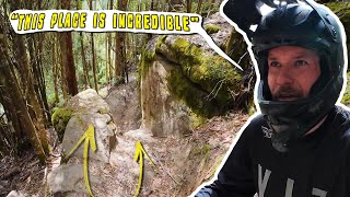
Tyenna got a renovation in 2022 turning into a blue jump trail. Table top jumps and fast, free-flowing berms make this one of the most fun trails in the park .This trail is a great blue jump option to finish your lap of the park.

Bike Park

Local Trail Association
  • trail association logo
  • Please consider joining or donating to the local trail association to support
    trail development & maintenance.
Traditionally Indigenous Territory

Recent Activity on Trail

Past Week
  • 1 rides
  • 5 miles average
6 Months
  • 159 rides
  • 16 miles avg distance
All
  • 1,420 rides
  • Last: Jun 11, 2026
c1c2c3c4
January
February
March
April
May
June
July
August
September
October
November
December
update trails status or condition

Tyenna Trail Reports

Status:
on Sep 27, 2024
Avg: 3.46 (9 votes)
Your vote: 0

view (12,919)
close
3D
Trail Conditions
  • Unknown
  • Snow Groomed
  • Snow Packed
  • Snow Covered
  • Snow Cover Partial
  • Freeze/thaw Cycle
  • Icy
  • Prevalent Mud
  • Wet
  • Variable
  • Ideal
  • Dry
  • Very Dry
Trail Flow (Ridden Direction)
Trailforks scans users ridelogs to determine the most popular direction each trail is ridden. A good flowing trail network will have most trails flowing in a single direction according to their intension.
The colour categories are based on what percentage of riders are riding a trail in its intended direction.
  • > 96%
  • > 90%
  • > 80%
  • > 70%
  • > 50%
  • < 50%
  • bi-directional trail
  • no data
Trail Last Ridden
Trailforks scans ridelogs to determine the last time a trail was ridden.
  • < 2 days
  • < 1 week
  • < 2 weeks
  • < 1 month
  • < 6 months
  • > 6 months
Trail Ridden Direction
The intended direction a trail should be ridden.
  • Downhill Only
  • Downhill Primary
  • Both Directions
  • Uphill Primary
  • Uphill Only
  • One Direction
Contribute Details
Colors indicate trail is missing specified detail.
  • Description
  • Photos
  • Description & Photos
  • Videos
Trail Popularity ?
Trailforks scans ridelogs to determine which trails are ridden the most in the last 9 months. Trails are compared with nearby trails in the same city region with a possible 25 colour shades. Think of this as a heatmap, more rides = more kinetic energy = warmer colors.
  • most popular
  • popular
  • less popular
  • not popular
ATV/ORV/OHV Filter
Max Vehicle Width
inches
US Cell Coverage
Legend
cell carrier legend

Radar Time
Activity Recordings
Trailforks uses anonymized public activity data. ?
Activity Recordings
Trailforks uses anonymized public activity data. ?
Personal Heatmap
Activity Types
all / none
Options
2
Date range month
Winter Trails
Warning A routing network for winter maps does not exist. Selecting trails using the winter trails layer has been disabled.
Missing Trails
Most Popular
Least Popular
Trails are colored based on popularity. The more popular a trail is, the more red. Less popular trails trend towards green.
Jump Magnitude Heatmap
Heatmap of where riders jump on trails. Zoom in to see individual jumps, click circles to view jump details.
BC Backroad Status

Service Road Atlas is a free to use, community-driven service for viewing and creating reports on the numerous back-country service roads around B.C. and Alberta.

map legend
Slope Aspect
Direction the slope faces
Flat N NE E SE S SW W NW
Trails Deemphasized
Trails are shown in grey.
disable
Only show trails with no bike usage.
Enable
Suggested Layers
Based on selected activity type

    Save the current map location and zoom level as your default home location whenever this page is loaded.

    Save
        Directions to tyenna trailhead (-42.759130, 146.631790)

        Photos

        1 more »
        370 |
        Jan 16, 2020 @ 2:53pm
        Jan 16, 2020

        Videos

        6 more »
        Maydena Mountain Bike Park - Tyenna
        0:16 | 41 | Oct 10, 2025 , Maydena
        youtuber this BIKEPARK is going Worldwide!! TD4
        20:32 | 51 | Apr 21, 2025 , Maydena
        Maydena Summit to the Bottom
        21:50 | 127 | Jan 31, 2023 , Maydena
        Maydena MTB Bike Park - Top To Bottom:...
        21:56 | 171 | Feb 27, 2021 , Maydena

        Trail Lists

        Routes with this trail

        5.0 30 miles 7,517 ft 35
        a fun weekend of riding. nothing to technical. all fun and flowy.
        2 miles 115 ft 9 Race
        StLukes Re-Run Round 4 2026, Powered by SRAM
        2 miles 122 ft 9 Race
        StLukes Re-Run Round 4 2026, Powered by SRAM

        Reviews / Comments

        No reviews yet, be the first to write a review or ask a question.
        Use trail reports to comment on trail conditions.


        We hope you've been enjoying Trailforks!

        Create a FREE account to view trail comments and much more.

        • By SchrodingersGatTF Pro MRTG & contributors
        • #117083 - 1,537 views

        Frequently Asked Questions About Tyenna

        Where is Tyenna located?
        Tyenna is located in Maydena Bike Park, Maydena, Australia. It is part of the Maydena Bike Park trail network. The trailhead is located at coordinates -42.75913, 146.63179.
        How hard is Tyenna?
        Tyenna is rated as Blue difficulty. The average grade is 8.4%.
        What is the elevation gain for Tyenna?
        Tyenna has 9 ft of elevation gain. The trail has 116 ft of elevation descent. The elevation ranges from 1,037 ft to 1,147 ft.
        How long is Tyenna?
        Tyenna is 1,283 ft long. The trail type is machine groomed.

        Hit the Trail

        Open in App

        Get this trail on your phone instantly.
        open trail in app

        Download Trail

        Save to wishlist, Garmin & download.
        save the trail

        Find Related Routes

        Find routes and users activities that include this trail.
        find routes for this trail

        You must enter a description before submitting.