more stats
1.9 miles
Distance
350 ft
Climb
-331 ft
Descent
00:30:39
Avg time
19 ft
Altitude change
3,285 ft
Altitude min
3,613 ft
Altitude max
3,289 ft
Altitude start
3,307 ft
Altitude end
0.2%
Grade
-36.6%
Grade max
29.7%
Grade min
5,194 ft
Distance climb
4,393 ft
Distance down
446 ft
Distance flat
00:30:39
Avg time

Upper Fifty Year Details

  • Activities
    • Mountain Bike
    • Horse
    • Hike
    • Trail Running
  • Riding Area
  • Difficulty Rating
  • Voted Difficulty
    Double Black Diamond (2 votes)
  • Local Popularity
    100 in Mountain Biking [+]
    • 65 in Trail Running
    • 80 in Hiking
    • 5 in Horseback
  • Global Ranking
    #8855 in Mountain Biking [+]
    • #71910 in Trail Running
    • #36841 in Hiking
  • Trail Type
    Singletrack
  • Bike Type
    AM, XC
  • Direction
    Both Directions
    Popular Direction Shown
  • Climb Difficulty
    Black Diamond
  • Physical Rating
    Hard
  • eBike Allowed
  • TTFs on Trail
    Drop, Rock Face

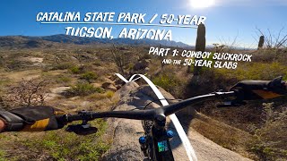
This trail starts with a sustained and sometimes technical climb, then after very briefly flattening out, continues climbing up a series of rock faces. The downhill winds through carved out chutes, over rock rolls (usually with ride around options), and over a number of difficult technical features and small drops. Keep an eye out for side lines and features. The landscape is beautiful. The trail can become rutted out after heavy rains.

To access this trail, drop into the chutes, but cut to the right almost immediately at the first fork. This will quickly take you the the base of the climbing portion of this trail. The trail is ridden almost exclusively in the clockwise direction, and is often combined with middlegate for a longer ride with similar character.

Trail Supporters

  • USFS
    Land Manager
Local Trail Association

Recent Activity on Trail

Past Week
  • 1 rides
  • 9 miles average
6 Months
  • 140 rides
  • 12 miles avg distance
All
  • 800 rides
  • Last: Jun 21, 2026
c1c2c3c4
January
February
March
April
May
June
July
August
September
October
November
December
Status:
on May 13, 2026
Dry
Avg: 4.14 (30 votes)
Your vote: 0

view (5,035)
close
3D
Trail Conditions
  • Unknown
  • Snow Groomed
  • Snow Packed
  • Snow Covered
  • Snow Cover Partial
  • Freeze/thaw Cycle
  • Icy
  • Prevalent Mud
  • Wet
  • Variable
  • Ideal
  • Dry
  • Very Dry
Trail Flow (Ridden Direction)
Trailforks scans users ridelogs to determine the most popular direction each trail is ridden. A good flowing trail network will have most trails flowing in a single direction according to their intension.
The colour categories are based on what percentage of riders are riding a trail in its intended direction.
  • > 96%
  • > 90%
  • > 80%
  • > 70%
  • > 50%
  • < 50%
  • bi-directional trail
  • no data
Trail Last Ridden
Trailforks scans ridelogs to determine the last time a trail was ridden.
  • < 2 days
  • < 1 week
  • < 2 weeks
  • < 1 month
  • < 6 months
  • > 6 months
Trail Ridden Direction
The intended direction a trail should be ridden.
  • Downhill Only
  • Downhill Primary
  • Both Directions
  • Uphill Primary
  • Uphill Only
  • One Direction
Contribute Details
Colors indicate trail is missing specified detail.
  • Description
  • Photos
  • Description & Photos
  • Videos
Trail Popularity ?
Trailforks scans ridelogs to determine which trails are ridden the most in the last 9 months. Trails are compared with nearby trails in the same city region with a possible 25 colour shades. Think of this as a heatmap, more rides = more kinetic energy = warmer colors.
  • most popular
  • popular
  • less popular
  • not popular
ATV/ORV/OHV Filter
Max Vehicle Width
inches
US Cell Coverage
Legend
cell carrier legend

Radar Time
Activity Recordings
Trailforks uses anonymized public activity data. ?
Activity Recordings
Trailforks uses anonymized public activity data. ?
Personal Heatmap
Activity Types
all / none
Options
2
Date range month
Winter Trails
Warning A routing network for winter maps does not exist. Selecting trails using the winter trails layer has been disabled.
Missing Trails
Most Popular
Least Popular
Trails are colored based on popularity. The more popular a trail is, the more red. Less popular trails trend towards green.
Jump Magnitude Heatmap
Heatmap of where riders jump on trails. Zoom in to see individual jumps, click circles to view jump details.
BC Backroad Status

Service Road Atlas is a free to use, community-driven service for viewing and creating reports on the numerous back-country service roads around B.C. and Alberta.

map legend
Slope Aspect
Direction the slope faces
Flat N NE E SE S SW W NW
Trails Deemphasized
Trails are shown in grey.
disable
Only show trails with no bike usage.
Enable
Suggested Layers
Based on selected activity type

    Save the current map location and zoom level as your default home location whenever this page is loaded.

    Save
        Directions to upper-fifty-year trailhead (32.495190, -110.867620)

        Photos

        36 more »
        61 |
        Jan 28, 2026 @ 8:23pm
        Jan 28, 2026
        48 |
        Dec 8, 2025 @ 1:56pm
        Dec 8, 2025
        49 |
        Dec 8, 2025 @ 1:56pm
        Dec 8, 2025
        57 |
        Dec 8, 2025 @ 1:56pm
        Dec 8, 2025

        Videos

        8 more »
        youtuber Hello Tucson - 50 Year Trail - Dusty betty...
        11:03 | 697 | Feb 20, 2019 , My City
        youtuber He Wasn't Planning on Crashing into a Cactus!
        14:43 | 686 | Feb 20, 2020 , My City
        youtuber Scenic, Technical MTB trail in Tucson, AZ -...
        11:26 | 406 | Feb 13, 2024 , My City
        Mountain Biking Upper 50 Year and Cowboy...
        11:22 | 170 | Feb 28, 2023 , My City

        Routes with this trail

        4.1 12 miles 1,364 ft 22
        A good sized loop that grabs basically all the good stuff in the Golder Ranch/50 Year area. Has everything...
        4.7 13 miles 1,267 ft 18 Loop
        Loop starting at Golder TH, around the Chutes, up and Rattlesnake, then down "Around the Mountain"
        5.0 7 miles 684 ft 8
        This loop combines the Upper Trail with Middle Gate.

        6 Reviews & Comments


        We hope you've been enjoying Trailforks!

        Create a FREE account to view trail comments and much more.

        • By toddTF Pro Trailforks & contributors
        • #15413 - 5,508 views

        Frequently Asked Questions About Upper Fifty Year

        Where is Upper Fifty Year located?
        Upper Fifty Year is located in Coronado National Forest - Mt Lemmon, Arizona, United States. It is part of the Coronado National Forest - Mt Lemmon trail network. The trailhead is located at coordinates 32.49519, -110.86762.
        How hard is Upper Fifty Year?
        Upper Fifty Year is rated as Black Diamond difficulty. The physical rating is Hard. The average grade is 0.2%. The climb difficulty is rated Black Diamond.
        What is the elevation gain for Upper Fifty Year?
        Upper Fifty Year has 350 ft of elevation gain. The trail has 331 ft of elevation descent. The elevation ranges from 3,285 ft to 3,613 ft.
        Is Upper Fifty Year a point to point trail?
        Upper Fifty Year is not a point to point trail. The direction is Both Directions. The trail type is singletrack.

        Hit the Trail

        Open in App

        Get this trail on your phone instantly.
        open trail in app

        Download Trail

        Save to wishlist, Garmin & download.
        save the trail

        Find Related Routes

        Find routes and users activities that include this trail.
        find routes for this trail

        You must enter a description before submitting.