more stats
965 ft
Distance
3 ft
Climb
-134 ft
Descent
00:01:33
Avg time
-131 ft
Altitude change
1,829 ft
Altitude min
1,960 ft
Altitude max
1,960 ft
Altitude start
1,827 ft
Altitude end
-13.6%
Grade
-36.8%
Grade max
5.2%
Grade min
56 ft
Distance climb
909 ft
Distance down
00:01:33
Avg time

Upper Hectic Details

  • Activities
    • Hike
    • Mountain Bike
    • E-Bike
    • Gravel Bike
    • Winter Fat Bike
    • Trail Running
  • Riding Area
    Topanga State Park
    Santa Monica, California
  • Difficulty Rating
  • Voted Difficulty
    Blue (1 vote)
  • Local Popularity
    75 in Mountain Biking [+]
    • 85 in E-Biking
    • 90 in Trail Running
    • 90 in Hiking
  • Global Ranking
    #94705 in Mountain Biking [+]
    • #52343 in E-Biking
    • #45496 in Trail Running
    • #56571 in Hiking
  • Hiking SAC Scale
    T3 Demanding Mountain Hiking
  • Trail Type
    Singletrack
  • Bike Type
    DH, AM, XC, Fat, CX, Gravel
  • Direction
    Downhill Primary
    Popular Direction Shown
  • Physical Rating
    Moderate
  • Trail Visibility
    Sometimes hard to follow
  • eBike Allowed

No community description for Upper Hectic trail has been added yet!

AI Generated Description

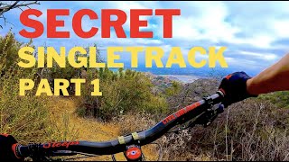
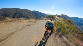
Upper Hectic is a 965 ft popular black diamond difficulty singletrack trail located near Santa Monica California. This hike primary trail can be used downhill primary and has a moderate overall physical rating. Trail visibility is sometimes hard to follow. On average it takes 1 minutes to complete this trail.

Access Info

Take farmer's ridge then head left uphill over the rocks to reach start of trail

Disclaimer

Watch for hikers

Traditionally Indigenous Territory

Recent Activity on Trail

Past Week
  • 1 rides
  • 19 miles average
6 Months
  • 25 rides
  • 15 miles avg distance
All
  • 182 rides
  • Last: Jun 16, 2026
c1c2c3c4
January
February
March
April
May
June
July
August
September
October
November
December
update trails status or condition

Upper Hectic Trail Reports

statusdatedescription
Mar 22, 2026 @ 7:26am (America/Los_Angeles)
Mar 22, 2026
Thank you to whoever cleared the trail. Somewhat loose as usual but good condition.
Oct 9, 2025 @ 2:26pm (America/Los_Angeles)
Oct 9, 2025
All clear and good to go!
Jan 5, 2025 @ 9:22am
Jan 5, 2025
May 2, 2024 @ 7:05am
May 2, 2024
It's getting very overgrown
Oct 1, 2023 @ 9:26am
Oct 1, 2023
more »
Status:
on Mar 22, 2026
Ideal
Avg: 3.86 (3 votes)
Your vote: 0

view (3,038)
close
3D
Trail Conditions
  • Unknown
  • Snow Groomed
  • Snow Packed
  • Snow Covered
  • Snow Cover Partial
  • Freeze/thaw Cycle
  • Icy
  • Prevalent Mud
  • Wet
  • Variable
  • Ideal
  • Dry
  • Very Dry
Trail Flow (Ridden Direction)
Trailforks scans users ridelogs to determine the most popular direction each trail is ridden. A good flowing trail network will have most trails flowing in a single direction according to their intension.
The colour categories are based on what percentage of riders are riding a trail in its intended direction.
  • > 96%
  • > 90%
  • > 80%
  • > 70%
  • > 50%
  • < 50%
  • bi-directional trail
  • no data
Trail Last Ridden
Trailforks scans ridelogs to determine the last time a trail was ridden.
  • < 2 days
  • < 1 week
  • < 2 weeks
  • < 1 month
  • < 6 months
  • > 6 months
Trail Ridden Direction
The intended direction a trail should be ridden.
  • Downhill Only
  • Downhill Primary
  • Both Directions
  • Uphill Primary
  • Uphill Only
  • One Direction
Contribute Details
Colors indicate trail is missing specified detail.
  • Description
  • Photos
  • Description & Photos
  • Videos
Trail Popularity ?
Trailforks scans ridelogs to determine which trails are ridden the most in the last 9 months. Trails are compared with nearby trails in the same city region with a possible 25 colour shades. Think of this as a heatmap, more rides = more kinetic energy = warmer colors.
  • most popular
  • popular
  • less popular
  • not popular
ATV/ORV/OHV Filter
Max Vehicle Width
inches
US Cell Coverage
Legend
cell carrier legend

Radar Time
Activity Recordings
Trailforks uses anonymized public activity data. ?
Activity Recordings
Trailforks uses anonymized public activity data. ?
Personal Heatmap
Activity Types
all / none
Options
2
Date range month
Winter Trails
Warning A routing network for winter maps does not exist. Selecting trails using the winter trails layer has been disabled.
Missing Trails
Most Popular
Least Popular
Trails are colored based on popularity. The more popular a trail is, the more red. Less popular trails trend towards green.
Jump Magnitude Heatmap
Heatmap of where riders jump on trails. Zoom in to see individual jumps, click circles to view jump details.
BC Backroad Status

Service Road Atlas is a free to use, community-driven service for viewing and creating reports on the numerous back-country service roads around B.C. and Alberta.

map legend
Slope Aspect
Direction the slope faces
Flat N NE E SE S SW W NW
Trails Deemphasized
Trails are shown in grey.
disable
Only show trails with no bike usage.
Enable
Suggested Layers
Based on selected activity type

    Save the current map location and zoom level as your default home location whenever this page is loaded.

    Save
        Directions to upper-hectic trailhead (34.128970, -118.532230)

        Photos

        No photos have been added for Upper Hectic yet, add a photo.

        Videos

        4 more »
        youtuber Single Tracks: Encino, CA - Hectic
        9:10 | 117 | Oct 26, 2023 , Santa Monica
        Hupper Hectic
        14:21 | 80 | Apr 4, 2023 , Santa Monica
        Training Ride with Payson McElveen (Upper...
        56:51 | 104 | Jul 5, 2022 , Santa Monica
        Upper Hectic
        0:36 | 242 | Jul 1, 2020 , Santa Monica

        Routes with this trail

        5.0 21 miles 4,378 ft 14 Loop
        A lot of the really fun enduro trails in the Santa Monica Mountains. The classics, and panic as that is a...
        27 miles 5,423 ft 13
        Good route hitting some of the lesser known good enduro trails in the area
        1.5 12 miles 2,219 ft 20
        Tarzana start and end loop

        1 Review & Comments


        We hope you've been enjoying Trailforks!

        Create a FREE account to view trail comments and much more.

        • By ersz & contributors
        • #77612 - 1,936 views

        Frequently Asked Questions About Upper Hectic

        Where is Upper Hectic located?
        Upper Hectic is located in Topanga State Park, Santa Monica, California, United States. It is part of the Topanga State Park trail network. The trailhead is located at coordinates 34.12897, -118.53223.
        How hard is Upper Hectic?
        Upper Hectic is rated as Black Diamond difficulty. The physical rating is Moderate. The average grade is 13.6%.
        What is the elevation gain for Upper Hectic?
        Upper Hectic has 3 ft of elevation gain. The trail has 134 ft of elevation descent. The elevation ranges from 1,829 ft to 1,960 ft.
        Is Upper Hectic a point to point trail?
        Upper Hectic is not a point to point trail. The direction is Downhill Primary. The trail type is singletrack.

        Hit the Trail

        Open in App

        Get this trail on your phone instantly.
        open trail in app

        Download Trail

        Save to wishlist, Garmin & download.
        save the trail

        Find Related Routes

        Find routes and users activities that include this trail.
        find routes for this trail

        You must enter a description before submitting.