more stats
2.5 miles
Distance
10 ft
Climb
-1,515 ft
Descent
00:15:42
Avg time
-1,508 ft
Altitude change
9,419 ft
Altitude min
10,934 ft
Altitude max
10,927 ft
Altitude start
9,419 ft
Altitude end
-11.4%
Grade
-64.7%
Grade max
4.8%
Grade min
420 ft
Distance climb
2 miles
Distance down
364 ft
Distance flat
00:15:42
Avg time

Upper Skid Marks Details

  • Activities
    • Mountain Bike
    • E-Bike
    • Adaptive Bike
  • Riding Area
    Mammoth Mountain Bike Park
    Mammoth Lakes, California
  • Difficulty Rating
  • Voted Difficulty
    Black Diamond (2 votes)
  • Local Popularity
    75 in Mountain Biking [+]
    • 80 in E-Biking
  • Global Ranking
    #67979 in Mountain Biking [+]
    • #29245 in E-Biking
  • Trail Type
    Singletrack
  • Bike Type
    DH, AM, Adaptive MTB
  • Direction
    Downhill Only
    Popular Direction Shown
  • Dogs Allowed
    Yes
  • eBike Allowed
    Yes up to Class 1

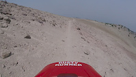
Extremely rocky trail that drops off of the top of the mountain. The top of Skid Marks has beautiful views of the lakes basin, but you'd best keep your eyes on this unrelenting trail.

Access Info

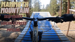
Take the Panorama Gondola to the summit. After exiting the gondola building, take a left and go behind the building. The trail splits from Off the Top after about 400 yards.

Adaptive Bike Info
aMTB Black Rating: Advanced obstacles exist, some trail obstructions.

Crossing the exposed pumice field at the top is a little sketchy

Trail Supporters

  • USFS
    Land Manager

Bike Park

Recent Activity on Trail

Past Week
  • 0 rides
  •  
6 Months
  • 0 rides
  •  
All
  • 104 rides
  • Last: Aug 22, 2022
c1c2c3c4
January
February
March
April
May
June
July
August
September
October
November
December
update trails status or condition

Upper Skid Marks Trail Reports

statusdatedescription
Aug 24, 2025 @ 9:23am
Aug 24, 2025
Jul 6, 2024 @ 9:13am
Jul 6, 2024
1 large patch of snow to walk around. Rest of the trail is clear.
Aug 1, 2022 @ 9:03am
Aug 1, 2022
No skid marks on a brown pow day after the rains
Jul 3, 2021 @ 11:23am
Jul 3, 2021
Oct 21, 2020 @ 12:35pm
Oct 21, 2020
Bike park closed for season, see you in 2021!
more »
Status:
on Aug 24, 2025
Ideal
Avg: 3.95 (15 votes)
Your vote: 0

view (1,352)
close
3D
Trail Conditions
  • Unknown
  • Snow Groomed
  • Snow Packed
  • Snow Covered
  • Snow Cover Partial
  • Freeze/thaw Cycle
  • Icy
  • Prevalent Mud
  • Wet
  • Variable
  • Ideal
  • Dry
  • Very Dry
Trail Flow (Ridden Direction)
Trailforks scans users ridelogs to determine the most popular direction each trail is ridden. A good flowing trail network will have most trails flowing in a single direction according to their intension.
The colour categories are based on what percentage of riders are riding a trail in its intended direction.
  • > 96%
  • > 90%
  • > 80%
  • > 70%
  • > 50%
  • < 50%
  • bi-directional trail
  • no data
Trail Last Ridden
Trailforks scans ridelogs to determine the last time a trail was ridden.
  • < 2 days
  • < 1 week
  • < 2 weeks
  • < 1 month
  • < 6 months
  • > 6 months
Trail Ridden Direction
The intended direction a trail should be ridden.
  • Downhill Only
  • Downhill Primary
  • Both Directions
  • Uphill Primary
  • Uphill Only
  • One Direction
Contribute Details
Colors indicate trail is missing specified detail.
  • Description
  • Photos
  • Description & Photos
  • Videos
Trail Popularity ?
Trailforks scans ridelogs to determine which trails are ridden the most in the last 9 months. Trails are compared with nearby trails in the same city region with a possible 25 colour shades. Think of this as a heatmap, more rides = more kinetic energy = warmer colors.
  • most popular
  • popular
  • less popular
  • not popular
ATV/ORV/OHV Filter
Max Vehicle Width
inches
US Cell Coverage
Legend
cell carrier legend

Radar Time
Activity Recordings
Trailforks uses anonymized public activity data. ?
Activity Recordings
Trailforks uses anonymized public activity data. ?
Personal Heatmap
Activity Types
all / none
Options
2
Date range month
Winter Trails
Warning A routing network for winter maps does not exist. Selecting trails using the winter trails layer has been disabled.
Missing Trails
Most Popular
Least Popular
Trails are colored based on popularity. The more popular a trail is, the more red. Less popular trails trend towards green.
Jump Magnitude Heatmap
Heatmap of where riders jump on trails. Zoom in to see individual jumps, click circles to view jump details.
BC Backroad Status

Service Road Atlas is a free to use, community-driven service for viewing and creating reports on the numerous back-country service roads around B.C. and Alberta.

map legend
Slope Aspect
Direction the slope faces
Flat N NE E SE S SW W NW
Trails Deemphasized
Trails are shown in grey.
disable
Only show trails with no bike usage.
Enable
Suggested Layers
Based on selected activity type

    Save the current map location and zoom level as your default home location whenever this page is loaded.

    Save
        Directions to upper-skid-marks trailhead (37.628040, -119.030800)

        Photos

        17 more »
        45 |
        Apr 1, 2025 @ 10:27am
        Apr 1, 2025
        109 |
        Sep 7, 2022 @ 9:04pm
        Sep 7, 2022
        195 |
        Aug 8, 2021 @ 1:45pm
        Aug 8, 2021
        183 |
        Aug 1, 2020 @ 2:06pm
        Aug 1, 2020

        Videos

        7 more »
        Can I Conquer Mammoth Bike Park After My Crash?
        11:57 | 59 | Aug 27, 2025 , Mammoth Lakes
        Skid Marks, Lincoln Express, and Pipeline
        9:59 | 393 | Sep 12, 2021 , Mammoth Lakes
        Skid marks Double Diamond trial at Mammoth
        6:04 | 2273 | Oct 5, 2019 , Mammoth Lakes
        Kitty litter
        0:58 | 385 | Aug 5, 2018 , Mammoth Lakes

        Trail Lists

        Routes with this trail

        7 miles 45 ft 6
        I have a love/hate relationship with Skid Marks. It’s worth doing (at least to mix it up from the top)...

        Trail Products

        6 Reviews & Comments


        We hope you've been enjoying Trailforks!

        Create a FREE account to view trail comments and much more.

        • By TheAngryTomatoTF Pro TRAILFORKS & contributors
        • #25022 - 4,236 views

        Frequently Asked Questions About Upper Skid Marks

        Where is Upper Skid Marks located?
        Upper Skid Marks is located in Mammoth Mountain Bike Park, Mammoth Lakes, California, United States. It is part of the Mammoth Mountain Bike Park trail network. The trailhead is located at coordinates 37.62804, -119.0308.
        How hard is Upper Skid Marks?
        Upper Skid Marks is rated as Double Black Diamond difficulty. The average grade is 11.4%.
        What is the elevation gain for Upper Skid Marks?
        Upper Skid Marks has 10 ft of elevation gain. The trail has 1,515 ft of elevation descent. The elevation ranges from 9,419 ft to 10,934 ft.
        Is Upper Skid Marks a point to point trail?
        Yes, Upper Skid Marks is a point to point trail. The direction is Downhill Only. The trail type is singletrack.

        Hit the Trail

        Open in App

        Get this trail on your phone instantly.
        open trail in app

        Download Trail

        Save to wishlist, Garmin & download.
        save the trail

        Find Related Routes

        Find routes and users activities that include this trail.
        find routes for this trail

        You must enter a description before submitting.