more stats
4,715 ft
Distance
189 ft
Climb
-698 ft
Descent
00:24:12
Avg time
-510 ft
Altitude change
713 ft
Altitude min
1,352 ft
Altitude max
1,223 ft
Altitude start
712 ft
Altitude end
-10.8%
Grade
-83.3%
Grade max
29.4%
Grade min
1,168 ft
Distance climb
2,874 ft
Distance down
620 ft
Distance flat
00:24:12
Avg time

Value Added Details

  • Activities
    • Mountain Bike
    • E-Bike
    • Observed Trials
  • Riding Area
    Alice Lake & Highlands
    Squamish, British Columbia
  • Difficulty Rating
  • Voted Difficulty
    Double Black Diamond (6 votes)
  • Local Popularity
    90 in Mountain Biking [+]
    • 90 in E-Biking
    • 5 in Observed Trials
  • Global Ranking
    #3701 in Mountain Biking [+]
    • #2638 in E-Biking
    • #162 in Observed Trials
  • Trail Type
    Singletrack
  • Bike Type
    AM
  • Climb Difficulty
    Black Diamond
  • Physical Rating
    Extreme
  • Dogs Allowed
    Yes
  • eBike Allowed
    Yes up to Class 1
  • TTFs on Trail
    Drop, Rock Face

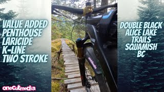
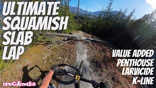
Awesome, long trail that starts with a ~1km technical singletrack climb, before descending for around 2km.

Big maintenance push/re-build winter 23/24 with the trail being armoured and slightly re routed to add a bit more flow. Still a traditional and technical descent with a few stand out slabs. The very end is starting to be lost to the forest (a good thing) therefore exiting the trail is recommended via 'added death', 'Value Addedwww.trailforks.com/trails/value-added-alt-exit/]Value Added Alt exit[/L]' or 'Penthouse'.

Good intro to double black as most features have a ride around.

Trail Supporters
  • past supporters

Local Trail Association
Traditionally Indigenous Territory

Recent Activity on Trail

Past Week
  • 14 rides
  • 17.0 km average
6 Months
  • 121 rides
  • 24.4 km avg distance
All
  • 974 rides
  • Last: Jun 2, 2026
c1c2c3c4
January
February
March
April
May
June
July
August
September
October
November
December
Status:
on May 2, 2026
Ideal
Avg: 4.65 (57 votes)
Your vote: 0

view (6,047)
close
3D
Trail Conditions
  • Unknown
  • Snow Groomed
  • Snow Packed
  • Snow Covered
  • Snow Cover Partial
  • Freeze/thaw Cycle
  • Icy
  • Prevalent Mud
  • Wet
  • Variable
  • Ideal
  • Dry
  • Very Dry
Trail Flow (Ridden Direction)
Trailforks scans users ridelogs to determine the most popular direction each trail is ridden. A good flowing trail network will have most trails flowing in a single direction according to their intension.
The colour categories are based on what percentage of riders are riding a trail in its intended direction.
  • > 96%
  • > 90%
  • > 80%
  • > 70%
  • > 50%
  • < 50%
  • bi-directional trail
  • no data
Trail Last Ridden
Trailforks scans ridelogs to determine the last time a trail was ridden.
  • < 2 days
  • < 1 week
  • < 2 weeks
  • < 1 month
  • < 6 months
  • > 6 months
Trail Ridden Direction
The intended direction a trail should be ridden.
  • Downhill Only
  • Downhill Primary
  • Both Directions
  • Uphill Primary
  • Uphill Only
  • One Direction
Contribute Details
Colors indicate trail is missing specified detail.
  • Description
  • Photos
  • Description & Photos
  • Videos
Trail Popularity ?
Trailforks scans ridelogs to determine which trails are ridden the most in the last 9 months. Trails are compared with nearby trails in the same city region with a possible 25 colour shades. Think of this as a heatmap, more rides = more kinetic energy = warmer colors.
  • most popular
  • popular
  • less popular
  • not popular
ATV/ORV/OHV Filter
Max Vehicle Width
inches
US Cell Coverage
Legend
cell carrier legend

Radar Time
Activity Recordings
Trailforks uses anonymized public activity data. ?
Activity Recordings
Trailforks uses anonymized public activity data. ?
Personal Heatmap
Activity Types
all / none
Options
2
Date range month
Winter Trails
Warning A routing network for winter maps does not exist. Selecting trails using the winter trails layer has been disabled.
Missing Trails
Most Popular
Least Popular
Trails are colored based on popularity. The more popular a trail is, the more red. Less popular trails trend towards green.
Jump Magnitude Heatmap
Heatmap of where riders jump on trails. Zoom in to see individual jumps, click circles to view jump details.
BC Backroad Status

Service Road Atlas is a free to use, community-driven service for viewing and creating reports on the numerous back-country service roads around B.C. and Alberta.

map legend
Slope Aspect
Direction the slope faces
Flat N NE E SE S SW W NW
Trails Deemphasized
Trails are shown in grey.
disable
Only show trails with no bike usage.
Enable
Suggested Layers
Based on selected activity type

    Save the current map location and zoom level as your default home location whenever this page is loaded.

    Save
        Directions to value-added-0 trailhead (49.765600, -123.113460)

        Photos

        64 more »
        1,573 |
        Jun 27, 2016 @ 9:58am
        Jun 27, 2016
        121 |
        Jun 16, 2024 @ 9:17pm
        Jun 16, 2024
        246 |
        Jun 29, 2023 @ 6:05pm
        Jun 29, 2023
        866 |
        Jan 21, 2022 @ 9:27am
        Jan 21, 2022

        Videos

        32 more »
        youtuber Riding a Marathon of Slabs
        24:19 | 1059 | Mar 27, 2022 , Squamish
        youtuber Double Black Alice Lake Trails   Squamish BC
        8:40 | 225 | Oct 5, 2024 , Squamish
        youtuber Ultimate Squamish Slab Lap,   Value Added,...
        18:29 | 392 | Jun 16, 2024 , Squamish
        youtuber Going -
        8:08 | 657 | Feb 14, 2023 , Squamish

        Articles

        Video: Remy Metailler & The Pinkbike Privateer Ride the Most Difficult Lap in Squamish
        Jun 26, 2019 from pinkbike.com
        It's actually a trifecta of the infamous Value Added, Penthouse, and Larvicide.

        Routes with this trail

        3.0 11 miles 2,094 ft 37 Loop
        The toughest trails in Squamish, compiled. Try not to crash.
        1.0 37 miles 6,933 ft 35 Loop
        There is a shuttle from Half Nelson lot to Garibaldi chain-up lot, courtesy of Shred Shuttle. As a result,...
        27 miles 5,170 ft 24 Loop
        Set in the BC coast mountain rain forest, the Squamish Enduro showcases some of the best, and most...

        9 Reviews & Comments


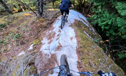
        We hope you've been enjoying Trailforks!

        Create a FREE account to view trail comments and much more.

        • By BCpovTF Pro & contributors
        • #1253 - 22,392 views

        Frequently Asked Questions About Value Added

        Where is Value Added located?
        Value Added is located in Alice Lake & Highlands, Squamish, British Columbia, Canada. It is part of the Alice Lake & Highlands trail network. The trailhead is located at coordinates 49.7656, -123.11346.
        How hard is Value Added?
        Value Added is rated as Double Black Diamond difficulty. The physical rating is Extreme. The average grade is 10.8%. The climb difficulty is rated Black Diamond.
        What is the elevation gain for Value Added?
        Value Added has 189 ft of elevation gain. The trail has 698 ft of elevation descent. The elevation ranges from 713 ft to 1,352 ft.
        How long is Value Added?
        Value Added is 4,715 ft long. The trail type is singletrack.

        Hit the Trail

        Open in App

        Get this trail on your phone instantly.
        open trail in app

        Download Trail

        Save to wishlist, Garmin & download.
        save the trail

        Find Related Routes

        Find routes and users activities that include this trail.
        find routes for this trail

        You must enter a description before submitting.