more stats
2,772 ft
Distance
3 ft
Climb
-164 ft
Descent
00:02:39
Avg time
-161 ft
Altitude change
639 ft
Altitude min
801 ft
Altitude max
801 ft
Altitude start
640 ft
Altitude end
-5.8%
Grade
-27.3%
Grade max
5.5%
Grade min
66 ft
Distance climb
2,441 ft
Distance down
266 ft
Distance flat
00:02:39
Avg time

Vasbyt Details

  • Activities
    • Mountain Bike
    • E-Bike
  • Riding Area
  • Difficulty Rating
  • Voted Difficulty
    Blue (2 votes)
  • Local Popularity
    95 in Mountain Biking [+]
    • 90 in E-Biking
  • Global Ranking
    #19638 in Mountain Biking [+]
    • #6510 in E-Biking
  • Trail Type
    Singletrack
  • Bike Type
    AM, XC
  • Climb Difficulty
    Blue
  • Physical Rating
    Moderate
  • eBike Allowed
    Yes up to Class 1
  • TTFs on Trail
    Berm, Drop, Jump
  • Land Owner
    South African National Parks

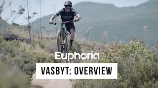
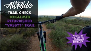
Vasbyt: NOTE - MAKE YOUR TRAIL CHOICE AT THE START AND DO NOT CROSS INTO THE NEIGBOURING DH3 TRACK BELOW THE VASBYT UPPER START. THIS IS FOR YOUR AND OTHER RIDER'S SAFETY. From the trail head on level 2 take the new entrance into a left hand berm and over the recently revised upper section. Stay left of the DH line and head over a few speed inducing rollers that guarantee some air time if you're off the brakes. The trail drops and rises here like a rollercoaster and speed control is a must as the trail narrows into a fast right hand berm into a high speed run over a mini table top. Then it heads into a series of super new berms which add huge flow to
the flatter middle section. A few small, avoidable jumps spice this section up further. The trail descends into more natural sandy terrain around these berms and straights before a long reinforced berm heads into rockier loose terrain as the this upper section of Vasbyt crosses a jeep track and enters Vasbyt Lower.
Is this trail for you?: Vasbyt requires good brake control to manage speed up top and the ability to ride sometimes slippery berms. All the trail features such as drops, jumps and such like are avoidable. The trail surface varies from smooth compacted dirt to loose rocks that can easily unsettle a rider.

Access Info

The best way to ride Vasbyt is from the trailhead as the Main Jeep Track meets the Level 2 Jeep Track. Climb the Main Jeep Track until you see the Level 2 Jeep Track on the right. A short climb takes you past DH3 on your right and then Vasbyt's entrance close to the farm fence line.

Disclaimer

A TMNP Level 3 Activity Permit is required to enter Tokai. Please consider joining TokaiMTB for R400.00 per annum. We build and manage the trails in Tokai you love to ride.

Trail Supporters
  • Euphoria Telecoms
    Sponsor
Local Trail Association

Recent Activity on Trail

Past Week
  • 7 rides
  • 14 miles average
6 Months
  • 227 rides
  • 14 miles avg distance
All
  • 1,097 rides
  • Last: Jun 19, 2026
c1c2c3c4
January
February
March
April
May
June
July
August
September
October
November
December
Status:
on Mar 8, 2026
Ideal
Avg: 4.19 (4 votes)
Your vote: 0

view (13,330)
close
3D
Trail Conditions
  • Unknown
  • Snow Groomed
  • Snow Packed
  • Snow Covered
  • Snow Cover Partial
  • Freeze/thaw Cycle
  • Icy
  • Prevalent Mud
  • Wet
  • Variable
  • Ideal
  • Dry
  • Very Dry
Trail Flow (Ridden Direction)
Trailforks scans users ridelogs to determine the most popular direction each trail is ridden. A good flowing trail network will have most trails flowing in a single direction according to their intension.
The colour categories are based on what percentage of riders are riding a trail in its intended direction.
  • > 96%
  • > 90%
  • > 80%
  • > 70%
  • > 50%
  • < 50%
  • bi-directional trail
  • no data
Trail Last Ridden
Trailforks scans ridelogs to determine the last time a trail was ridden.
  • < 2 days
  • < 1 week
  • < 2 weeks
  • < 1 month
  • < 6 months
  • > 6 months
Trail Ridden Direction
The intended direction a trail should be ridden.
  • Downhill Only
  • Downhill Primary
  • Both Directions
  • Uphill Primary
  • Uphill Only
  • One Direction
Contribute Details
Colors indicate trail is missing specified detail.
  • Description
  • Photos
  • Description & Photos
  • Videos
Trail Popularity ?
Trailforks scans ridelogs to determine which trails are ridden the most in the last 9 months. Trails are compared with nearby trails in the same city region with a possible 25 colour shades. Think of this as a heatmap, more rides = more kinetic energy = warmer colors.
  • most popular
  • popular
  • less popular
  • not popular
ATV/ORV/OHV Filter
Max Vehicle Width
inches
US Cell Coverage
Legend
cell carrier legend

Radar Time
Activity Recordings
Trailforks uses anonymized public activity data. ?
Activity Recordings
Trailforks uses anonymized public activity data. ?
Personal Heatmap
Activity Types
all / none
Options
2
Date range month
Winter Trails
Warning A routing network for winter maps does not exist. Selecting trails using the winter trails layer has been disabled.
Missing Trails
Most Popular
Least Popular
Trails are colored based on popularity. The more popular a trail is, the more red. Less popular trails trend towards green.
Jump Magnitude Heatmap
Heatmap of where riders jump on trails. Zoom in to see individual jumps, click circles to view jump details.
BC Backroad Status

Service Road Atlas is a free to use, community-driven service for viewing and creating reports on the numerous back-country service roads around B.C. and Alberta.

map legend
Slope Aspect
Direction the slope faces
Flat N NE E SE S SW W NW
Trails Deemphasized
Trails are shown in grey.
disable
Only show trails with no bike usage.
Enable
Suggested Layers
Based on selected activity type

    Save the current map location and zoom level as your default home location whenever this page is loaded.

    Save
        Directions to vasbyt trailhead (-34.049990, 18.403030)

        Photos

        2 more »
        315 |
        Sep 1, 2018 @ 3:34am
        Sep 1, 2018
        237 |
        Jul 7, 2009 @ 5:21am
        Jul 7, 2009

        Videos

        2 more »
        featured Euphoria Vasbyt: Overview
        4:01 | 746 | Dec 7, 2020 , Tokai
        TOKAI MTB // REFURBISHED VASBYT TRAIL // POV
        3:03 | 722 | Dec 26, 2019 , Tokai

        Routes with this trail

        40 miles 5,988 ft 12
        Start at Tokai forest and make your way up Ou Kaapse Weg. starts at the mountain bike parking lot at...
        8 miles 1,970 ft 15
        Route for me and James, we aren't that fit though
        36 miles 4,859 ft 11
        50km MTB Route , Muizeburg , Silvermines , Tokai

        Reviews / Comments

        No reviews yet, be the first to write a review or ask a question.
        Use trail reports to comment on trail conditions.


        We hope you've been enjoying Trailforks!

        Create a FREE account to view trail comments and much more.

        Frequently Asked Questions About Vasbyt

        Where is Vasbyt located?
        Vasbyt is located in Tokai Forest MTB Trails, Tokai, South Africa. It is part of the Tokai Forest MTB Trails trail network. The trailhead is located at coordinates -34.04999, 18.40303.
        How hard is Vasbyt?
        Vasbyt is rated as Blue difficulty. The physical rating is Moderate. The average grade is 5.8%. The climb difficulty is rated Blue.
        What is the elevation gain for Vasbyt?
        Vasbyt has 3 ft of elevation gain. The trail has 164 ft of elevation descent. The elevation ranges from 639 ft to 801 ft.
        How long is Vasbyt?
        Vasbyt is 2,772 ft long. The trail type is singletrack.

        Hit the Trail

        Open in App

        Get this trail on your phone instantly.
        open trail in app

        Download Trail

        Save to wishlist, Garmin & download.
        save the trail

        Find Related Routes

        Find routes and users activities that include this trail.
        find routes for this trail

        You must enter a description before submitting.