more stats
3,816 ft
Distance
33 ft
Climb
-592 ft
Descent
00:11:36
Avg time
-560 ft
Altitude change
1,183 ft
Altitude min
1,744 ft
Altitude max
1,744 ft
Altitude start
1,184 ft
Altitude end
-14.7%
Grade
-62.7%
Grade max
16.2%
Grade min
217 ft
Distance climb
3,153 ft
Distance down
423 ft
Distance flat
00:11:36
Avg time

Viking Details

  • Activities
    • Mountain Bike
    • E-Bike
  • Riding Area
    Sentiers du Moulin
    Lac Beauport, Quebec
  • Difficulty Rating
  • Local Popularity
    80 in Mountain Biking [+]
    • 65 in E-Biking
  • Global Ranking
    #3590 in Mountain Biking [+]
    • #8273 in E-Biking
  • Trail Type
    Singletrack
  • Bike Type
    AM
  • Direction
    Downhill Only
    Popular Direction Shown
  • Physical Rating
    Moderate
  • Season
    mai à octobre
  • eBike Allowed
    Yes up to Class 1
  • TTFs on Trail
    Bridge, Drop, Jump, Ladder Bridge, Log Ride, Rock Face, Rock Garden, Roller Coaster, Skinny, Wallride
  • Year Opened
    2017
  • Land Owner
    Sentiers du Moulin

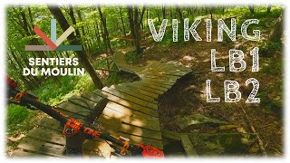
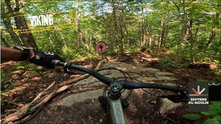
La Viking a été inaugurée en juin 2017. Il s'agit d'une piste enduro de type old school comprenant 12 modules north shore.

Gestion de projet et design : Éric Gagnon et Étienne Boileau
Aménagement mécanisé et design : Patrice Dorion / MTN Évolution
Construction des modules et finition : Jeff Tardif (bénévolement 150h)
Finition : Équipe de sentiers SDM

Local Trail Association
Traditionally Indigenous Territory

Recent Activity on Trail

Past Week
  • 5 rides
  • 7 miles average
6 Months
  • 11 rides
  • 9 miles avg distance
All
  • 384 rides
  • Last: Jun 17, 2026
c1c2c3c4
January
February
March
April
May
June
July
August
September
October
November
December
Status:
on May 15, 2026
Ideal
Avg: 4.75 (34 votes)
Your vote: 0

view (3,285)
close
3D
Trail Conditions
  • Unknown
  • Snow Groomed
  • Snow Packed
  • Snow Covered
  • Snow Cover Partial
  • Freeze/thaw Cycle
  • Icy
  • Prevalent Mud
  • Wet
  • Variable
  • Ideal
  • Dry
  • Very Dry
Trail Flow (Ridden Direction)
Trailforks scans users ridelogs to determine the most popular direction each trail is ridden. A good flowing trail network will have most trails flowing in a single direction according to their intension.
The colour categories are based on what percentage of riders are riding a trail in its intended direction.
  • > 96%
  • > 90%
  • > 80%
  • > 70%
  • > 50%
  • < 50%
  • bi-directional trail
  • no data
Trail Last Ridden
Trailforks scans ridelogs to determine the last time a trail was ridden.
  • < 2 days
  • < 1 week
  • < 2 weeks
  • < 1 month
  • < 6 months
  • > 6 months
Trail Ridden Direction
The intended direction a trail should be ridden.
  • Downhill Only
  • Downhill Primary
  • Both Directions
  • Uphill Primary
  • Uphill Only
  • One Direction
Contribute Details
Colors indicate trail is missing specified detail.
  • Description
  • Photos
  • Description & Photos
  • Videos
Trail Popularity ?
Trailforks scans ridelogs to determine which trails are ridden the most in the last 9 months. Trails are compared with nearby trails in the same city region with a possible 25 colour shades. Think of this as a heatmap, more rides = more kinetic energy = warmer colors.
  • most popular
  • popular
  • less popular
  • not popular
ATV/ORV/OHV Filter
Max Vehicle Width
inches
US Cell Coverage
Legend
cell carrier legend

Radar Time
Activity Recordings
Trailforks uses anonymized public activity data. ?
Activity Recordings
Trailforks uses anonymized public activity data. ?
Personal Heatmap
Activity Types
all / none
Options
2
Date range month
Winter Trails
Warning A routing network for winter maps does not exist. Selecting trails using the winter trails layer has been disabled.
Missing Trails
Most Popular
Least Popular
Trails are colored based on popularity. The more popular a trail is, the more red. Less popular trails trend towards green.
Jump Magnitude Heatmap
Heatmap of where riders jump on trails. Zoom in to see individual jumps, click circles to view jump details.
BC Backroad Status

Service Road Atlas is a free to use, community-driven service for viewing and creating reports on the numerous back-country service roads around B.C. and Alberta.

map legend
Slope Aspect
Direction the slope faces
Flat N NE E SE S SW W NW
Trails Deemphasized
Trails are shown in grey.
disable
Only show trails with no bike usage.
Enable
Suggested Layers
Based on selected activity type

    Save the current map location and zoom level as your default home location whenever this page is loaded.

    Save
        Directions to viking-73612 trailhead (46.991700, -71.268520)

        Photos

        15 more »
        3,471 |
        Jun 22, 2017 @ 3:21pm
        Jun 22, 2017
        1,031 |
        Sep 13, 2017 @ 4:59pm
        Sep 13, 2017
        479 |
        Sep 13, 2017 @ 7:44am
        Sep 13, 2017
        841 |
        Sep 13, 2017 @ 7:44am
        Sep 13, 2017

        Videos

        16 more »
        youtuber On ride trois pistes experte classique de SDM!
        13:33 | 525 | Aug 15, 2022 , Lac Beauport
        youtuber ????️ Riding with BKXC - Viking | Sentiers...
        6:20 | 1289 | Sep 9, 2018 , Lac Beauport
        youtuber Viking | Sentiers du Moulin | Quebec City MTB
        1687 | Jul 27, 2017 , Lac Beauport
        On essaye la viking aux Sentiers du Moulin
        21:15 | 82 | Sep 24, 2024 , Lac Beauport

        4 Reviews & Comments


        We hope you've been enjoying Trailforks!

        Create a FREE account to view trail comments and much more.

        • By SentiersduMoulinTF Pro VQ SDM & contributors
        • #73612 - 7,813 views

        Frequently Asked Questions About Viking

        Where is Viking located?
        Viking is located in Sentiers du Moulin, Lac Beauport, Quebec, Canada. It is part of the Sentiers du Moulin trail network. The trailhead is located at coordinates 46.9917, -71.26852.
        How hard is Viking?
        Viking is rated as Double Black Diamond difficulty. The physical rating is Moderate. The average grade is 14.7%.
        What is the elevation gain for Viking?
        Viking has 33 ft of elevation gain. The trail has 592 ft of elevation descent. The elevation ranges from 1,183 ft to 1,744 ft.
        Is Viking a point to point trail?
        Yes, Viking is a point to point trail. The direction is Downhill Only. The trail type is singletrack.

        Hit the Trail

        Open in App

        Get this trail on your phone instantly.
        open trail in app

        Download Trail

        Save to wishlist, Garmin & download.
        save the trail

        Find Related Routes

        Find routes and users activities that include this trail.
        find routes for this trail

        You must enter a description before submitting.