more stats
2.3 miles
Distance
113 ft
Climb
-111 ft
Descent
00:29:40
Avg time
2 ft
Altitude change
64 ft
Altitude min
99 ft
Altitude max
80 ft
Altitude start
82 ft
Altitude end
-9.9%
Grade max
25.7%
Grade min
3,048 ft
Distance climb
3,012 ft
Distance down
1 mile
Distance flat
00:29:40
Avg time

Vortex Details

  • Activities
    • Mountain Bike
  • Riding Area
    Vortex
    Ocala, Florida
  • Difficulty Rating
  • Voted Difficulty
    Black Diamond (2 votes)
  • Local Popularity
    70 in Mountain Biking
  • Global Ranking
    #35426 in Mountain Biking
  • Trail Type
    Singletrack
  • Bike Type
    AM, XC
  • Direction
    Downhill Primary
  • Climb Difficulty
    Black Diamond
  • Physical Rating
    Hard
  • Dogs Allowed
    Yes
  • eBike Allowed
  • TTFs on Trail
    Bridge, Drop, Jump, Skinny, Wallride

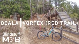
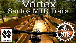
a fun trail, with options through out the trail, not a sight seeing trail, keep yer wits about ya.... enjoy!

Trail basically now ends where it exits on the lime rock road as the last part has been taken over by the flow trail area.

Local Trail Association
Traditionally Indigenous Territory

Recent Activity on Trail

Past Week
  • 6 rides
  • 13 miles average
6 Months
  • 163 rides
  • 15 miles avg distance
All
  • 1,792 rides
  • Last: Jun 27, 2026
c1c2c3c4
January
February
March
April
May
June
July
August
September
October
November
December
update trails status or condition

Vortex Trail Reports

statusdatedescription
May 14, 2026 @ 1:50pm (America/Nassau)
May 14, 2026
Day after rain, so like super hero dirt, but super slow rolling
Jan 26, 2026 @ 4:22pm (America/Nassau)
Jan 26, 2026
Nov 15, 2025 @ 9:35am (America/Nassau)
Nov 15, 2025
Apr 13, 2025 @ 1:53pm
Apr 13, 2025
In the last part, near Indigo Flow after Indigo Flow ends in those 2 berms then there's another trail besides the access road that heads back up...
Mar 13, 2025 @ 4:06pm
Mar 13, 2025
more »
Status:
on May 14, 2026
Ideal
Avg: 4.51 (29 votes)
Your vote: 0

view (11,198)
close
3D
Trail Conditions
  • Unknown
  • Snow Groomed
  • Snow Packed
  • Snow Covered
  • Snow Cover Partial
  • Freeze/thaw Cycle
  • Icy
  • Prevalent Mud
  • Wet
  • Variable
  • Ideal
  • Dry
  • Very Dry
Trail Flow (Ridden Direction)
Trailforks scans users ridelogs to determine the most popular direction each trail is ridden. A good flowing trail network will have most trails flowing in a single direction according to their intension.
The colour categories are based on what percentage of riders are riding a trail in its intended direction.
  • > 96%
  • > 90%
  • > 80%
  • > 70%
  • > 50%
  • < 50%
  • bi-directional trail
  • no data
Trail Last Ridden
Trailforks scans ridelogs to determine the last time a trail was ridden.
  • < 2 days
  • < 1 week
  • < 2 weeks
  • < 1 month
  • < 6 months
  • > 6 months
Trail Ridden Direction
The intended direction a trail should be ridden.
  • Downhill Only
  • Downhill Primary
  • Both Directions
  • Uphill Primary
  • Uphill Only
  • One Direction
Contribute Details
Colors indicate trail is missing specified detail.
  • Description
  • Photos
  • Description & Photos
  • Videos
Trail Popularity ?
Trailforks scans ridelogs to determine which trails are ridden the most in the last 9 months. Trails are compared with nearby trails in the same city region with a possible 25 colour shades. Think of this as a heatmap, more rides = more kinetic energy = warmer colors.
  • most popular
  • popular
  • less popular
  • not popular
ATV/ORV/OHV Filter
Max Vehicle Width
inches
US Cell Coverage
Legend
cell carrier legend

Radar Time
Activity Recordings
Trailforks uses anonymized public activity data. ?
Activity Recordings
Trailforks uses anonymized public activity data. ?
Personal Heatmap
Activity Types
all / none
Options
2
Date range month
Winter Trails
Warning A routing network for winter maps does not exist. Selecting trails using the winter trails layer has been disabled.
Missing Trails
Most Popular
Least Popular
Trails are colored based on popularity. The more popular a trail is, the more red. Less popular trails trend towards green.
Jump Magnitude Heatmap
Heatmap of where riders jump on trails. Zoom in to see individual jumps, click circles to view jump details.
BC Backroad Status

Service Road Atlas is a free to use, community-driven service for viewing and creating reports on the numerous back-country service roads around B.C. and Alberta.

map legend
Slope Aspect
Direction the slope faces
Flat N NE E SE S SW W NW
Trails Deemphasized
Trails are shown in grey.
disable
Only show trails with no bike usage.
Enable
Suggested Layers
Based on selected activity type

    Save the current map location and zoom level as your default home location whenever this page is loaded.

    Save
        Directions to vortex-29318 trailhead (29.090690, -82.107130)

        Photos

        7 more »
        48 |
        Feb 1, 2026 @ 10:28am
        Feb 1, 2026
        66 |
        Feb 1, 2026 @ 10:28am
        Feb 1, 2026
        194 |
        Sep 9, 2023 @ 8:07am
        Sep 9, 2023
        203 |
        Sep 9, 2023 @ 8:04am
        Sep 9, 2023

        Videos

        40 more »
        youtuber Sessioning Florida's Best MTB Trails | Santos...
        11:51 | 840 | Feb 13, 2021 , Ocala
        youtuber Exploring Florida's Best MTB Trails
        7:49 | 840 | Jan 17, 2020 , Ocala
        youtuber Mountain Biking the Vortex at Ocala, FL
        1724 | Mar 9, 2017 , Ocala
        Vortex Loop V2.0 - Santos Mountain Bike Trail...
        24:05 | 1167 | Jun 24, 2021 , Ocala

        Routes with this trail

        3.3 16 miles 504 ft 38 Loop
        This is a good route to get a little bit of everything Santos has to offer in about 2 hours for the...
        3.0 16 miles 531 ft 54 Loop
        Hits most trails in Santos. Pretty difficult, we ate lunch right before we rode around the Vortex area....
        73 miles 1,854 ft 38 Point to Point
        Full run through Santos, Vortex, and Spider Kingdom. Features the most fun trails you can ride in Florida...

        1 Review & Comments


        We hope you've been enjoying Trailforks!

        Create a FREE account to view trail comments and much more.

        Nearby Trails

        • By r8chTF Pro & contributors
        • #29318 - 12,704 views

        Frequently Asked Questions About Vortex

        Where is Vortex located?
        Vortex is located in Vortex, Ocala, Florida, United States. It is part of the Vortex trail network. The trailhead is located at coordinates 29.09069, -82.10713.
        How hard is Vortex?
        Vortex is rated as Black Diamond difficulty. The physical rating is Hard. The climb difficulty is rated Black Diamond.
        What is the elevation gain for Vortex?
        Vortex has 113 ft of elevation gain. The trail has 111 ft of elevation descent. The elevation ranges from 64 ft to 99 ft.
        Is Vortex a point to point trail?
        Vortex is not a point to point trail. The direction is Downhill Primary. The trail type is singletrack.

        Hit the Trail

        Open in App

        Get this trail on your phone instantly.
        open trail in app

        Download Trail

        Save to wishlist, Garmin & download.
        save the trail

        Find Related Routes

        Find routes and users activities that include this trail.
        find routes for this trail

        You must enter a description before submitting.