more stats
1.3 miles
Distance
159 ft
Climb
-123 ft
Descent
00:17:09
Avg time
36 ft
Altitude change
838 ft
Altitude min
982 ft
Altitude max
945 ft
Altitude start
981 ft
Altitude end
0.5%
Grade
-10.4%
Grade max
14.5%
Grade min
3,120 ft
Distance climb
2,976 ft
Distance down
577 ft
Distance flat
00:17:09
Avg time

Wagon Wheel Trail Details

  • Activities
    • Mountain Bike
    • E-Bike
    • Hike
    • Trail Running
  • Riding Area
    Tamarancho
    Fairfax, California
  • Difficulty Rating
  • Voted Difficulty
    Blue (10 votes)
  • Local Popularity
    90 in Mountain Biking [+]
    • 70 in E-Biking
    • 55 in Trail Running
    • 65 in Hiking
  • Global Ranking
    #29578 in Mountain Biking [+]
    • #34056 in E-Biking
    • #77139 in Trail Running
    • #54079 in Hiking
  • Trail Type
    Singletrack
  • Bike Type
    XC
  • Direction
    Both Directions
    Popular Direction Shown
  • Climb Difficulty
    Blue
  • Physical Rating
    Moderate
  • Dogs Allowed
    Yes
  • eBike Allowed
  • Land Owner
    Boy Scouts of America

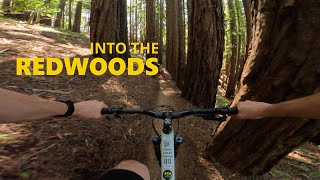
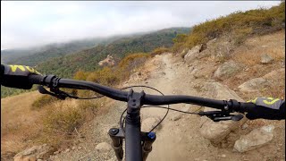
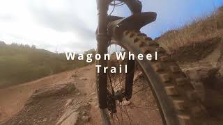
A trail that lives up to its name. Trail is the fastest on wagon wheel 29 bikes but is enjoyable on all bikes. Whole trail is practically on some form of rock from crushed granite to big rock gardens. In the middle is a nice man made rock garden that requires technical ability at slower speeds.There is also an section near the end with a couple of loose drops off of small boulder piles above the trail to the left, which can be fun to session. It is not marked on the trail, but most people stop to attempt it or take a break in the shade. Overall trail adds nice variety to the Tamarancho loop.

Local Trail Association
Traditionally Indigenous Territory

Recent Activity on Trail

Past Week
  • 18 rides
  • 18 miles average
6 Months
  • 264 rides
  • 15 miles avg distance
All
  • 1,860 rides
  • Last: Jun 21, 2026
c1c2c3c4
January
February
March
April
May
June
July
August
September
October
November
December
Status:
on Apr 15, 2026
Variable
Avg: 4.45 (27 votes)
Your vote: 0

view (16,447)
close
3D
Trail Conditions
  • Unknown
  • Snow Groomed
  • Snow Packed
  • Snow Covered
  • Snow Cover Partial
  • Freeze/thaw Cycle
  • Icy
  • Prevalent Mud
  • Wet
  • Variable
  • Ideal
  • Dry
  • Very Dry
Trail Flow (Ridden Direction)
Trailforks scans users ridelogs to determine the most popular direction each trail is ridden. A good flowing trail network will have most trails flowing in a single direction according to their intension.
The colour categories are based on what percentage of riders are riding a trail in its intended direction.
  • > 96%
  • > 90%
  • > 80%
  • > 70%
  • > 50%
  • < 50%
  • bi-directional trail
  • no data
Trail Last Ridden
Trailforks scans ridelogs to determine the last time a trail was ridden.
  • < 2 days
  • < 1 week
  • < 2 weeks
  • < 1 month
  • < 6 months
  • > 6 months
Trail Ridden Direction
The intended direction a trail should be ridden.
  • Downhill Only
  • Downhill Primary
  • Both Directions
  • Uphill Primary
  • Uphill Only
  • One Direction
Contribute Details
Colors indicate trail is missing specified detail.
  • Description
  • Photos
  • Description & Photos
  • Videos
Trail Popularity ?
Trailforks scans ridelogs to determine which trails are ridden the most in the last 9 months. Trails are compared with nearby trails in the same city region with a possible 25 colour shades. Think of this as a heatmap, more rides = more kinetic energy = warmer colors.
  • most popular
  • popular
  • less popular
  • not popular
ATV/ORV/OHV Filter
Max Vehicle Width
inches
US Cell Coverage
Legend
cell carrier legend

Radar Time
Activity Recordings
Trailforks uses anonymized public activity data. ?
Activity Recordings
Trailforks uses anonymized public activity data. ?
Personal Heatmap
Activity Types
all / none
Options
2
Date range month
Winter Trails
Warning A routing network for winter maps does not exist. Selecting trails using the winter trails layer has been disabled.
Missing Trails
Most Popular
Least Popular
Trails are colored based on popularity. The more popular a trail is, the more red. Less popular trails trend towards green.
Jump Magnitude Heatmap
Heatmap of where riders jump on trails. Zoom in to see individual jumps, click circles to view jump details.
BC Backroad Status

Service Road Atlas is a free to use, community-driven service for viewing and creating reports on the numerous back-country service roads around B.C. and Alberta.

map legend
Slope Aspect
Direction the slope faces
Flat N NE E SE S SW W NW
Trails Deemphasized
Trails are shown in grey.
disable
Only show trails with no bike usage.
Enable
Suggested Layers
Based on selected activity type

    Save the current map location and zoom level as your default home location whenever this page is loaded.

    Save
        Directions to wagon-wheel-trail trailhead (37.987010, -122.614660)

        Photos

        18 more »
        1,240 |
        Feb 14, 2018 @ 11:22pm
        Feb 14, 2018
        1,273 |
        Jun 23, 2015 @ 10:36pm
        Jun 23, 2015
        999 |
        Feb 16, 2015 @ 9:07pm
        Feb 16, 2015
        1,105 |
        Feb 16, 2015 @ 9:09pm
        Feb 16, 2015

        Videos

        6 more »
        Camp Tamarancho Loop, Marin County, California
        6:00 | 243 | Jun 1, 2024 , Fairfax
        Visiting the Birthplace of MTB | Mountain...
        16:39 | 439 | Sep 25, 2021 , Fairfax
        Rocky path
        2:00 | 306 | Jul 18, 2021 , Fairfax
        Broken rear derailleur at Tamarancho in 4k
        14:03 | 220 | Oct 6, 2020 , Fairfax

        Routes with this trail

        5.0 14 miles 2,406 ft 7
        Tamarancho Ride from Fairfax. Maiden Voyage
        3.5 7 miles 1,254 ft 10 Loop
        Great loop around Tamarancho Trail system!
        3.5 19 miles 2,965 ft 11 Loop
        Begin the Tamarancho loop via Alchemists Trail then take Dead Heifer Fire Road at the bottom of the Endor...

        Trail Products

        2 Reviews & Comments


        We hope you've been enjoying Trailforks!

        Create a FREE account to view trail comments and much more.

        • By TheBikeNerdTF Pro NWTA & contributors
        • #20429 - 9,268 views

        Frequently Asked Questions About Wagon Wheel Trail

        Where is Wagon Wheel Trail located?
        Wagon Wheel Trail is located in Tamarancho, Fairfax, California, United States. It is part of the Tamarancho trail network. The trailhead is located at coordinates 37.98701, -122.61466.
        How hard is Wagon Wheel Trail?
        Wagon Wheel Trail is rated as Blue difficulty. The physical rating is Moderate. The average grade is 0.5%. The climb difficulty is rated Blue.
        What is the elevation gain for Wagon Wheel Trail?
        Wagon Wheel Trail has 159 ft of elevation gain. The trail has 123 ft of elevation descent. The elevation ranges from 838 ft to 982 ft.
        Is Wagon Wheel Trail a point to point trail?
        Wagon Wheel Trail is not a point to point trail. The direction is Both Directions. The trail type is singletrack.

        Hit the Trail

        Open in App

        Get this trail on your phone instantly.
        open trail in app

        Download Trail

        Save to wishlist, Garmin & download.
        save the trail

        Find Related Routes

        Find routes and users activities that include this trail.
        find routes for this trail

        You must enter a description before submitting.