more stats
2,031 ft
Distance
-157 ft
Descent
00:00:35
Avg time
-160 ft
Altitude change
1,671 ft
Altitude min
1,831 ft
Altitude max
1,831 ft
Altitude start
1,670 ft
Altitude end
-7.9%
Grade
-23.3%
Grade max
1,772 ft
Distance down
220 ft
Distance flat
00:00:35
Avg time

Weißer Stein Trail Details

  • Activities
    • Mountain Bike
    • E-Bike
  • Riding Area
  • AKA
    Gelbes X Alternative
  • Difficulty Rating
  • Voted Difficulty
    Green (1 vote)
  • Local Popularity
    100 in Mountain Biking [+]
    • 100 in E-Biking
  • Global Ranking
    #34709 in Mountain Biking [+]
    • #3819 in E-Biking
  • Trail Type
    Singletrack
  • Bike Type
    AM, XC
  • Direction
    Downhill Only
    Popular Direction Shown
  • Physical Rating
    Moderate
  • Dogs Allowed
    Yes
  • eBike Allowed
  • TTFs on Trail
    Berm, Jump
  • Year Opened
    2024

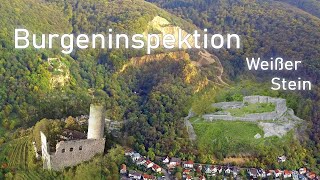
Der erste Trail der Steinbrecher-Trails.
Flowig und nicht allzu steil geht es vom Weißen Stier hier hinunter, mit ein paar kleineren und auch ein paar größeren Sprünge, wobei diese abrollbar oder umfahrbar sind. Ein paar Kompressionen kann man auch als Steilkurven mitnehmen.

Local Trail Association

Recent Activity on Trail

Past Week
  • 0 rides
  •  
6 Months
  • 71 rides
  • 20 miles avg distance
All
  • 386 rides
  • Last: Jun 14, 2026
c1c2c3c4
January
February
March
April
May
June
July
August
September
October
November
December
Status:
on Apr 22, 2026
Dry
Avg: 4.45 (6 votes)
Your vote: 0

view (2,846)
close
3D
Trail Conditions
  • Unknown
  • Snow Groomed
  • Snow Packed
  • Snow Covered
  • Snow Cover Partial
  • Freeze/thaw Cycle
  • Icy
  • Prevalent Mud
  • Wet
  • Variable
  • Ideal
  • Dry
  • Very Dry
Trail Flow (Ridden Direction)
Trailforks scans users ridelogs to determine the most popular direction each trail is ridden. A good flowing trail network will have most trails flowing in a single direction according to their intension.
The colour categories are based on what percentage of riders are riding a trail in its intended direction.
  • > 96%
  • > 90%
  • > 80%
  • > 70%
  • > 50%
  • < 50%
  • bi-directional trail
  • no data
Trail Last Ridden
Trailforks scans ridelogs to determine the last time a trail was ridden.
  • < 2 days
  • < 1 week
  • < 2 weeks
  • < 1 month
  • < 6 months
  • > 6 months
Trail Ridden Direction
The intended direction a trail should be ridden.
  • Downhill Only
  • Downhill Primary
  • Both Directions
  • Uphill Primary
  • Uphill Only
  • One Direction
Contribute Details
Colors indicate trail is missing specified detail.
  • Description
  • Photos
  • Description & Photos
  • Videos
Trail Popularity ?
Trailforks scans ridelogs to determine which trails are ridden the most in the last 9 months. Trails are compared with nearby trails in the same city region with a possible 25 colour shades. Think of this as a heatmap, more rides = more kinetic energy = warmer colors.
  • most popular
  • popular
  • less popular
  • not popular
ATV/ORV/OHV Filter
Max Vehicle Width
inches
US Cell Coverage
Legend
cell carrier legend

Radar Time
Activity Recordings
Trailforks uses anonymized public activity data. ?
Activity Recordings
Trailforks uses anonymized public activity data. ?
Personal Heatmap
Activity Types
all / none
Options
2
Date range month
Winter Trails
Warning A routing network for winter maps does not exist. Selecting trails using the winter trails layer has been disabled.
Missing Trails
Most Popular
Least Popular
Trails are colored based on popularity. The more popular a trail is, the more red. Less popular trails trend towards green.
Jump Magnitude Heatmap
Heatmap of where riders jump on trails. Zoom in to see individual jumps, click circles to view jump details.
BC Backroad Status

Service Road Atlas is a free to use, community-driven service for viewing and creating reports on the numerous back-country service roads around B.C. and Alberta.

map legend
Slope Aspect
Direction the slope faces
Flat N NE E SE S SW W NW
Trails Deemphasized
Trails are shown in grey.
disable
Only show trails with no bike usage.
Enable
Suggested Layers
Based on selected activity type

    Save the current map location and zoom level as your default home location whenever this page is loaded.

    Save
        Directions to weiszer-stein-trail trailhead (49.453210, 8.722860)

        Photos

        5 more »
        58 |
        Jun 15, 2025 @ 11:59pm
        Jun 15, 2025
        116 |
        May 7, 2024 @ 5:47am
        May 7, 2024
        115 |
        May 7, 2024 @ 5:47am
        May 7, 2024
        129 |
        May 7, 2024 @ 5:47am
        May 7, 2024

        Videos

        8 more »
        youtuber Let's Ride MTB - Heidelberg // Weißer Stein -...
        12:22 | 287 | Nov 27, 2022 , Dossenheim
        youtuber Steinbrecher Trails und noch mehr //...
        12:48 | 39 | Apr 26, 2026 , Dossenheim
        Steinbrecher Trail Red Line Neue Legale MTB...
        13:28 | 146 | Aug 11, 2024 , Dossenheim
        youtuber Let's Ride MTB - Steinbrecher Trails -...
        13:00 | 227 | Apr 20, 2024 , Dossenheim

        Routes with this trail

        5.0 4 miles 577 ft 7 Point to Point
        Startpunkt ist am Weißen Stein, wo man das erste Stück Gelbe X mitnimmt (bzw. den alternativen Einstieg)...
        5.0 3 miles 142 ft 7 Point to Point
        Am Weißen Stein startend fährt man erst mal das Gelbe X hinunter. An dessen Ende geht es erstmal flach...
        5.0 12 miles 2,097 ft 9 Loop
        Der Start ist am , von wo aus man in Richtung fährt. Hat man diesen passiert, findet sich links dann der...

        Reviews / Comments

        No reviews yet, be the first to write a review or ask a question.
        Use trail reports to comment on trail conditions.


        We hope you've been enjoying Trailforks!

        Create a FREE account to view trail comments and much more.

        • By sp00n82TF Pro HDRiders & contributors
        • #162486 - 2,471 views

        Frequently Asked Questions About Weißer Stein Trail

        Where is Weißer Stein Trail located?
        Weißer Stein Trail is located in Dossenheim, Germany. It is part of the Dossenheim trail network. The trailhead is located at coordinates 49.45321, 8.72286.
        How hard is Weißer Stein Trail?
        Weißer Stein Trail is rated as Blue difficulty. The physical rating is Moderate. The average grade is 7.9%.
        What is the elevation gain for Weißer Stein Trail?
        The trail has 48 m of elevation descent. The elevation ranges from 509 m to 558 m.
        Is Weißer Stein Trail a point to point trail?
        Yes, Weißer Stein Trail is a point to point trail. The direction is Downhill Only. The trail type is singletrack.

        Hit the Trail

        Open in App

        Get this trail on your phone instantly.
        open trail in app

        Download Trail

        Save to wishlist, Garmin & download.
        save the trail

        Find Related Routes

        Find routes and users activities that include this trail.
        find routes for this trail

        You must enter a description before submitting.