more stats
4,229 ft
Distance
-503 ft
Descent
00:10:17
Avg time
-503 ft
Altitude change
3,079 ft
Altitude min
3,583 ft
Altitude max
3,583 ft
Altitude start
3,081 ft
Altitude end
-11.9%
Grade
-56.6%
Grade max
2.3%
Grade min
56 ft
Distance climb
4,045 ft
Distance down
128 ft
Distance flat
00:10:17
Avg time

Wet Dream Details

  • Activities
    • Mountain Bike
    • Hike
    • Trail Running
  • Riding Area
    Whitewater Gravity Trails
    Nelson, British Columbia
  • Difficulty Rating
  • Local Popularity
    30 in Mountain Biking [+]
    • 5 in Trail Running
    • 5 in Hiking
  • Global Ranking
    #104836 in Mountain Biking [+]
    • #295634 in Trail Running
    • #307016 in Hiking
  • Trail Type
    Singletrack
  • Bike Type
    DH, AM, XC
  • Direction
    Downhill Only
    Popular Direction Shown
  • Physical Rating
    Moderate
  • Season
    May-Oct
  • Dogs Allowed
    Yes
  • TTFs on Trail
    Berm, Bridge, Drop, Jump, Ladder Bridge, Log Ride, Rock Garden, Skinny

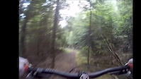
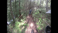
Short but sweet hand built trail through old growth cedar forest alongside Apex Creek. Several action-packed sections interconnected by smooth pedaling singletrack.

Trail Supporters
Local Trail Association

Recent Activity on Trail

Past Week
  • 0 rides
  •  
6 Months
  • 0 rides
  •  
All
  • 25 rides
  • Last: Sep 18, 2025
c1c2c3c4
January
February
March
April
May
June
July
August
September
October
November
December
update trails status or condition

Wet Dream Trail Reports

statusdatedescription
Jun 15, 2026 @ 2:51pm (America/Vancouver)
Jun 15, 2026
reporter RDCK closure of the rail trail has now ended. Trails are open again, condition is unknown. Bears are likely still present in this area, ride aware...
May 6, 2026 @ 9:14pm (America/Vancouver)
May 6, 2026
reporter The RDCK has closed the rail trail between Cottonwood Lake and Hall Siding due to bear activity. As a result, Secret Stash and Wet Dreams are also...
Sep 18, 2025 @ 9:58am (America/Vancouver)
Sep 18, 2025
reporter Re opened. Trail condition unknown.
Aug 19, 2025 @ 8:31am
Aug 19, 2025
reporter Please avoid these trails until September 1st, while the toadlet migration uses Wet Dreams, Secret Stash and the lower Clearwater FSR.
Jul 6, 2025 @ 10:26am
Jul 6, 2025
couple trees down on the trail, needs a power saw to clear. would stay away until this work gets done. still rideable but fucks the flow
more » 2 social media mentions
Status:
on Jun 15, 2026
Avg: 4.53 (7 votes)
Your vote: 0

view (217)
close
3D
Trail Conditions
  • Unknown
  • Snow Groomed
  • Snow Packed
  • Snow Covered
  • Snow Cover Partial
  • Freeze/thaw Cycle
  • Icy
  • Prevalent Mud
  • Wet
  • Variable
  • Ideal
  • Dry
  • Very Dry
Trail Flow (Ridden Direction)
Trailforks scans users ridelogs to determine the most popular direction each trail is ridden. A good flowing trail network will have most trails flowing in a single direction according to their intension.
The colour categories are based on what percentage of riders are riding a trail in its intended direction.
  • > 96%
  • > 90%
  • > 80%
  • > 70%
  • > 50%
  • < 50%
  • bi-directional trail
  • no data
Trail Last Ridden
Trailforks scans ridelogs to determine the last time a trail was ridden.
  • < 2 days
  • < 1 week
  • < 2 weeks
  • < 1 month
  • < 6 months
  • > 6 months
Trail Ridden Direction
The intended direction a trail should be ridden.
  • Downhill Only
  • Downhill Primary
  • Both Directions
  • Uphill Primary
  • Uphill Only
  • One Direction
Contribute Details
Colors indicate trail is missing specified detail.
  • Description
  • Photos
  • Description & Photos
  • Videos
Trail Popularity ?
Trailforks scans ridelogs to determine which trails are ridden the most in the last 9 months. Trails are compared with nearby trails in the same city region with a possible 25 colour shades. Think of this as a heatmap, more rides = more kinetic energy = warmer colors.
  • most popular
  • popular
  • less popular
  • not popular
ATV/ORV/OHV Filter
Max Vehicle Width
inches
US Cell Coverage
Legend
cell carrier legend

Radar Time
Activity Recordings
Trailforks uses anonymized public activity data. ?
Activity Recordings
Trailforks uses anonymized public activity data. ?
Personal Heatmap
Activity Types
all / none
Options
2
Date range month
Winter Trails
Warning A routing network for winter maps does not exist. Selecting trails using the winter trails layer has been disabled.
Missing Trails
Most Popular
Least Popular
Trails are colored based on popularity. The more popular a trail is, the more red. Less popular trails trend towards green.
Jump Magnitude Heatmap
Heatmap of where riders jump on trails. Zoom in to see individual jumps, click circles to view jump details.
BC Backroad Status

Service Road Atlas is a free to use, community-driven service for viewing and creating reports on the numerous back-country service roads around B.C. and Alberta.

map legend
Slope Aspect
Direction the slope faces
Flat N NE E SE S SW W NW
Trails Deemphasized
Trails are shown in grey.
disable
Only show trails with no bike usage.
Enable
Suggested Layers
Based on selected activity type

    Save the current map location and zoom level as your default home location whenever this page is loaded.

    Save
        Directions to wet-dream trailhead (49.408250, -117.191210)

        Photos

        89 more »
        57 |
        Jul 2, 2024 @ 3:34pm
        Jul 2, 2024
        46 |
        Jul 2, 2024 @ 3:34pm
        Jul 2, 2024
        76 |
        Oct 14, 2022 @ 5:26pm
        Oct 14, 2022
        67 |
        Oct 14, 2022 @ 2:53pm
        Oct 14, 2022

        Videos

        5 more »
        Nelson BC - Wet Dream
        5:54 | 1282 | Jul 11, 2018 , Nelson
        Mountain Biking - Wet Dreams - Nelson,BC 7/16/2013
        1018 | Sep 26, 2016 , Nelson
        Wetdream
        4:03 | 376 | Jul 12, 2016 , Nelson
        Bike takes a ride in class 5 rapids
        0:46 | 133753 | Jul 4, 2011 , Nelson

        Routes with this trail

        5.0 48 miles 10,380 ft 19 Loop
        Strava ended up being ~82km, and 3300m elevation. Completed Oct 1st, 2022. Started 6am, not enough light...

        2 Reviews & Comments


        We hope you've been enjoying Trailforks!

        Create a FREE account to view trail comments and much more.

        • By slabloverTF Pro & contributors
        • #32150 - 5,869 views

        Frequently Asked Questions About Wet Dream

        Where is Wet Dream located?
        Wet Dream is located in Whitewater Gravity Trails, Nelson, British Columbia, Canada. It is part of the Whitewater Gravity Trails trail network. The trailhead is located at coordinates 49.40825, -117.19121.
        How hard is Wet Dream?
        Wet Dream is rated as Black Diamond difficulty. The physical rating is Moderate. The average grade is 11.9%.
        What is the elevation gain for Wet Dream?
        The trail has 503 ft of elevation descent. The elevation ranges from 3,079 ft to 3,583 ft.
        Is Wet Dream a point to point trail?
        Yes, Wet Dream is a point to point trail. The direction is Downhill Only. The trail type is singletrack.

        Hit the Trail

        Open in App

        Get this trail on your phone instantly.
        open trail in app

        Download Trail

        Save to wishlist, Garmin & download.
        save the trail

        Find Related Routes

        Find routes and users activities that include this trail.
        find routes for this trail

        You must enter a description before submitting.