more stats
1.3 miles
Distance
13 ft
Climb
-858 ft
Descent
00:14:46
Avg time
-847 ft
Altitude change
2,957 ft
Altitude min
3,805 ft
Altitude max
3,804 ft
Altitude start
2,956 ft
Altitude end
-12.3%
Grade
-62.4%
Grade max
6.7%
Grade min
453 ft
Distance climb
1 mile
Distance down
92 ft
Distance flat
00:14:46
Avg time

Whiskey Details

  • Activities
    • Mountain Bike
    • E-Bike
  • Riding Area
    Malde Creek
    Rossland, British Columbia
  • Difficulty Rating
  • Voted Difficulty
    Blue (4 votes)
  • Local Popularity
    90 in Mountain Biking [+]
    • 95 in E-Biking
  • Global Ranking
    #22797 in Mountain Biking [+]
    • #17420 in E-Biking
  • Trail Type
    Singletrack
  • Bike Type
    DH, AM
  • Direction
    Downhill Only
    Popular Direction Shown
  • Climb Difficulty
    Blue
  • Physical Rating
    Moderate
  • Trail Visibility
    Always easy to follow
  • Season
    June - Oct
  • Dogs Allowed
    Yes
  • eBike Allowed
    Yes up to Class 1
  • TTFs on Trail
    Bridge, Drop, Jump, Rock Face, Roller Coaster, Skinny
  • OSM Way

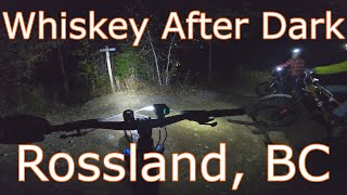
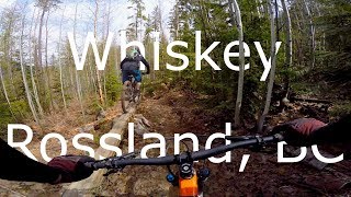
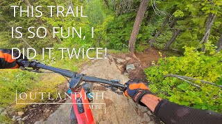
The Whiskey trail has seen many changes over the years, and in it’s current incarnation exhibits a mixed personality.

Whiskey is a Rossland classic and is a very popular trail within the network and certainly the most popular in the Malde Creek area. The upper section of the trail is technically challenging with rock slabs, stump stunts and optional jumps. Choose your own adventure as there are multiple lines available each with varying levels of difficulty and exposure. The lower section hosts mostly fast, sinuous single-track, peppered with stunts and jumps and the occasional bridge and which empties onto the Railgrade for a quick ride back to town or parked vehicle.

Access Info

On the drive from Rossland, watch for the parking area on the Railgrade, just off Gelez Rd, about 500m past Drakes Rd
intersection. Leave a vehicle at the Malde Creek Parking Lot if shuttling or park and hop on your bike Ride (it’s about a 45 min climb) or drive to the top of Malde Creek Rd, a rough gravel road. After four switchbacks, turn onto Birch Main [gated]. Ride along Birch Main 750m and the Whiskey trailhead is on your right.

If you prefer a singletrack and CLASSIC Rossland climb: ride up Malde Creek FSR for 950m, turn right on Doukhobor Draw Access, turn left onto Doukhobor Draw and connect to Tamarack. Ride up Tamarack until it connects to Malde Creek FSR. Turn left and ride down Malde Creek FSR until you see the Birch Main Gate. Turn right at Birch Main and ride 750m to the Whiskey trailhead.

Local Trail Association

Recent Activity on Trail

Past Week
  • 4 rides
  • 9.9 km average
6 Months
  • 39 rides
  • 12.5 km avg distance
All
  • 519 rides
  • Last: Jun 23, 2026
c1c2c3c4
January
February
March
April
May
June
July
August
September
October
November
December
update trails status or condition

Whiskey Trail Reports

statusdatedescription
May 23, 2026 @ 10:17am (America/Vancouver)
May 23, 2026
reporter The KCTS trail crew completed repairs to the landing of the Whiskey Drop.
May 1, 2026 @ 7:54am (America/Vancouver)
May 1, 2026
reporter The KCTS trail crew completed seasonal inspection and maintenance.
Apr 24, 2026 @ 12:36pm (America/Vancouver)
Apr 24, 2026
There is a low hanging fallen tree above the trail in the lower section (after the trail cuts through Tiger Main). The tree is hanging above a...
Apr 24, 2026 @ 12:31pm (America/Vancouver)
Apr 24, 2026
Apr 23, 2026 @ 5:32pm (America/Vancouver)
Apr 23, 2026
The tree in upper section now removed
more »
Status:
on May 23, 2026
Ideal
Avg: 4.54 (36 votes)
Your vote: 0

view (4,421)
close
3D
Trail Conditions
  • Unknown
  • Snow Groomed
  • Snow Packed
  • Snow Covered
  • Snow Cover Partial
  • Freeze/thaw Cycle
  • Icy
  • Prevalent Mud
  • Wet
  • Variable
  • Ideal
  • Dry
  • Very Dry
Trail Flow (Ridden Direction)
Trailforks scans users ridelogs to determine the most popular direction each trail is ridden. A good flowing trail network will have most trails flowing in a single direction according to their intension.
The colour categories are based on what percentage of riders are riding a trail in its intended direction.
  • > 96%
  • > 90%
  • > 80%
  • > 70%
  • > 50%
  • < 50%
  • bi-directional trail
  • no data
Trail Last Ridden
Trailforks scans ridelogs to determine the last time a trail was ridden.
  • < 2 days
  • < 1 week
  • < 2 weeks
  • < 1 month
  • < 6 months
  • > 6 months
Trail Ridden Direction
The intended direction a trail should be ridden.
  • Downhill Only
  • Downhill Primary
  • Both Directions
  • Uphill Primary
  • Uphill Only
  • One Direction
Contribute Details
Colors indicate trail is missing specified detail.
  • Description
  • Photos
  • Description & Photos
  • Videos
Trail Popularity ?
Trailforks scans ridelogs to determine which trails are ridden the most in the last 9 months. Trails are compared with nearby trails in the same city region with a possible 25 colour shades. Think of this as a heatmap, more rides = more kinetic energy = warmer colors.
  • most popular
  • popular
  • less popular
  • not popular
ATV/ORV/OHV Filter
Max Vehicle Width
inches
US Cell Coverage
Legend
cell carrier legend

Radar Time
Activity Recordings
Trailforks uses anonymized public activity data. ?
Activity Recordings
Trailforks uses anonymized public activity data. ?
Personal Heatmap
Activity Types
all / none
Options
2
Date range month
Winter Trails
Warning A routing network for winter maps does not exist. Selecting trails using the winter trails layer has been disabled.
Missing Trails
Most Popular
Least Popular
Trails are colored based on popularity. The more popular a trail is, the more red. Less popular trails trend towards green.
Jump Magnitude Heatmap
Heatmap of where riders jump on trails. Zoom in to see individual jumps, click circles to view jump details.
BC Backroad Status

Service Road Atlas is a free to use, community-driven service for viewing and creating reports on the numerous back-country service roads around B.C. and Alberta.

map legend
Slope Aspect
Direction the slope faces
Flat N NE E SE S SW W NW
Trails Deemphasized
Trails are shown in grey.
disable
Only show trails with no bike usage.
Enable
Suggested Layers
Based on selected activity type

    Save the current map location and zoom level as your default home location whenever this page is loaded.

    Save
        Directions to whiskey trailhead (49.044220, -117.789800)

        Photos

        50 more »
        243 |
        Jul 22, 2022 @ 8:19am
        Jul 22, 2022
        216 |
        Jul 22, 2022 @ 8:19am
        Jul 22, 2022
        217 |
        Jun 30, 2022 @ 8:40pm
        Jun 30, 2022
        328 |
        Jan 3, 2021 @ 3:56am
        Jan 3, 2021

        Videos

        9 more »
        youtuber WHISKEY: Rossland: Trail Review
        11:25 | 747 | Jun 29, 2022 , Rossland
        youtuber Whiskey After Dark - Rossland, BC
        8:37 | 434 | Oct 16, 2020 , Rossland
        youtuber Whiskey - Rossland, BC
        7:13 | 1144 | Apr 29, 2019 , Rossland
        A super fun trail, don't miss it!
        7:08 | 181 | Nov 4, 2024 , Rossland

        Routes with this trail

        5.0 38 miles 7,280 ft 28 Loop
        A long ride, almost all singletrack. Redtop up and down, Caldera, Eddie J, lower Mongoose, KC, Techno...
        4.0 11 miles 1,993 ft 12 Loop
        A great "BCXC" type of ride. The climbing trail has plenty of descents,until you get to . Then it's a...
        2 miles 140 ft 3 Shuttled
        To shuttle , park at the start of on . Ride up 800m until you hit the / on the Rocks junction. Drop left...

        3 Reviews & Comments


        We hope you've been enjoying Trailforks!

        Create a FREE account to view trail comments and much more.

        • By canadakaTF Pro Trailforks & contributors
        • #2147 - 13,805 views

        Frequently Asked Questions About Whiskey

        Where is Whiskey located?
        Whiskey is located in Malde Creek, Rossland, British Columbia, Canada. It is part of the Malde Creek trail network. The trailhead is located at coordinates 49.04422, -117.7898.
        How hard is Whiskey?
        Whiskey is rated as Black Diamond difficulty. The physical rating is Moderate. The average grade is 12.3%. The climb difficulty is rated Blue.
        What is the elevation gain for Whiskey?
        Whiskey has 13 ft of elevation gain. The trail has 858 ft of elevation descent. The elevation ranges from 2,957 ft to 3,805 ft.
        Is Whiskey a point to point trail?
        Yes, Whiskey is a point to point trail. The direction is Downhill Only. The trail type is singletrack.

        Hit the Trail

        Open in App

        Get this trail on your phone instantly.
        open trail in app

        Download Trail

        Save to wishlist, Garmin & download.
        save the trail

        Find Related Routes

        Find routes and users activities that include this trail.
        find routes for this trail

        You must enter a description before submitting.