



Open in App
Get this trail on your phone instantly.

1% of the downhill riders are giving 100% of the MTB community a bad name. PLEASE be nice. PLEASE slow down and leave lots of room when you approach another trail user. Remember, nobody cares about your Strava time. Chillax and ride nice. Please pass the word. Thanks.
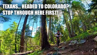
A lot of people ride this as a shuttled decent, but it also makes for a good up and down ride. Keep in mind it is multi-use with lots of hikers and bikers going in both directions. Hikers have the right of way. Uphill bikers have right of way.
If you want to ride up (like a badass) there are several parking areas on the end of the road, just make note of the signs. If parking is full, you could park down at the Tesuque Village Market a couple of miles away.
Park, and head up the road to the trail head, you cant miss it. Bike uphill for 9.25 miles. Take it easy down low, it will get a lot harder as you go. There used to be 17 wet stream crossings, however, in 2023 Santa Fe Fat Tire Society completed a project to put in 12 bridges and eliminate 5 crossings by building new trail without stream crossings. Gone are the days of wet feet and wet bottom bracket bearings in the spring.
If you shuttle, you can take the free "Blue Bus" (https://www.ncrtd.org/255-mountain-trail-route/) that has bike racks or drive up towards Ski Sante Fe and park just before the base area on the left. You begin descending a fairly fast and technical section before crossing forest road FS 102. After the road crossing, the trail becomes less technical and faster. You'll come to several trail junctions on the way down, just follow Winsor signs.
Lower down, the trail crosses back and forth over Tesuque Creek several times before dumping out onto a private dirt road. The trail continues in and out of the road before ending on the pavement.

| c1 | c2 | c3 | c4 |
|---|---|---|---|
January | February | March | April |
May | June | July | August |
September | October | November | December |


Service Road Atlas is a free to use, community-driven service for viewing and creating reports on the numerous back-country service roads around B.C. and Alberta.
Save the current map location and zoom level as your default home location whenever this page is loaded.
SaveWe hope you've been enjoying Trailforks!
Create a FREE account to view trail comments and much more.
 & contributors
You must enter a description before submitting.

