more stats
1,306 ft
Distance
-151 ft
Descent
00:01:40
Avg time
-151 ft
Altitude change
487 ft
Altitude min
637 ft
Altitude max
637 ft
Altitude start
486 ft
Altitude end
-11.5%
Grade
-27.2%
Grade max
-4.4%
Grade min
1,306 ft
Distance down
00:01:40
Avg time

Wishbone Details

  • Activities
    • Mountain Bike
  • Riding Area
    Lord Hill Regional Park
    Snohomish, Washington
  • Difficulty Rating
  • Voted Difficulty
    Black Diamond (4 votes)
  • Local Popularity
    85 in Mountain Biking
  • Global Ranking
    #33943 in Mountain Biking
  • Trail Type
    Singletrack
  • Bike Type
    AM, XC
  • Direction
    Downhill Only
    Popular Direction Shown
  • Climb Difficulty
    Blue
  • Physical Rating
    Moderate
  • Season
    All Year
  • Dogs Allowed
    Yes
  • eBike Allowed
  • TTFs on Trail
    Berm, Jump
  • Ride in Rain
    Yes
  • Land Owner
    Snohomish County Parks & Recreation

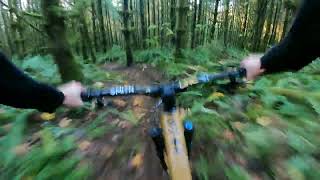
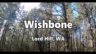
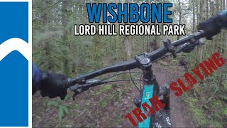
One of the best downhill trails at LH. Wonderfully flowing and steep single track. Trust your line on the berms and carry your speed Entrance starts on top of the big rock garden, sharing the start to Golden Eye. Starting on top of the rock garden is necessary if you want to clear the first two jumps! (just watch out for people pedaling in from pipeline.

Access Info

Ride it east to west.

Local Trail Association
Traditionally Indigenous Territory

Recent Activity on Trail

Past Week
  • 15 rides
  • 9 miles average
6 Months
  • 246 rides
  • 8 miles avg distance
All
  • 1,919 rides
  • Last: Jun 23, 2026
c1c2c3c4
January
February
March
April
May
June
July
August
September
October
November
December
update trails status or condition

Wishbone Trail Reports

statusdatedescription
Jun 21, 2026 @ 8:05am (America/Vancouver)
Jun 21, 2026
[L=https://www.evergreenmtb.org/trails/ride-reports/rr-9656]Evergreen MTB Report[/L]
Jun 2, 2026 @ 8:25am (America/Vancouver)
Jun 2, 2026
Running great. [L=https://www.evergreenmtb.org/trails/ride-reports/rr-9626]Evergreen MTB Report[/L]
May 19, 2026 @ 9:15am (America/Los_Angeles)
May 19, 2026
Brushed, raked, and patched up the catch berm at the first chute. Ty Chauncy & Eric!
Apr 25, 2026 @ 1:49pm (America/Vancouver)
Apr 25, 2026
Apr 17, 2026 @ 1:42pm (America/Vancouver)
Apr 17, 2026
[L=https://www.evergreenmtb.org/trails/ride-reports/rr-9557]Evergreen MTB Report[/L]
more »
Status:
on Jun 21, 2026
Ideal
Avg: 4.54 (21 votes)
Your vote: 0

view (7,033)
close
3D
Trail Conditions
  • Unknown
  • Snow Groomed
  • Snow Packed
  • Snow Covered
  • Snow Cover Partial
  • Freeze/thaw Cycle
  • Icy
  • Prevalent Mud
  • Wet
  • Variable
  • Ideal
  • Dry
  • Very Dry
Trail Flow (Ridden Direction)
Trailforks scans users ridelogs to determine the most popular direction each trail is ridden. A good flowing trail network will have most trails flowing in a single direction according to their intension.
The colour categories are based on what percentage of riders are riding a trail in its intended direction.
  • > 96%
  • > 90%
  • > 80%
  • > 70%
  • > 50%
  • < 50%
  • bi-directional trail
  • no data
Trail Last Ridden
Trailforks scans ridelogs to determine the last time a trail was ridden.
  • < 2 days
  • < 1 week
  • < 2 weeks
  • < 1 month
  • < 6 months
  • > 6 months
Trail Ridden Direction
The intended direction a trail should be ridden.
  • Downhill Only
  • Downhill Primary
  • Both Directions
  • Uphill Primary
  • Uphill Only
  • One Direction
Contribute Details
Colors indicate trail is missing specified detail.
  • Description
  • Photos
  • Description & Photos
  • Videos
Trail Popularity ?
Trailforks scans ridelogs to determine which trails are ridden the most in the last 9 months. Trails are compared with nearby trails in the same city region with a possible 25 colour shades. Think of this as a heatmap, more rides = more kinetic energy = warmer colors.
  • most popular
  • popular
  • less popular
  • not popular
ATV/ORV/OHV Filter
Max Vehicle Width
inches
US Cell Coverage
Legend
cell carrier legend

Radar Time
Activity Recordings
Trailforks uses anonymized public activity data. ?
Activity Recordings
Trailforks uses anonymized public activity data. ?
Personal Heatmap
Activity Types
all / none
Options
2
Date range month
Winter Trails
Warning A routing network for winter maps does not exist. Selecting trails using the winter trails layer has been disabled.
Missing Trails
Most Popular
Least Popular
Trails are colored based on popularity. The more popular a trail is, the more red. Less popular trails trend towards green.
Jump Magnitude Heatmap
Heatmap of where riders jump on trails. Zoom in to see individual jumps, click circles to view jump details.
BC Backroad Status

Service Road Atlas is a free to use, community-driven service for viewing and creating reports on the numerous back-country service roads around B.C. and Alberta.

map legend
Slope Aspect
Direction the slope faces
Flat N NE E SE S SW W NW
Trails Deemphasized
Trails are shown in grey.
disable
Only show trails with no bike usage.
Enable
Suggested Layers
Based on selected activity type

    Save the current map location and zoom level as your default home location whenever this page is loaded.

    Save
        Directions to wishbone trailhead (47.850040, -122.048570)

        Photos

        12 more »
        126 |
        Mar 18, 2023 @ 3:46pm
        Mar 18, 2023
        360 |
        Apr 3, 2021 @ 9:05am
        Apr 3, 2021
        302 |
        Apr 3, 2021 @ 9:05am
        Apr 3, 2021
        252 |
        Oct 25, 2018 @ 10:47am
        Oct 25, 2018

        Videos

        3 more »
        Lord Hill - Wishbone
        0:22 | 324 | Nov 9, 2022 , Snohomish
        Wishbone | Mountain Bike Lord Hill, WA
        2:42 | 302 | Apr 21, 2022 , Snohomish
        Lord Hill Regional Park - Wishbone MTB
        0:18 | 427 | Feb 8, 2022 , Snohomish

        Routes with this trail

        10 miles 1,380 ft 19
        This route combines both downhill and XC trails to create the 3 longest downhill runs in the park. Expect...
        3.0 8 miles 1,392 ft 20
        This takes the easiest climb from the park's south entrance to access the core mountain bike trails. The...
        8 miles 1,033 ft 20
        Focusing on downhill trails. Upper and , Meat Cutter, Golden Eye, , .

        6 Reviews & Comments


        We hope you've been enjoying Trailforks!

        Create a FREE account to view trail comments and much more.

        Frequently Asked Questions About Wishbone

        Where is Wishbone located?
        Wishbone is located in Lord Hill Regional Park, Snohomish, Washington, United States. It is part of the Lord Hill Regional Park trail network. The trailhead is located at coordinates 47.85004, -122.04857.
        How hard is Wishbone?
        Wishbone is rated as Blue difficulty. The physical rating is Moderate. The average grade is 11.5%. The climb difficulty is rated Blue.
        What is the elevation gain for Wishbone?
        The trail has 151 ft of elevation descent. The elevation ranges from 487 ft to 637 ft.
        Is Wishbone a point to point trail?
        Yes, Wishbone is a point to point trail. The direction is Downhill Only. The trail type is singletrack.

        Hit the Trail

        Open in App

        Get this trail on your phone instantly.
        open trail in app

        Download Trail

        Save to wishlist, Garmin & download.
        save the trail

        Find Related Routes

        Find routes and users activities that include this trail.
        find routes for this trail

        You must enter a description before submitting.