more stats
1.9 miles
Distance
29 ft
Climb
-790 ft
Descent
00:11:17
Avg time
-762 ft
Altitude change
7,029 ft
Altitude min
7,790 ft
Altitude max
7,790 ft
Altitude start
7,028 ft
Altitude end
-7.4%
Grade
-35.9%
Grade max
20.5%
Grade min
328 ft
Distance climb
2 miles
Distance down
00:11:17
Avg time

Worlds Greatest Details

  • Activities
    • Mountain Bike
    • Hike
    • Trail Running
  • Riding Area
    West Eagle
    Eagle, Colorado
  • Difficulty Rating
  • Local Popularity
    80 in Mountain Biking [+]
    • 5 in Trail Running
    • 5 in Hiking
  • Global Ranking
    #58107 in Mountain Biking [+]
    • #277837 in Trail Running
    • #293838 in Hiking
  • Trail Type
    Singletrack
  • Direction
    Downhill Primary
    Popular Direction Shown
  • Dogs Allowed
    Yes

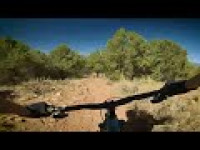
A super fun, fast descent. Expect more rock and chunk compared to most of the trails in Eagle.

*Closed to bikes Dec 1 - Apr 15 each year to protect deer/elk populations

Trail Supporters
  • BLM
    BLM
    Land Manager
Local Trail Association
Traditionally Indigenous Territory

Recent Activity on Trail

Past Week
  • 0 rides
  •  
6 Months
  • 13 rides
  • 13 miles avg distance
All
  • 139 rides
  • Last: Jun 23, 2026
c1c2c3c4
January
February
March
April
May
June
July
August
September
October
November
December
update trails status or condition

Worlds Greatest Trail Reports

statusdatedescription
May 16, 2026 @ 2:19pm (America/Denver)
May 16, 2026
Apr 16, 2026 @ 12:03am (America/Los_Angeles)
Apr 16, 2026
Dec 1, 2025 @ 1:00am (America/Denver)
Dec 1, 2025
reporter This trail is closed seasonally to all users from 12/1 thru 4/15 to protect deer and elk habitat.
Oct 25, 2025 @ 11:28am (America/Denver)
Oct 25, 2025
reporter
Jun 15, 2025 @ 11:12am
Jun 15, 2025
Super dusty. Ruts are really rutting today.
more »
Status:
on May 16, 2026
Dry
Avg: 4.28 (10 votes)
Your vote: 0

view (1,448)
close
3D
Trail Conditions
  • Unknown
  • Snow Groomed
  • Snow Packed
  • Snow Covered
  • Snow Cover Partial
  • Freeze/thaw Cycle
  • Icy
  • Prevalent Mud
  • Wet
  • Variable
  • Ideal
  • Dry
  • Very Dry
Trail Flow (Ridden Direction)
Trailforks scans users ridelogs to determine the most popular direction each trail is ridden. A good flowing trail network will have most trails flowing in a single direction according to their intension.
The colour categories are based on what percentage of riders are riding a trail in its intended direction.
  • > 96%
  • > 90%
  • > 80%
  • > 70%
  • > 50%
  • < 50%
  • bi-directional trail
  • no data
Trail Last Ridden
Trailforks scans ridelogs to determine the last time a trail was ridden.
  • < 2 days
  • < 1 week
  • < 2 weeks
  • < 1 month
  • < 6 months
  • > 6 months
Trail Ridden Direction
The intended direction a trail should be ridden.
  • Downhill Only
  • Downhill Primary
  • Both Directions
  • Uphill Primary
  • Uphill Only
  • One Direction
Contribute Details
Colors indicate trail is missing specified detail.
  • Description
  • Photos
  • Description & Photos
  • Videos
Trail Popularity ?
Trailforks scans ridelogs to determine which trails are ridden the most in the last 9 months. Trails are compared with nearby trails in the same city region with a possible 25 colour shades. Think of this as a heatmap, more rides = more kinetic energy = warmer colors.
  • most popular
  • popular
  • less popular
  • not popular
ATV/ORV/OHV Filter
Max Vehicle Width
inches
US Cell Coverage
Legend
cell carrier legend

Radar Time
Activity Recordings
Trailforks uses anonymized public activity data. ?
Activity Recordings
Trailforks uses anonymized public activity data. ?
Personal Heatmap
Activity Types
all / none
Options
2
Date range month
Winter Trails
Warning A routing network for winter maps does not exist. Selecting trails using the winter trails layer has been disabled.
Missing Trails
Most Popular
Least Popular
Trails are colored based on popularity. The more popular a trail is, the more red. Less popular trails trend towards green.
Jump Magnitude Heatmap
Heatmap of where riders jump on trails. Zoom in to see individual jumps, click circles to view jump details.
BC Backroad Status

Service Road Atlas is a free to use, community-driven service for viewing and creating reports on the numerous back-country service roads around B.C. and Alberta.

map legend
Slope Aspect
Direction the slope faces
Flat N NE E SE S SW W NW
Trails Deemphasized
Trails are shown in grey.
disable
Only show trails with no bike usage.
Enable
Suggested Layers
Based on selected activity type

    Save the current map location and zoom level as your default home location whenever this page is loaded.

    Save
        Directions to worlds-greatest trailhead (39.604280, -106.848540)

        Photos

        6 more »
        81 |
        Aug 5, 2023 @ 1:34pm
        Aug 5, 2023
        227 |
        Apr 27, 2019 @ 9:26pm
        Apr 27, 2019
        270 |
        Mar 20, 2019 @ 10:32am
        Mar 20, 2019
        263 |
        Oct 14, 2017 @ 7:32pm
        Oct 14, 2017

        Videos

        3 more »
        Eagle Empanada Downhill
        7:52 | 122 | Aug 5, 2024 , Eagle
        Bold Claims: World's Greatest | Eagle, Colorado
        8:48 | 615 | Jun 4, 2020 , Eagle
        Crash on World's Greatest Trail
        0:48 | 104 | Sep 30, 2021 , Eagle

        Routes with this trail

        5.0 9 miles 1,422 ft 7 Point to Point
        Start/End trailhead off of Abrams Road and Lone Spur Cul-de-sac. to & , then back down
        5.0 9 miles 1,934 ft 9
        A good tour of West Eagle.
        26 miles 3,769 ft 16
        Seagulls Annual Full Send Route

        3 Reviews & Comments


        We hope you've been enjoying Trailforks!

        Create a FREE account to view trail comments and much more.

        • By toddTF Pro Trailforks & contributors
        • #14214 - 3,665 views

        Frequently Asked Questions About Worlds Greatest

        Where is Worlds Greatest located?
        Worlds Greatest is located in West Eagle, Eagle, Colorado, United States. It is part of the West Eagle trail network. The trailhead is located at coordinates 39.60428, -106.84854.
        How hard is Worlds Greatest?
        Worlds Greatest is rated as Black Diamond difficulty. The average grade is 7.4%.
        What is the elevation gain for Worlds Greatest?
        Worlds Greatest has 29 ft of elevation gain. The trail has 790 ft of elevation descent. The elevation ranges from 7,029 ft to 7,790 ft.
        Is Worlds Greatest a point to point trail?
        Worlds Greatest is not a point to point trail. The direction is Downhill Primary. The trail type is singletrack.

        Hit the Trail

        Open in App

        Get this trail on your phone instantly.
        open trail in app

        Download Trail

        Save to wishlist, Garmin & download.
        save the trail

        Find Related Routes

        Find routes and users activities that include this trail.
        find routes for this trail

        You must enter a description before submitting.