more stats
2.3 miles
Distance
180 ft
Climb
-184 ft
Descent
00:18:13
Avg time
-4 ft
Altitude change
258 ft
Altitude min
377 ft
Altitude max
377 ft
Altitude start
374 ft
Altitude end
-0%
Grade
-27.4%
Grade max
19.4%
Grade min
4,163 ft
Distance climb
4,718 ft
Distance down
3,035 ft
Distance flat
00:18:13
Avg time

Yer Tiz Details

  • Activities
    • Mountain Bike
  • Riding Area
    Leigh Woods
    Bristol
  • AKA
    Leigh Woods Blue Loop
  • Difficulty Rating
  • Voted Difficulty
    Green (1 vote)
  • Local Popularity
    100 in Mountain Biking
  • Global Ranking
    #28912 in Mountain Biking
  • Trail Type
    Singletrack
  • Bike Type
    XC
  • Direction
    Downhill Only
  • Climb Difficulty
    Green
  • Physical Rating
    Easy
  • Season
    All year
  • Dogs Allowed
    Yes
  • eBike Allowed
    Yes up to Class 1
  • Ride in Rain
    Yes
  • Year Opened
    2011
  • Land Owner

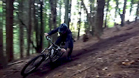
Purpose built XC loop. Connected to a short skills area and optional red sections. Ridden anticlockwise from North Road.

Access Info

Entry from the footpath on North Road or alternatively from the car park at the end of valley road.

Local Trail Association

Recent Activity on Trail

Past Week
  • 2 rides
  • 23 miles average
6 Months
  • 33 rides
  • 10 miles avg distance
All
  • 239 rides
  • Last: Jun 18, 2026
c1c2c3c4
January
February
March
April
May
June
July
August
September
October
November
December
update trails status or condition

Yer Tiz Trail Reports

statusdatedescription
Mar 24, 2026 @ 8:52pm (Europe/London)
Mar 24, 2026
Recently re-surfaced and it's in the best condition it's ever been in!
Jun 30, 2025 @ 11:01am
Jun 30, 2025
Throughout the trail the dirt has slowly been eroded to expose a large amount of rocks and pebbles all the way around making it very much like a...
Jun 17, 2023 @ 6:41am
Jun 17, 2023
Awesome condition in well managed Park
Feb 26, 2023 @ 3:22am
Feb 26, 2023
Nov 19, 2022 @ 6:59pm
Nov 19, 2022
more »
Status:
on Mar 24, 2026
Ideal
Avg: 3.53 (9 votes)
Your vote: 0

view (4,841)
close
3D
Trail Conditions
  • Unknown
  • Snow Groomed
  • Snow Packed
  • Snow Covered
  • Snow Cover Partial
  • Freeze/thaw Cycle
  • Icy
  • Prevalent Mud
  • Wet
  • Variable
  • Ideal
  • Dry
  • Very Dry
Trail Flow (Ridden Direction)
Trailforks scans users ridelogs to determine the most popular direction each trail is ridden. A good flowing trail network will have most trails flowing in a single direction according to their intension.
The colour categories are based on what percentage of riders are riding a trail in its intended direction.
  • > 96%
  • > 90%
  • > 80%
  • > 70%
  • > 50%
  • < 50%
  • bi-directional trail
  • no data
Trail Last Ridden
Trailforks scans ridelogs to determine the last time a trail was ridden.
  • < 2 days
  • < 1 week
  • < 2 weeks
  • < 1 month
  • < 6 months
  • > 6 months
Trail Ridden Direction
The intended direction a trail should be ridden.
  • Downhill Only
  • Downhill Primary
  • Both Directions
  • Uphill Primary
  • Uphill Only
  • One Direction
Contribute Details
Colors indicate trail is missing specified detail.
  • Description
  • Photos
  • Description & Photos
  • Videos
Trail Popularity ?
Trailforks scans ridelogs to determine which trails are ridden the most in the last 9 months. Trails are compared with nearby trails in the same city region with a possible 25 colour shades. Think of this as a heatmap, more rides = more kinetic energy = warmer colors.
  • most popular
  • popular
  • less popular
  • not popular
ATV/ORV/OHV Filter
Max Vehicle Width
inches
US Cell Coverage
Legend
cell carrier legend

Radar Time
Activity Recordings
Trailforks uses anonymized public activity data. ?
Activity Recordings
Trailforks uses anonymized public activity data. ?
Personal Heatmap
Activity Types
all / none
Options
2
Date range month
Winter Trails
Warning A routing network for winter maps does not exist. Selecting trails using the winter trails layer has been disabled.
Missing Trails
Most Popular
Least Popular
Trails are colored based on popularity. The more popular a trail is, the more red. Less popular trails trend towards green.
Jump Magnitude Heatmap
Heatmap of where riders jump on trails. Zoom in to see individual jumps, click circles to view jump details.
BC Backroad Status

Service Road Atlas is a free to use, community-driven service for viewing and creating reports on the numerous back-country service roads around B.C. and Alberta.

map legend
Slope Aspect
Direction the slope faces
Flat N NE E SE S SW W NW
Trails Deemphasized
Trails are shown in grey.
disable
Only show trails with no bike usage.
Enable
Suggested Layers
Based on selected activity type

    Save the current map location and zoom level as your default home location whenever this page is loaded.

    Save
        Directions to yer-tiz trailhead (51.456950, -2.640750)

        Photos

        34 more »
        25 |
        Mar 24, 2026 @ 2:03pm
        Mar 24, 2026
        23 |
        Mar 24, 2026 @ 1:59pm
        Mar 24, 2026
        183 |
        Apr 4, 2019 @ 5:30pm
        Apr 4, 2019
        143 |
        Apr 4, 2019 @ 5:29pm
        Apr 4, 2019

        Videos

        5 more »
        The Trails Next Door
        1015 | Mar 14, 2015 , Bristol
        Joe McEwan - Starling
        4:24 | 4954 | Nov 23, 2017 , Bristol
        Peak Productions- T-dawg rides Leigh Woods
        0:32 | 609 | Jun 8, 2016 , Bristol
        Getting low in the Loam!
        0:28 | 706 | Oct 23, 2015 , Bristol

        Routes with this trail

        4.0 17 miles 1,467 ft 35 Loop
        A loop taking in the best of Bristol singletrack taking in the first half of Leigh Woods, down to , can...
        12 miles 1,076 ft 13
        Alternative version of 15 miler avoiding the very greasy picnic bench sections.
        11 miles 1,194 ft 14 Loop
        a 15 mile ish circular bristol route, leigh olds off piste very muddy and slippy in the wet!!

        4 Reviews & Comments


        We hope you've been enjoying Trailforks!

        Create a FREE account to view trail comments and much more.

        • By camomatic & contributors
        • #27008 - 7,939 views

        Frequently Asked Questions About Yer Tiz

        Where is Yer Tiz located?
        Yer Tiz is located in Leigh Woods, Bristol, United Kingdom. It is part of the Leigh Woods trail network. The trailhead is located at coordinates 51.45695, -2.64075.
        How hard is Yer Tiz?
        Yer Tiz is rated as Blue difficulty. The physical rating is Easy. The climb difficulty is rated Green.
        What is the elevation gain for Yer Tiz?
        Yer Tiz has 55 m of elevation gain. The trail has 56 m of elevation descent. The elevation ranges from 79 m to 115 m.
        Is Yer Tiz a point to point trail?
        Yes, Yer Tiz is a point to point trail. The direction is Downhill Only. The trail type is singletrack.

        Hit the Trail

        Open in App

        Get this trail on your phone instantly.
        open trail in app

        Download Trail

        Save to wishlist, Garmin & download.
        save the trail

        Find Related Routes

        Find routes and users activities that include this trail.
        find routes for this trail

        You must enter a description before submitting.