more stats
2,480 ft
Distance
166 ft
Climb
00:05:45
Avg time
166 ft
Altitude change
2,523 ft
Altitude min
2,689 ft
Altitude max
2,523 ft
Altitude start
2,690 ft
Altitude end
6.7%
Grade
24.3%
Grade min
2,198 ft
Distance climb
282 ft
Distance flat
00:05:45
Avg time

Zig Zag Details

  • Activities
    • Mountain Bike
    • Gravel Bike
    • Hike
    • Trail Running
  • Riding Area
    Twin Peaks
    Wickenburg, Arizona
  • Difficulty Rating
  • Voted Difficulty
    Blue (1 vote)
  • Local Popularity
    95 in Mountain Biking [+]
    • 5 in Trail Running
    • 5 in Hiking
  • Trail Type
    Singletrack
  • Bike Type
    DH, AM, XC, Gravel
  • Direction
    Both Directions
  • Climb Difficulty
    Blue
  • Physical Rating
    Moderate
  • Trail Visibility
    Always easy to follow
  • Season
    Year Round

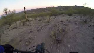
Another option to get to the top of Candy Bar trail. It is longer and less steep than the climb on the west end of Candy Bar.

Access Info

Trail is head can be accessed via the abandoned Hwy 60 which runs through the area. Trail is located on State Trust Land and the grazing rights are leased so please close gates.

Disclaimer

Trail is located on State Trust Land, permit is required.

Recent Activity on Trail

Past Week
  • 0 rides
  •  
6 Months
  • 21 rides
  • 20.5 km avg distance
All
  • 92 rides
  • Last: May 15, 2026
c1c2c3c4
January
February
March
April
May
June
July
August
September
October
November
December
update trails status or condition

Zig Zag Trail Reports

Status:
on May 15, 2026
Dry
Avg: 3.84 (1 votes)
Your vote: 0

view (174)
close
3D
Trail Conditions
  • Unknown
  • Snow Groomed
  • Snow Packed
  • Snow Covered
  • Snow Cover Partial
  • Freeze/thaw Cycle
  • Icy
  • Prevalent Mud
  • Wet
  • Variable
  • Ideal
  • Dry
  • Very Dry
Trail Flow (Ridden Direction)
Trailforks scans users ridelogs to determine the most popular direction each trail is ridden. A good flowing trail network will have most trails flowing in a single direction according to their intension.
The colour categories are based on what percentage of riders are riding a trail in its intended direction.
  • > 96%
  • > 90%
  • > 80%
  • > 70%
  • > 50%
  • < 50%
  • bi-directional trail
  • no data
Trail Last Ridden
Trailforks scans ridelogs to determine the last time a trail was ridden.
  • < 2 days
  • < 1 week
  • < 2 weeks
  • < 1 month
  • < 6 months
  • > 6 months
Trail Ridden Direction
The intended direction a trail should be ridden.
  • Downhill Only
  • Downhill Primary
  • Both Directions
  • Uphill Primary
  • Uphill Only
  • One Direction
Contribute Details
Colors indicate trail is missing specified detail.
  • Description
  • Photos
  • Description & Photos
  • Videos
Trail Popularity ?
Trailforks scans ridelogs to determine which trails are ridden the most in the last 9 months. Trails are compared with nearby trails in the same city region with a possible 25 colour shades. Think of this as a heatmap, more rides = more kinetic energy = warmer colors.
  • most popular
  • popular
  • less popular
  • not popular
ATV/ORV/OHV Filter
Max Vehicle Width
inches
US Cell Coverage
Legend
cell carrier legend

Radar Time
Activity Recordings
Trailforks uses anonymized public activity data. ?
Activity Recordings
Trailforks uses anonymized public activity data. ?
Personal Heatmap
Activity Types
all / none
Options
2
Date range month
Winter Trails
Warning A routing network for winter maps does not exist. Selecting trails using the winter trails layer has been disabled.
Missing Trails
Most Popular
Least Popular
Trails are colored based on popularity. The more popular a trail is, the more red. Less popular trails trend towards green.
Jump Magnitude Heatmap
Heatmap of where riders jump on trails. Zoom in to see individual jumps, click circles to view jump details.
BC Backroad Status

Service Road Atlas is a free to use, community-driven service for viewing and creating reports on the numerous back-country service roads around B.C. and Alberta.

map legend
Slope Aspect
Direction the slope faces
Flat N NE E SE S SW W NW
Trails Deemphasized
Trails are shown in grey.
disable
Only show trails with no bike usage.
Enable
Suggested Layers
Based on selected activity type

    Save the current map location and zoom level as your default home location whenever this page is loaded.

    Save
        Directions to zig-zag-678407 trailhead (33.948940, -112.824330)

        Photos

        7 more »
        23 |
        Mar 13, 2024 @ 1:36pm
        Mar 13, 2024
        27 |
        Mar 13, 2024 @ 1:35pm
        Mar 13, 2024
        31 |
        Mar 13, 2024 @ 1:34pm
        Mar 13, 2024
        24 |
        Mar 8, 2024 @ 7:48pm
        Mar 8, 2024

        Videos

        1 more »
        Twin Peaks - Zig Zag (Wickenburg, AZ) - Full Trail
        3:03 | 64 | Jan 15, 2024 , Wickenburg

        1 Review & Comments


        We hope you've been enjoying Trailforks!

        Create a FREE account to view trail comments and much more.

        • By bdalleyTF Pro & contributors
        • #678407 - 318 views

        Frequently Asked Questions About Zig Zag

        Where is Zig Zag located?
        Zig Zag is located in Twin Peaks, Wickenburg, Arizona, United States. It is part of the Twin Peaks trail network. The trailhead is located at coordinates 33.94894, -112.82433.
        How hard is Zig Zag?
        Zig Zag is rated as Blue difficulty. The physical rating is Moderate. The average grade is 6.7%. The climb difficulty is rated Blue.
        What is the elevation gain for Zig Zag?
        Zig Zag has 166 ft of elevation gain. The elevation ranges from 2,523 ft to 2,689 ft.
        Is Zig Zag a point to point trail?
        Zig Zag is not a point to point trail. The direction is Both Directions. The trail type is singletrack.

        Hit the Trail

        Open in App

        Get this trail on your phone instantly.
        open trail in app

        Download Trail

        Save to wishlist, Garmin & download.
        save the trail

        Find Related Routes

        Find routes and users activities that include this trail.
        find routes for this trail

        You must enter a description before submitting.