more stats
3,684 ft
Distance
2 ft
Climb
-545 ft
Descent
00:02:50
Avg time
-543 ft
Altitude change
2,553 ft
Altitude min
3,096 ft
Altitude max
3,096 ft
Altitude start
2,552 ft
Altitude end
-14.7%
Grade
-46.1%
Grade max
6.7%
Grade min
33 ft
Distance climb
3,648 ft
Distance down
00:02:50
Avg time

Zoot Track Details

  • Activities
    • Mountain Bike
    • E-Bike
    • Hike
    • Trail Running
  • Riding Area
  • Difficulty Rating
  • Local Popularity
    55 in Mountain Biking [+]
    • 80 in E-Biking
    • 50 in Trail Running
    • 45 in Hiking
  • Global Ranking
    #35241 in Mountain Biking [+]
    • #23415 in E-Biking
    • #98885 in Trail Running
    • #107268 in Hiking
  • Trail Type
    Singletrack
  • Bike Type
    DH, AM
  • Dogs Allowed
    Yes
  • eBike Allowed

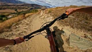
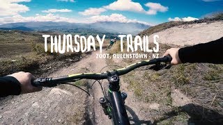
Fast and fun with lots of optional side lines. Gets a bit rough due to it's gradient but nothing very difficult.
Runs ok for most of winter as does Carry on but Lower Zoot/Groot is clay based so is best avoided

Access Info

Starts from Skippers saddle which can be shuttled or pedalled.
Has a split near the bottom. Left will keep you on Zoot and back to the road and Carry On or staying straight leads to a small uphill to Lower Zoot/Groot

Bike Park

Traditionally Indigenous Territory

Recent Activity on Trail

Past Week
  • 0 rides
  •  
6 Months
  • 109 rides
  • 14 miles avg distance
All
  • 356 rides
  • Last: Jun 6, 2026
c1c2c3c4
January
February
March
April
May
June
July
August
September
October
November
December
update trails status or condition

Zoot Track Trail Reports

statusdatedescription
Jun 12, 2026 @ 1:13pm (Pacific/Auckland)
Jun 11, 2026
lots of frost heave and very muddy at the bottom. didn't ride the trail
May 7, 2026 @ 9:35am (Pacific/Auckland)
May 6, 2026
Some jumps and water bars need rebuilt back up. Few dodgy proud rocks. Suggest bday machine run in spring
May 7, 2026 @ 9:22am (Pacific/Auckland)
May 6, 2026
Works complete adding a new link at the zoot/groot intersection to make it more user friendly. Turn left for zoot/carry on and stay straight for...
Apr 30, 2026 @ 11:31am (Pacific/Auckland)
Apr 29, 2026
Elevate trails on track with excavator, creating better area for lower zoot to route off. zoot will be closed until the weekend.
Apr 15, 2026 @ 10:22am (Pacific/Auckland)
Apr 14, 2026
Running pretty good
more »
Status:
on Jun 12, 2026
Freeze/thaw Cycle
Avg: 4.29 (25 votes)
Your vote: 0

view (3,425)
close
3D
Trail Conditions
  • Unknown
  • Snow Groomed
  • Snow Packed
  • Snow Covered
  • Snow Cover Partial
  • Freeze/thaw Cycle
  • Icy
  • Prevalent Mud
  • Wet
  • Variable
  • Ideal
  • Dry
  • Very Dry
Trail Flow (Ridden Direction)
Trailforks scans users ridelogs to determine the most popular direction each trail is ridden. A good flowing trail network will have most trails flowing in a single direction according to their intension.
The colour categories are based on what percentage of riders are riding a trail in its intended direction.
  • > 96%
  • > 90%
  • > 80%
  • > 70%
  • > 50%
  • < 50%
  • bi-directional trail
  • no data
Trail Last Ridden
Trailforks scans ridelogs to determine the last time a trail was ridden.
  • < 2 days
  • < 1 week
  • < 2 weeks
  • < 1 month
  • < 6 months
  • > 6 months
Trail Ridden Direction
The intended direction a trail should be ridden.
  • Downhill Only
  • Downhill Primary
  • Both Directions
  • Uphill Primary
  • Uphill Only
  • One Direction
Contribute Details
Colors indicate trail is missing specified detail.
  • Description
  • Photos
  • Description & Photos
  • Videos
Trail Popularity ?
Trailforks scans ridelogs to determine which trails are ridden the most in the last 9 months. Trails are compared with nearby trails in the same city region with a possible 25 colour shades. Think of this as a heatmap, more rides = more kinetic energy = warmer colors.
  • most popular
  • popular
  • less popular
  • not popular
ATV/ORV/OHV Filter
Max Vehicle Width
inches
US Cell Coverage
Legend
cell carrier legend

Radar Time
Activity Recordings
Trailforks uses anonymized public activity data. ?
Activity Recordings
Trailforks uses anonymized public activity data. ?
Personal Heatmap
Activity Types
all / none
Options
2
Date range month
Winter Trails
Warning A routing network for winter maps does not exist. Selecting trails using the winter trails layer has been disabled.
Missing Trails
Most Popular
Least Popular
Trails are colored based on popularity. The more popular a trail is, the more red. Less popular trails trend towards green.
Jump Magnitude Heatmap
Heatmap of where riders jump on trails. Zoom in to see individual jumps, click circles to view jump details.
BC Backroad Status

Service Road Atlas is a free to use, community-driven service for viewing and creating reports on the numerous back-country service roads around B.C. and Alberta.

map legend
Slope Aspect
Direction the slope faces
Flat N NE E SE S SW W NW
Trails Deemphasized
Trails are shown in grey.
disable
Only show trails with no bike usage.
Enable
Suggested Layers
Based on selected activity type

    Save the current map location and zoom level as your default home location whenever this page is loaded.

    Save
        Directions to zoot-track trailhead (-44.940780, 168.705850)

        Photos

        44 more »
        56 |
        Apr 15, 2023 @ 2:35am
        Apr 15, 2023
        182 |
        Feb 27, 2018 @ 12:37am
        Feb 27, 2018
        185 |
        Feb 27, 2018 @ 12:36am
        Feb 27, 2018
        173 |
        Feb 27, 2018 @ 12:37am
        Feb 27, 2018

        Videos

        12 more »
        youtuber Zoot-Lower Zoot @ Coronet Peak. Queenstown
        6:36 | 80 | Oct 27, 2025 , Queenstown
        youtuber Zoot - Scenic Downhill in Queenstown New Zealand
        2:46 | 752 | Jun 22, 2017 , Queenstown
        Coronet MTB Trails - Dirt Serpent | Coronet DH...
        14:59 | 50 | Mar 30, 2026 , Queenstown
        Zoot Track & Rude Rock - MTB trails -...
        10:13 | 487 | Mar 3, 2019 , Queenstown

        Routes with this trail

        185 miles 39,064 ft 36
        Starting in Tāhuna , heading on bike path to Frankton ,taking in Remarkables, before returning to bike...
        2.0 12 miles 3,148 ft 6 Loop
        This takes a lot of the good trails on Coronet. Best done with a friend so you can leave one vehicle a the...
        22 miles 5,936 ft 11
        Big pedal loop (you can cheat and shuttle CP road) taking in all the Coronet classics as of 2021. Coronet...

        1 Review & Comments


        We hope you've been enjoying Trailforks!

        Create a FREE account to view trail comments and much more.

        • By frriv31TF Pro & contributors
        • #25284 - 10,508 views

        Frequently Asked Questions About Zoot Track

        Where is Zoot Track located?
        Zoot Track is located in Coronet Peak Ski & Mountain Bike Park, Queenstown, New Zealand. It is part of the Coronet Peak Ski & Mountain Bike Park trail network. The trailhead is located at coordinates -44.94078, 168.70585.
        How hard is Zoot Track?
        Zoot Track is rated as Advanced difficulty. The average grade is 14.7%.
        What is the elevation gain for Zoot Track?
        Zoot Track has 2 ft of elevation gain. The trail has 545 ft of elevation descent. The elevation ranges from 2,553 ft to 3,096 ft.
        How long is Zoot Track?
        Zoot Track is 3,684 ft long. The trail type is singletrack.

        Hit the Trail

        Open in App

        Get this trail on your phone instantly.
        open trail in app

        Download Trail

        Save to wishlist, Garmin & download.
        save the trail

        Find Related Routes

        Find routes and users activities that include this trail.
        find routes for this trail

        You must enter a description before submitting.