more stats
1.1 miles
Distance
50 ft
Climb
-770 ft
Descent
00:17:41
Avg time
-720 ft
Altitude change
1,626 ft
Altitude min
2,389 ft
Altitude max
2,346 ft
Altitude start
1,627 ft
Altitude end
-11.9%
Grade
-64.3%
Grade max
10.6%
Grade min
1,083 ft
Distance climb
4,964 ft
Distance down
16 ft
Distance flat
00:17:41
Avg time

Zubatá Details

  • Activities
    • Mountain Bike
    • E-Bike
    • Winter Fat Bike
    • Hike
    • Trail Running
  • Riding Area
    Veľký Tríbeč
    Topoľčany
  • AKA
    Mr. Grim
  • Difficulty Rating
  • Local Popularity
    65 in Mountain Biking [+]
    • 50 in E-Biking
    • 85 in Trail Running
    • 90 in Hiking
  • Global Ranking
    #73914 in Mountain Biking [+]
    • #62613 in E-Biking
    • #34623 in Trail Running
    • #21949 in Hiking
  • Hiking SAC Scale
    T1 Hiking
  • Trail Type
    Singletrack
  • Bike Type
    DH, AM, XC, Fat
  • Direction
    Downhill Primary
    Popular Direction Shown
  • Climb Difficulty
    Blue
  • Physical Rating
    Hard
  • Season
    Mar-Nov
  • Dogs Allowed
    Yes
  • eBike Allowed
  • TTFs on Trail
    Drop, Jump, Gap Jump, Rock Face, Rock Garden
  • Ride in Rain
    Yes
  • Year Opened
    2017

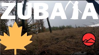
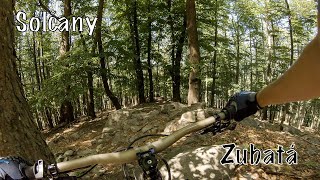
Trail začína priamo na Medveďom vrchu. Počiatočný výšlap vystrieda to pravé enduro - prudké, plné koreňov a kameňov.. Rýchle pasáže sa striedajú s pomalými - technickými.

Access Info

Uphill Zubata

This trail is unsanctioned.

Recent Activity on Trail

Past Week
  • 0 rides
  •  
6 Months
  • 1 rides
  • 20.3 km avg distance
All
  • 16 rides
  • Last: Jun 17, 2026
c1c2c3c4
January
February
March
April
May
June
July
August
September
October
November
December
update trails status or condition

Zubatá Trail Reports

statusdatedescription
Aug 17, 2025 @ 9:55am
Aug 17, 2025
Trail je opäť kompletne prejazdný, vysoká tráva je vykosená, popadané stromy buď odpratané,alebo je obchádzka. Na konci sekcie...
Jul 13, 2025 @ 11:15am
Jul 13, 2025
Popadané stromy v hornej časti občas sme hladali trail. Chce to spraviť údržbu.
Sep 19, 2024 @ 2:08am
Sep 19, 2024
super povrch ,všetko zjazdné. v hornej časti trochu vysšia tráva ale dá sa
Aug 14, 2024 @ 11:40pm
Aug 14, 2024
Zjazdny v celej dlzke. Sucho, smyka sa.
Aug 28, 2023 @ 2:15am
Aug 28, 2023
V spodnej časti spadnuté stromy po ťažbe. Nič vážne.
more »
Status:
on Aug 17, 2025
Very Dry
Avg: 4.45 (7 votes)
Your vote: 0

view (310)
close
3D
Trail Conditions
  • Unknown
  • Snow Groomed
  • Snow Packed
  • Snow Covered
  • Snow Cover Partial
  • Freeze/thaw Cycle
  • Icy
  • Prevalent Mud
  • Wet
  • Variable
  • Ideal
  • Dry
  • Very Dry
Trail Flow (Ridden Direction)
Trailforks scans users ridelogs to determine the most popular direction each trail is ridden. A good flowing trail network will have most trails flowing in a single direction according to their intension.
The colour categories are based on what percentage of riders are riding a trail in its intended direction.
  • > 96%
  • > 90%
  • > 80%
  • > 70%
  • > 50%
  • < 50%
  • bi-directional trail
  • no data
Trail Last Ridden
Trailforks scans ridelogs to determine the last time a trail was ridden.
  • < 2 days
  • < 1 week
  • < 2 weeks
  • < 1 month
  • < 6 months
  • > 6 months
Trail Ridden Direction
The intended direction a trail should be ridden.
  • Downhill Only
  • Downhill Primary
  • Both Directions
  • Uphill Primary
  • Uphill Only
  • One Direction
Contribute Details
Colors indicate trail is missing specified detail.
  • Description
  • Photos
  • Description & Photos
  • Videos
Trail Popularity ?
Trailforks scans ridelogs to determine which trails are ridden the most in the last 9 months. Trails are compared with nearby trails in the same city region with a possible 25 colour shades. Think of this as a heatmap, more rides = more kinetic energy = warmer colors.
  • most popular
  • popular
  • less popular
  • not popular
ATV/ORV/OHV Filter
Max Vehicle Width
inches
US Cell Coverage
Legend
cell carrier legend

Radar Time
Activity Recordings
Trailforks uses anonymized public activity data. ?
Activity Recordings
Trailforks uses anonymized public activity data. ?
Personal Heatmap
Activity Types
all / none
Options
2
Date range month
Winter Trails
Warning A routing network for winter maps does not exist. Selecting trails using the winter trails layer has been disabled.
Missing Trails
Most Popular
Least Popular
Trails are colored based on popularity. The more popular a trail is, the more red. Less popular trails trend towards green.
Jump Magnitude Heatmap
Heatmap of where riders jump on trails. Zoom in to see individual jumps, click circles to view jump details.
BC Backroad Status

Service Road Atlas is a free to use, community-driven service for viewing and creating reports on the numerous back-country service roads around B.C. and Alberta.

map legend
Slope Aspect
Direction the slope faces
Flat N NE E SE S SW W NW
Trails Deemphasized
Trails are shown in grey.
disable
Only show trails with no bike usage.
Enable
Suggested Layers
Based on selected activity type

    Save the current map location and zoom level as your default home location whenever this page is loaded.

    Save
        Directions to zubata trailhead (48.484040, 18.259410)

        Photos

        19 more »
        128 |
        Feb 25, 2022 @ 9:51pm
        Feb 25, 2022
        381 |
        Apr 21, 2019 @ 5:07am
        Apr 21, 2019
        345 |
        Apr 21, 2019 @ 5:06am
        Apr 21, 2019
        291 |
        Apr 21, 2019 @ 5:04am
        Apr 21, 2019

        Videos

        3 more »
        Trail Zubatá 2023
        3:11 | 192 | Nov 6, 2023 , Topoľčany
        Zubata part - Stonehenge
        2:10 | 424 | Jul 19, 2020 , Topoľčany
        Zubatá
        8:20 | 543 | May 31, 2020 , Topoľčany

        Routes with this trail

        13 miles 2,634 ft 4
        Traily pod Velkym Tribecom.

        3 Reviews & Comments


        We hope you've been enjoying Trailforks!

        Create a FREE account to view trail comments and much more.

        • #138090 - 7,132 views

        Frequently Asked Questions About Zubatá

        Where is Zubatá located?
        Zubatá is located in Veľký Tríbeč, Topoľčany, Slovakia. It is part of the Veľký Tríbeč trail network. The trailhead is located at coordinates 48.48404, 18.25941.
        How hard is Zubatá?
        Zubatá is rated as Black Diamond difficulty. The physical rating is Hard. The average grade is 11.9%. The climb difficulty is rated Blue.
        What is the elevation gain for Zubatá?
        Zubatá has 50 ft of elevation gain. The trail has 770 ft of elevation descent. The elevation ranges from 1,626 ft to 2,389 ft.
        Is Zubatá a point to point trail?
        Zubatá is not a point to point trail. The direction is Downhill Primary. The trail type is singletrack.

        Hit the Trail

        Open in App

        Get this trail on your phone instantly.
        open trail in app

        Download Trail

        Save to wishlist, Garmin & download.
        save the trail

        Find Related Routes

        Find routes and users activities that include this trail.
        find routes for this trail

        You must enter a description before submitting.