more stats
1.4 miles
Distance
114 ft
Climb
-130 ft
Descent
00:15:59
Avg time
-16 ft
Altitude change
614 ft
Altitude min
655 ft
Altitude max
647 ft
Altitude start
630 ft
Altitude end
-0.2%
Grade
-12.4%
Grade max
17.5%
Grade min
2,379 ft
Distance climb
3,035 ft
Distance down
1,709 ft
Distance flat
00:15:59
Avg time

Zulu Details

  • Activities
    • Mountain Bike
    • E-Bike
  • Riding Area
    Griffin Bike Park
    Terre Haute, Indiana
  • AKA
    Advanced Loop 3
  • Difficulty Rating
  • Voted Difficulty
    Black Diamond (1 vote)
  • Local Popularity
    40 in Mountain Biking [+]
    • 35 in E-Biking
  • Global Ranking
    #101656 in Mountain Biking [+]
    • #97096 in E-Biking
  • Blaze Color
  • Trail Type
    Singletrack
  • Bike Type
    XC
  • Direction
    Both Directions
  • Climb Difficulty
    Blue
  • Physical Rating
    Hard
  • Trail Visibility
    Always easy to follow
  • eBike Allowed
    Yes up to Class 1
  • TTFs on Trail
    Berm, Bridge, Drop, Jump, Ladder Bridge, Rock Garden, Skinny, Other
  • Year Opened
    2020

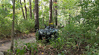
Zulu offers the natural integrity and tight corridors of a beautifully constructed hand-built trail. The trail starts at the top of the Freedom Trail with a drop down--the trail the crosses under a wooden bridge and enters a quick climb. From here the trail enters into three "ugly" jumps and then follows atop some ridges of strip-mining spoils.

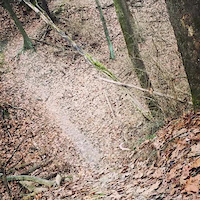
Riders follow a steep drop-down to the left and pass where Zulu nearly touches Freedom Trail. After crossing some corduroy, the trail skirts the shores of two small lakes. Bikers then climb into a section punctuated by some steep drops (saddles, G-outs) with physics taking them from the tops of one small ridge to the next. Once section has a ladder bridge ending in a 1-ft. drop (rollable). A particularly fun section involves banking to-and-fro across the walls (not bench cut) of two small ridges.

MTBers then come across a rock garden after that, the biggest of the G-outs that has two choices at the top--there's a dirt high road and a ladder bridge low road. Ride or slide down to the trail beyond to another climb on narrow, off-camber track, followed by two smaller saddles and a ride across an over/under wooden bridge/drop feature to close the loop. Then enter into the flowing Zulu Trail exit--it twists through the forest and at the end can be exited to the left via rocky steps down to Freedom Trail.

Access Info

From the northernmost end of Freedom Trail; Zulu can also be accessed at SW portion from abutting Freedom Trail.

Recent Activity on Trail

Past Week
  • 0 rides
  •  
6 Months
  • 2 rides
  • 29 miles avg distance
All
  • 73 rides
  • Last: May 30, 2026
c1c2c3c4
January
February
March
April
May
June
July
August
September
October
November
December
Status:
on Jun 16, 2026
Prevalent Mud
Avg: 4.3 (7 votes)
Your vote: 0

view (1,106)
close
3D
Trail Conditions
  • Unknown
  • Snow Groomed
  • Snow Packed
  • Snow Covered
  • Snow Cover Partial
  • Freeze/thaw Cycle
  • Icy
  • Prevalent Mud
  • Wet
  • Variable
  • Ideal
  • Dry
  • Very Dry
Trail Flow (Ridden Direction)
Trailforks scans users ridelogs to determine the most popular direction each trail is ridden. A good flowing trail network will have most trails flowing in a single direction according to their intension.
The colour categories are based on what percentage of riders are riding a trail in its intended direction.
  • > 96%
  • > 90%
  • > 80%
  • > 70%
  • > 50%
  • < 50%
  • bi-directional trail
  • no data
Trail Last Ridden
Trailforks scans ridelogs to determine the last time a trail was ridden.
  • < 2 days
  • < 1 week
  • < 2 weeks
  • < 1 month
  • < 6 months
  • > 6 months
Trail Ridden Direction
The intended direction a trail should be ridden.
  • Downhill Only
  • Downhill Primary
  • Both Directions
  • Uphill Primary
  • Uphill Only
  • One Direction
Contribute Details
Colors indicate trail is missing specified detail.
  • Description
  • Photos
  • Description & Photos
  • Videos
Trail Popularity ?
Trailforks scans ridelogs to determine which trails are ridden the most in the last 9 months. Trails are compared with nearby trails in the same city region with a possible 25 colour shades. Think of this as a heatmap, more rides = more kinetic energy = warmer colors.
  • most popular
  • popular
  • less popular
  • not popular
ATV/ORV/OHV Filter
Max Vehicle Width
inches
US Cell Coverage
Legend
cell carrier legend

Radar Time
Activity Recordings
Trailforks uses anonymized public activity data. ?
Activity Recordings
Trailforks uses anonymized public activity data. ?
Personal Heatmap
Activity Types
all / none
Options
2
Date range month
Winter Trails
Warning A routing network for winter maps does not exist. Selecting trails using the winter trails layer has been disabled.
Missing Trails
Most Popular
Least Popular
Trails are colored based on popularity. The more popular a trail is, the more red. Less popular trails trend towards green.
Jump Magnitude Heatmap
Heatmap of where riders jump on trails. Zoom in to see individual jumps, click circles to view jump details.
BC Backroad Status

Service Road Atlas is a free to use, community-driven service for viewing and creating reports on the numerous back-country service roads around B.C. and Alberta.

map legend
Slope Aspect
Direction the slope faces
Flat N NE E SE S SW W NW
Trails Deemphasized
Trails are shown in grey.
disable
Only show trails with no bike usage.
Enable
Suggested Layers
Based on selected activity type

    Save the current map location and zoom level as your default home location whenever this page is loaded.

    Save
        Directions to zulu trailhead (39.340300, -87.358090)

        Photos

        18 more »
        61 |
        Oct 26, 2024 @ 1:47pm
        Oct 26, 2024
        52 |
        Oct 26, 2024 @ 1:47pm
        Oct 26, 2024
        145 |
        Jul 11, 2021 @ 8:44pm
        Jul 11, 2021
        220 |
        Jan 18, 2020 @ 6:39am
        Jan 18, 2020

        Videos

        4 more »
        What's that trail? Zulu (Griffin Bike Park -...
        7:16 | 183 | Dec 10, 2021 , Terre Haute
        over under zulu
        0:17 | 144 | Jan 16, 2021 , Terre Haute
        Zulu New Drop
        0:07 | 96 | Jan 16, 2021 , Terre Haute
        The Big E
        0:26 | 173 | Jan 18, 2020 , Terre Haute

        4 Reviews & Comments


        We hope you've been enjoying Trailforks!

        Create a FREE account to view trail comments and much more.

        • By WimGTF Pro FOGBP & contributors
        • #60721 - 3,241 views

        Frequently Asked Questions About Zulu

        Where is Zulu located?
        Zulu is located in Griffin Bike Park, Terre Haute, Indiana, United States. It is part of the Griffin Bike Park trail network. The trailhead is located at coordinates 39.3403, -87.35809.
        How hard is Zulu?
        Zulu is rated as Black Diamond difficulty. The physical rating is Hard. The average grade is 0.2%. The climb difficulty is rated Blue.
        What is the elevation gain for Zulu?
        Zulu has 35 m of elevation gain. The trail has 40 m of elevation descent. The elevation ranges from 187 m to 200 m.
        Is Zulu a point to point trail?
        Zulu is not a point to point trail. The direction is Both Directions. The trail type is singletrack.

        Hit the Trail

        Open in App

        Get this trail on your phone instantly.
        open trail in app

        Download Trail

        Save to wishlist, Garmin & download.
        save the trail

        Find Related Routes

        Find routes and users activities that include this trail.
        find routes for this trail

        You must enter a description before submitting.