close
-
Layers w
- Weather Layers
- Pro
- Pro
- Pro
- Pro
- Pro
- Pro
- More Layers
- Pro
- Pro
- Pro
- Pro
-
Upgrade to

3D
Trail Conditions
- Unknown
- Snow Groomed
- Snow Packed
- Snow Covered
- Snow Cover Partial
- Freeze/thaw Cycle
- Icy
- Prevalent Mud
- Wet
- Variable
- Ideal
- Dry
- Very Dry
Trail Flow (Ridden Direction)
Trailforks scans users ridelogs to determine the most popular direction each trail is ridden. A good flowing trail network will have most trails flowing in a single direction according to their intension.
The colour categories are based on what percentage of riders are riding a trail in its intended direction.
The colour categories are based on what percentage of riders are riding a trail in its intended direction.
- > 96%
- > 90%
- > 80%
- > 70%
- > 50%
- < 50%
- bi-directional trail
- no data
Trail Last Ridden
Trailforks scans ridelogs to determine the last time a trail was ridden.
- < 2 days
- < 1 week
- < 2 weeks
- < 1 month
- < 6 months
- > 6 months
Trail Ridden Direction
The intended direction a trail should be ridden.
- Downhill Only
- Downhill Primary
- Both Directions
- Uphill Primary
- Uphill Only
- One Direction
Contribute Details
Colors indicate trail is missing specified detail.
- Description
- Photos
- Description & Photos
- Videos
Trail Popularity ?
Trailforks scans ridelogs to determine which trails are ridden the most in the last 9 months.
Trails are compared with nearby trails in the same city region with a possible 25 colour shades.
Think of this as a heatmap, more rides = more kinetic energy = warmer colors.
- most popular
- popular
- less popular
- not popular
ATV/ORV/OHV Filter
Max Vehicle Width
inches
US Cell Coverage
Legend

Radar Time
Activity Recordings
Trailforks uses anonymized public activity data.
?
Activity Recordings
Trailforks uses anonymized public activity data.
?
Personal Heatmap
▶
Activity Types
all
/
none
▶
Options
2
Date range
month
–
Winter Trails
Warning
A routing network for winter maps does not exist. Selecting trails using the winter trails layer has been disabled.
Missing Trails
Most Popular
Least Popular
Trails are colored based on popularity. The more popular a trail is, the more red. Less popular trails trend towards green.
Jump Magnitude Heatmap
Heatmap of where riders jump on trails. Zoom in to see individual jumps, click circles to view jump details.
BC Backroad Status
![map legend]()
Service Road Atlas is a free to use, community-driven service for viewing and creating reports on the numerous back-country service roads around B.C. and Alberta.

Slope Aspect
Direction the slope faces
Trails Deemphasized
Trails are shown in grey.
Only show trails with no bike usage.
Suggested Layers
Based on selected activity type
Save the current map location and zoom level as your default home location whenever this page is loaded.
Saveas of 1 Janurary 2020 This is the city of Askim - in Indre Østfold Municipality - Viken Fylke
Links
- Indre Østfold Municipality Website
- https://www.askim.no/
- Ski map
- https://kart.gulesider.no/?c=59.597059,11.175784&z=12&l=aerial&q=%22askim%22;geo
- https://ostfoldfk.maps.arcgis.com/apps/webappviewer/index.html?id=80cb418930c74b92895923beef93352b
- Norges Kart
- https://no.wikipedia.org/wiki/Viken_(fylke)
- vegvesen - traffic reports- roads closed and so on
This region uses the Uk/Euro style trail grading system.
Activities Click to view
- Mountain Bike
963 trails
- E-Bike
691 trails
- Gravel Bike
0 trails
- Adaptive Bike
0 trails
- Winter Fat Bike
0 trails
- Horse
13 trails
- Hike
947 trails
- Trail Running
926 trails
- Dirtbike/Moto
14 trails
- ATV/ORV/OHV
14 trails
- Snowmobile
4 trails
- Snowshoe
4 trails
- Downhill Ski
7 trails
- Nordic Ski
83 trails
Region Details
- 255
- 61
- 286
- 249
- 54
- 13
- 12
Region Status
Caution as of May 22, 2026E-Bike Stats
- Global Ranking
- #203
- State Ranking
- #7
- Trails (view details)
- 691
- Trails Mountain Bike
- 965
- Trails E-Bike
- 691
- Trails Horse
- 13
- Trails Hike
- 947
- Trails Trail Running
- 926
- Trails Dirtbike/Moto
- 14
- Trails Observed Trials
- 1
- Trails ATV/ORV/OHV
- 14
- Trails Snowmobile
- 4
- Trails Snowshoe
- 4
- Trails Downhill Ski
- 7
- Trails Nordic Ski
- 83
- Total Distance
- 102 miles
- Total Descent Distance
- 39 miles
- Total Descent
- 8,068 ft
- Total Vertical
- 505 ft
- Reports
- 2,339
- Ridden Counter
- 31
Sub Regions
-
Åsermarka
- 29
- 46
- 8
- 5
- 4
-
Askim City Centre
- 9
- 19
- 5
- 4
- 1
-
Askim Museum
- 11
- 5
- 4
- 1
- 1
-
Henstadskogen
- 1
- 4
- 10
- 1
-
Hovskogen
- 3
- 45
- 26
- 2
-
Hundremeterskogen
- 5
- 17
- 11
-
Korsegård
- 14
- 12
- 5
-
Kråkåsen
- 1
- 11
- 17
- 7
- 1
-
Kykkelsrud
- 8
- 6
- 5
-
Langnes
- 2
- 3
- 10
- 1
-
Nylendeåsen
- 3
- 2
- 1
-
Prestegårdsskogen
- 2
- 42
- 53
- 8
- 1
- 3
-
Romsåsen
- 5
- 5
- 2
-
Rudsmosen
- 5
- 3
-
Sekkelsten
- 2
- 1
-
Trollskogen
- 10
- 7
- 2
Popular Askim E-Biking Trails
• 100 ★ 3.0 • 1,063 ft • 44 ft • 1 •
Popular white difficulty family friendly paved path. This mountain bike primary trail can be used both directions and has a easy overall physical rating with a 44 ft green climb. Trail visibility is always easy to follow. On average it takes 1 minutes to complete this trail.
• 5 ★ 5.0 • 1,375 ft • 54 ft • 1 •
Less popular red difficulty singletrack. This mountain bike primary trail can be used both directions and has a hard overall physical rating with a 54 ft black diamond climb. Trail visibility is always easy to follow. On average it takes 9 minutes to complete this trail.
• 5 ★ 5.0 • 161 ft • 0 ft • 1 •
Popular green difficulty singletrack. This mountain bike primary trail can be used both directions and has a easy overall physical rating with a 0 ft green climb. On average it takes 31 minutes to complete this trail.
• 5 ★ 5.0 • 2,008 ft • 14 ft • 1 •
Stien starter ganske lett, ned fra skiltene, en skiltene, et kort parti ned til en bro og klatre etter broen, etter denne lange delen med korte svinger med partier har stien flere fall, men de kan kjøres ned hvis du rir dem sakte, så...
• 5 ★ 5.0 • 2,287 ft • 7 ft • 1 •
Popular red difficulty singletrack. This mountain bike primary trail can be used both directions and has a moderate overall physical rating with a 7 ft blue climb. Trail visibility is always easy to follow. On average it takes 12 minutes to complete this trail.
• 100 ★ 5.0 • 277 ft • 26 ft • 1 •
The old Illuminated ski track section, which can double as sledding hill. Norsk/Norwegian: Den gamle Opplyste skisportsavsnittet, som kan doble som akebakke.
• 5 ★ 5.0 • 374 ft • 3 ft • 1 •
Less popular black diamond difficulty singletrack. This mountain bike primary trail can be used both directions and has a hard overall physical rating with a 3 ft black diamond climb. It features ladder bridge and rock garden. Trail visibility is always easy to follow. On average it takes minutes to complete this trail.
• 5 ★ 5.0 • 1,483 ft • 17 ft • 1 •
Less popular black difficulty singletrack. This multi-use trail can be used both directions and has a moderate overall physical rating with a 17 ft blue climb. It features ladder bridge. Trail visibility is always easy to follow. On average it takes 5 minutes to complete this trail.
Askim Routes
★ 5.0 • 2 miles • 27 ft • 1 • Point to Point •
2,5km punkt til punkt, løp som kalles Linnatrimmen, Starter nærbrannstasjonen og ender hvor skiltet til...
8 miles • 636 ft • 3 •
Starts from Askim city centre goes trough whole Solbergfosslinna, which is a nice smooth gravel rail...
★ 5.0 • 1 mile • 76 ft • 9 • Out & Back •
2.5 Km long ski out and back route. long straight then left slight climb, and down fast at steep decline,...
9 miles • 739 ft • 3 • Point to Point •
Route from Askim City centre to Stegen Stadion at Skimtefjell, trough Solbergfosslinna, Solbergfossveien.
5 miles • 317 ft • 1 • Loop •
A long route , starting near the old hotel, going down to thee north west country side of Askim. the rout...
7 miles • 212 ft • 11 • Point to Point •
This is the section is a part of Unionsleden Moss – Karlstad. But this is the section which goes through...
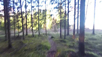
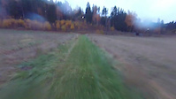
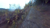
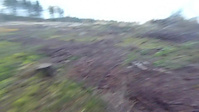
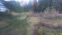
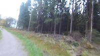
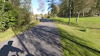
Photos of Askim
Videos of Askim
25:35 |
20 |
Nov 17, 2016
trail: Trostebekk Gård Grassti
0:37 |
5 |
Oct 27, 2016
4:13 |
17 |
Oct 26, 2016
trail: Ned i skogen
6:36 |
16 |
Oct 23, 2016
trail: Gudim Runden
6:05 |
15 |
Oct 21, 2016
trail: Røtter og trangt
3:47 |
11 |
Oct 17, 2016
0:40 |
8 |
Oct 3, 2016
trail: Langs parkerings plassen
0:57 |
2 |
Oct 3, 2016
Recent Trail Reports
| status | trail | date | condition | info | user |
|---|---|---|---|---|---|
| Nedre Sira Sigurdsgate | May 22, 2026 @ 12:45pm (Europe/Oslo) May 22, 2026 | Ideal | mtbboy1993 TRAILFORKS | ||
| Armeringsjernstien | May 20, 2026 @ 3:11pm (Europe/Oslo) May 20, 2026 | Ideal | mtbboy1993 TRAILFORKS | ||
| Klara Skoglunds gate | May 10, 2026 @ 7:05am (Europe/Oslo) May 9, 2026 | Ideal | mtbboy1993 TRAILFORKS | ||
| Øvre Sira Sigurdsgate | May 10, 2026 @ 7:05am (Europe/Oslo) May 9, 2026 | Ideal | mtbboy1993 TRAILFORKS | ||
| Eidsberg veien ned til tunellen | May 10, 2026 @ 7:05am (Europe/Oslo) May 9, 2026 | Ideal | mtbboy1993 TRAILFORKS | ||
| Silobrua | May 10, 2026 @ 7:05am (Europe/Oslo) May 9, 2026 | Ideal | mtbboy1993 TRAILFORKS | ||
| Rundkjøringa-Askim Torget | May 10, 2026 @ 7:04am (Europe/Oslo) May 9, 2026 | Ideal | mtbboy1993 TRAILFORKS | ||
| Kirkegata | May 10, 2026 @ 7:04am (Europe/Oslo) May 9, 2026 | Ideal | mtbboy1993 TRAILFORKS | ||
| Østfoldbadetstien | May 10, 2026 @ 7:03am (Europe/Oslo) May 9, 2026 | Ideal | mtbboy1993 TRAILFORKS | ||
| 100 M Skogen | Apr 13, 2026 @ 1:46am (Europe/Oslo) Apr 12, 2026 | Variable | mtbboy1993 TRAILFORKS |
Activity Feed
| username | action | type | title | date |
|---|---|---|---|---|
| mtbboy1993 | update | trail | activity #95231661 | May 22, 2026 @ 4:01am May 22, 2026 |
| mtbboy1993 | update | polygon | activity #95231381 | May 22, 2026 @ 3:52am May 22, 2026 |
| mtbboy1993 | add | report | activity #95231291 and 1 more | May 22, 2026 @ 3:48am May 22, 2026 |
| mtbboy1993 | add | report | activity #95102883 | May 20, 2026 @ 6:12am May 20, 2026 |
| mtbboy1993 | update | polygon | activity #95102494 | May 20, 2026 @ 6:04am May 20, 2026 |
Recent Comments
| username | type | title | comment | date |
|---|---|---|---|---|
| report | Hello, {[email protected]} I am... | Apr 27, 2025 @ 12:28pm Apr 27, 2025 | ||
| report | Det | Aug 31, 2021 @ 10:30am Aug 31, 2021 | ||
| report | Dry, packet good condition | May 14, 2018 @ 2:49pm May 14, 2018 |
Activity Type Stats
| activitytype | trails | distance | descent | descent distance | total vertical | rating | global rank | state rank | photos | reports | routes | ridelogs |
|---|---|---|---|---|---|---|---|---|---|---|---|---|
| Mountain Bike | 963 | 137 miles | 10,787 ft | 51 miles | 955 ft | #133 | #1 | 5,031 | 2,771 | 19 | 1,673 | |
| E-Bike | 691 | 102 miles | 8,068 ft | 39 miles | 505 ft | #203 | #7 | 2,339 | 11 | 6 | ||
| Horse | 13 | 5 miles | 282 ft | 2 miles | 338 ft | #262 | #4 | 6 | 1,291 | |||
| Hike | 947 | 137 miles | 10,951 ft | 52 miles | 955 ft | #200 | #3 | 10 | 2,654 | 6 | 25 | |
| Trail Running | 926 | 133 miles | 10,207 ft | 49 miles | 955 ft | #188 | #3 | 2,648 | 6 | 36 | ||
| Dirtbike/Moto | 14 | 4 miles | 174 ft | 1 mile | 338 ft | #209 | #1 | 1,302 | ||||
| Observed Trials | 1 | 2,257 ft | 3 ft | 259 ft | 92 ft | |||||||
| ATV/ORV/OHV | 14 | 4 miles | 174 ft | 1 mile | 338 ft | #125 | #2 | 1,302 | ||||
| Snowmobile | 4 | 614 ft | 72 ft | 20 ft | #63 | #2 | 4 | |||||
| Snowshoe | 4 | 614 ft | 72 ft | 20 ft | #157 | #5 | 14 | |||||
| Downhill Ski | 7 | 1,804 ft | 167 ft | 1,237 ft | 102 ft | #310 | #5 | 5 | 10 | |||
| Nordic Ski | 83 | 36 miles | 2,139 ft | 15 miles | 427 ft | #31 | #3 | 3 | 116 | 3 | 54 |
Frequently Asked Questions About Askim
▼
What are the best places to ride in Askim?
Askim has 16 areas to explore for e-biking. The top rated areas are:
▼
What are the highest rated e-biking trails in Askim?
The highest rated e-biking trails in Askim are:
- Juletrestien (0/5)
- Sollia-Tornerud (0/5)
- gamle Lysløpe Gamglekirkevei til volleyballbane (0/5)
- Solveien-Osloveien (0/5)
- Myr-nybråten (0/5)
▼
Where can I park to ride in Askim?
There are 44 parking locations listed in Askim. The most popular parking spots are: View all parking and trailhead locations on the map to plan your visit.
▼
What is the longest trail in Askim?
The longest trail in Askim is Skovegg - Trippestad at 1.8 miles. View all trails sorted by distance.
Activities
Trails
- By mtbboy1993
 TRAILFORKS SSK & contributors
 - Admins: apply
- #15058 - 15,372 views
- askim activity log | embed map of Askim mountain bike trails | askim mountain biking points of interest polygons
Downloading of trail gps tracks in kml & gpx formats is enabled for Askim.
You must login to download files.